Browse All
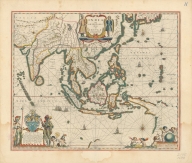
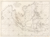
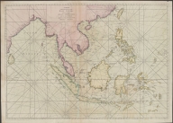
Printed 4687820500011 Blaeu map of Southeast Asia … Blaeu, Willem Janszoon, 1571 … |

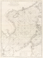
Printed 4687820500534 Blaeu map of Southeast Asia … Blaeu, Willem Janszoon, 1571 … |
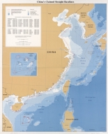
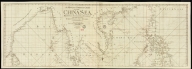
Printed 4687820500604 China's claimed straight bas … United States. Central Intel … |
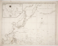
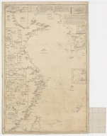
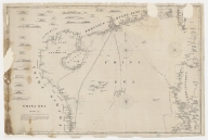
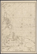
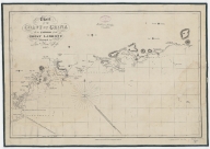
Printed 4687820500041 [Chart of the China Sea] Norie, J. W. (John William), … |
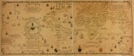
Printed 4687820500016 Map of the World by Viconte … [Maggiolo, Vesconte, active |
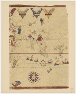
Printed 4687820500017 Map of the World by Viconte … [Maggiolo, Vesconte, active |
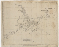
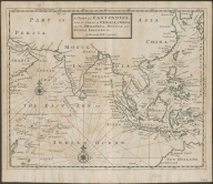
Printed 4687820500782 A chart of the East India Is … Anonymous |
Printed 4687820500018 Map of the World by Viconte … [Maggiolo, Vesconte, active |
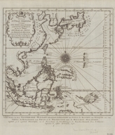
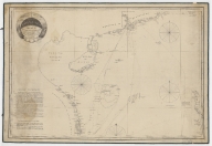
Printed 4687820500783 A general chart of the China … Anonymous |
Printed 4687820500785 A chart of the eastermost pa … Seller, John, active 1658-16 … |
Printed 4687820500788 A chart of ye East-Indies wi … Moll, Herman, -1732 |
Printed 4687820500789 Suite de L'Ocean Oriental : … [Bellin, Jacques Nicolas, 17 |
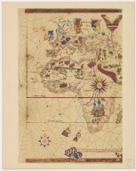
Printed 4687820500019 Map of the World by Viconte … [Maggiolo, Vesconte, active |
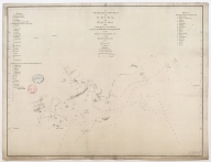
Printed 4687820500795 Pacific Ocean : Chusan Islan … [Great Britain. Hydrographic |
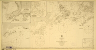
Printed 4687820500800 [Map of the East Indies] Anonymous |
Printed 4687820500802 Paskaerte Zynde t'Oosterdeel … Goos, Pieter, approximately … |
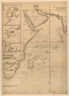
Printed 4687820500094 Map of the Indian Ocean Vinckeboons, Joan |
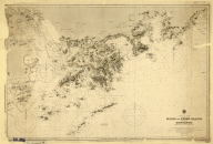
Printed 4687820500855 Map of the western Pacific o … Anonymous |
Printed 4687820500120 Plan of the entrance of Aimo … Keulen, Johannes van, 1654-1 … |
Printed 4687820500131 Carte des côtes de l'Améri … La Pérouse, Jean-François de … |
Printed 4687820500108 The Nauigation of the Portin … [Wolfe, John, Phillip, Willi |
Printed 4687820500450 To John Reeves Esq.re F.R.S. … [Horsburgh, James, 1762-1836 |
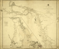
Printed 4687820500574 Chu-Kiang or Canton River fr … |
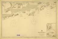
Printed 4687820500570 China. Sheet 1. Eastern Coas … Great Britain. Admiralty, Hy … |
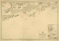
Printed 4687820500572 China. S.E. Coast. Macao to … Davies & Company |
Printed 4687820500571 China-South Coast : Tien Pak … Davies & Company |
Printed 4687820500573 China-South Coast : Tien Pak … Davies & Company |
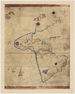
Printed 4687820500622 Carta Universal en que se co … [Ribeiro, Diogo, fl. 1519-15 |
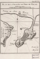
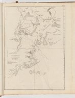
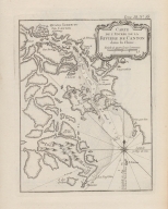
Printed 4687820500658 Plan de la ville et du port … Bellin, Jacques-Nicolas, 170 … |
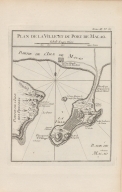
Printed 4687820500498 Plan de la ville et du port … Bellin, Jacques-Nicolas, 170 … |
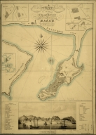
Printed 4687820500710 A map of the city and harbou … Bramston, William, 17---18-- … |
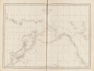
Printed 4687820500105 China Sea. Sheet II Horsburgh, James, 1762-1836, … |
Printed 4687820500050 China Sea. Sheet 1.st to Jam … [Horsburgh, James, 1762-1836 |
Printed 4687820500260 A chart of the China Sea, an … Whittle & Laurie, publisher |
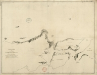
Printed 4687820500255 A chart of the south coast o … [Haldane, John, captain, fl. |
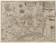
Printed 4687820500370 Nova et accurata Japoniae, t … Jansson, Jan, 1588-1664, pri … |

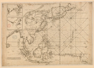
Printed 4687820500218 A chart of the China Sea : i … [Dalrymple, Alexander, 1737- |
Printed 4687820501174 Carte d'une partie de la mer … Rosili Mesros, François Etie … |

Printed 3687800354287I To the Honorable the Court o … [Heather, William, 1764-1812 |
Printed 3687800354289K To the Honorable the Court o … [Heather, William, 1764-1812 |

Printed 4687820500336 A new chart of the China Sea … [Laurie & Whittle, author, p |

Printed 3687800354267G A new chart of the China Sea … [Laurie & Whittle, author, p |
Printed 4687820501177 A chart of part of the coast … [Dalrymple, Alexander, 1737- |
Printed 4687820501171 Chart of the Strait of Solor … [Harmer, Thomas, fl. 1784-18 |
Printed 4687820501007 [[Carte portugaise de la mer Albernaz, João Teixeira, fl. … |
Printed 4687820501029 [[Carte portugaise de la mer Albernaz, João Teixeira, fl. … |
Printed 4687820501178 A new and correct chart of t … [Moore, John Hamilton, 1738- |
Printed 4687820500373 Chart of the coast of China … [Ross, Daniel, 1780-1849, ca |
Printed 4687820500010 Carte de l'entrée de la rivi … Bellin, Jacques-Nicolas, 170 … |
Printed 4687820500008 Carte des Isles qui sont a l … Bellin, Jacques-Nicolas, 170 … |