|
Barcode
4687820500509
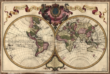
Title
Mappemonde a l'usage du roy
Contributor
Delisle, Guillaume, 1675-1726, cartographer
Type
Printed
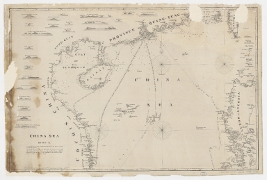
Barcode
4687820500105
Title
China Sea. Sheet II
Contributor
Horsburgh, James, 1762-1836, cartographer, publisher
Type
Printed
Barcode
4687820500050
Title
China Sea. Sheet 1.st to James Drummond Esquire in acknowledgement for his laudable endeavours towards perfecting the navigation of the China Sea
Contributor
[Horsburgh, James, 1762-1836, cartographer, publisher, James Drummond, 8th Viscount Strathallan, 1767-1851, dedicatee]
Type
Printed
Barcode
4687820500260
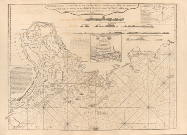
Title
A chart of the China Sea, and Philippine Islands with the Archipelagos of Felicia and Soloo : shewing the whole tract comprized, between Canton and Balambangan, with the soundings, shoals, rocks, & ca.
Contributor
Whittle & Laurie, publisher
Type
Printed
Barcode
4687820500255
Title
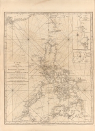
A chart of the south coast of Hay-nan, from Tinhosa to Guichou
Contributor
[Haldane, John, captain, fl. 177-, cartographer, Laurie & Whittle, publisher]
Type
Printed
Barcode
4687820500336
Title
A new chart of the China Sea, with its several entrances : drawn from a great number of draughts, journals, and other National documents, regulated by astronomical observations
Contributor
[Laurie & Whittle, author, publisher, Larkins, John Pascal, 17---1794, cartographer, Rees, Captain, cartographer]
Type
Printed
Barcode
3687800354267G
Title
A new chart of the China Sea, with its several entrances : drawn from a great number of draughts, journals, and other National documents, regulated by astronomical observation
Contributor
[Laurie & Whittle, author, publisher, Larkins, John Pascal, 17---1794, cartographer, Rees, Captain, cartographer]
Type
Printed
Barcode
4687820500373
Title
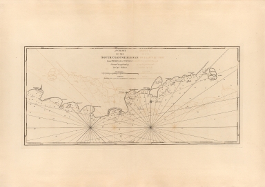
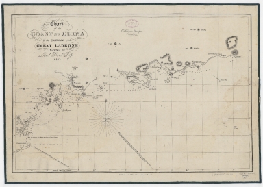
Chart of the coast of China to the eastward of the great Ladrone
Contributor
[Ross, Daniel, 1780-1849, cartographer, Horsburgh, James, 1762-1836, publisher]
Type
Printed
Barcode
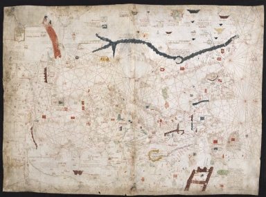
3687800239892M
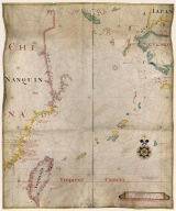
Title
[Asia]
Contributor
Albernaz, João Teixeira, fl. 1602-1649, cartographer
Type
Manuscripts
Barcode
4687820501249
Title
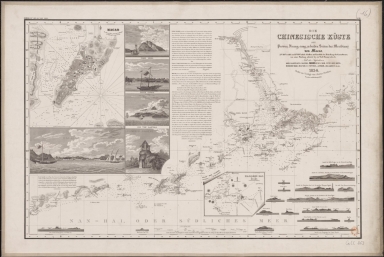
Die Chinesische Küste der Provinz Kuang-tung, zu beiden Seiten des Meridians von Macao
Contributor
[Herzberg, H., fl. 18--, cartographer, Justus Perthes (Firm : Gotha, Germany), publisher]
Type
Printed
Barcode
4687820501205
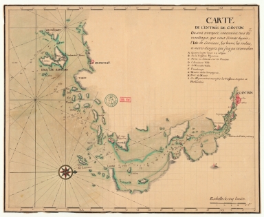
Title
Carte de l'entrée de Canton où sont marquez exactement tous les mouillages, que nous fismes depuis l'isle de Sanciam, les bancs, les roches et autres dangers que j'ay pu reconnoître
Contributor
Anonymous
Type
Manuscripts
Barcode
4687820500576
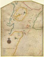
Title
[Tonquin, Quancy, Aynam]
Contributor
[Hacke, William, fl. 16--, cartographer, Sharpe, Bartholomew, fl. 1679-1682, author]
Type
Manuscripts
Barcode
687800354127B
Title
A chart of the China Sea from the Island of Sanciam to Pedra Branca with the course of the River Tigris from Canton to Macao
Contributor
[Après de Mannevillette, Jean-Baptiste-Nicolas-Denis d', 1707-1780, cartographer, Larkins, John Pascal, 17---1794, author, bibliographic antecedent, Anson, George Anson, baron, 1697-1762, author, Huddart, Joseph, 1741-1816, bibliographic antecedent]
Type
Printed
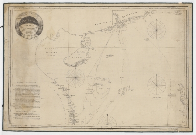
Barcode
3687800354567J
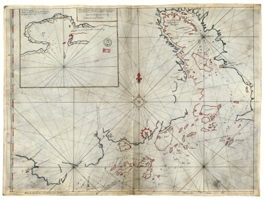
Title
[Chart of the Sea of Canton to Cambodia and the Philippines]
Type
Manuscripts
Barcode
3687800354564G
Title
Chart of the China Sea
Contributor
Thornton, John, 1641-1708, cartographer
Type
Manuscripts
Barcode
3687800354571E
Title
Island of Amoy
Contributor
Thornton, John, 1641-1708, cartographer
Type
Manuscripts
Barcode
3687800317471C
Title
A new and correct chart of the coast of China : from latitude 12° north to 26° including Formosa, Hayman and the Philippine Islands.
Contributor
W. and J. Mount, T. and T. Page, 1747-1763, publisher, bookseller
Type
Printed
Barcode
36878003541237
Title
Plan de la Riviere de Canton en Chine
Type
Manuscripts
Barcode
3687800301756B
Title
A new chart of the oriental seas and islands with the coasts of the continent from the Isle of Ceylon to Amoye in China
Contributor
[Après de Mannevillette, Jean-Baptiste-Nicolas-Denis d', 1707-1780, cartographer, Laurie & Whittle, publisher]
Type
Printed
Barcode
4687820500774
Title
Carta hydrografica da Colonia de Macau
Contributor
[Macau. Obras dos Portos, Braga, José Maria, 1897-1988, former owner]
Type
Printed
Barcode
3687800354675J
Title
Carte marine de la mer Baltique, de la mer du Nord, de l'océan Atlantique Est, de la mer Méditerranée, de la mer Noire et de la mer Rouge
Contributor
Dulcert, Angelino, 1350-1400, cartographer
Type
Manuscripts
|


![[Asia]](http://lunamap.must.edu.mo:80/MediaManager/srvr?mediafile=/Size2/MUST~2~2/41/G1015+.T4+1630-12.jpg)
![[Tonquin, Quancy, Aynam]](http://lunamap.must.edu.mo:80/MediaManager/srvr?mediafile=/Size2/MUST~2~2/33/G2201.P5+H3+1690.jpg)
![[Chart of the Sea of Canton to Cambodia and the Philippines]](http://lunamap.must.edu.mo:80/MediaManager/srvr?mediafile=/Size2/MUST~2~2/54/GE+SH+18+PF+181+P+21+RES+Carte+des+mers+de+Canton.jpg)