Browse All
Manuscripts 3687800354228D Gulf of Tonkin Blaeu, Joan, 1596-1673, cart … |
Manuscripts 3687800354566I Gulf of Tonkin Blaeu, Joan, 1650-1712, cart … |
Manuscripts 4687820501106 Filipinas Bagay, Nicolás de la Cruz, 1 … |
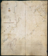
Manuscripts 3687800354499N [Map of the southeast coast … |
Manuscripts 3687800354560C China Sea Blaeu, Joan, 1596-1673, cart … |
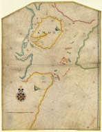
Manuscripts 3687800354571E Island of Amoy Thornton, John, 1641-1708, c … |
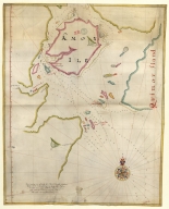
Manuscripts 3687800354570D English chart of the island … Thornton, John, 1641-1708, c … |
Manuscripts 3687800354262B Southern part of the China S … |
Manuscripts 3687800354259H Chart of the seas of Canton … |
Manuscripts 3687800371235A [Carte de la ville et de la … |
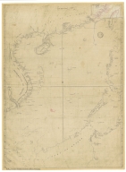
Manuscripts 3687800317467H Chart of the China Sea |
Manuscripts 36878003222323 Chart of the river of Canton … Vinckeboons, Joan, 1617-1670 … |
Manuscripts 3687800354297J North Atlantic Ocean [Homem, Lopo, fl. 1517-1565, |
Manuscripts 3687800354590F Charta Rogeriana [Idrīsī, ca. 1100-1166, ca |
Manuscripts 36878003222413 Carte reduite de l'Ocean-Ori … [Le Moyne, François-Pierre, |
Manuscripts 36878003541237 Plan de la Riviere de Canton … |
Manuscripts 3687800317484G Handwritten map of the coast … Jaillot, Alexis Hubert, ca. … |
Manuscripts 3687800354097H |
Manuscripts 36878003546108 Disc of 495 mm diameter Homem, Diogo, ca. 1520-1576, … |
Manuscripts 36878003546119 Disc of 460 mm diameter. Homem, Diogo, ca. 1520-1576, … |
Manuscripts 3687800354613B Mediterranean Sea, Black Sea … Homem, Diogo, ca. 1520-1576, … |
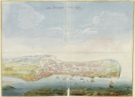
Manuscripts 4687820500716 Platte Grondt van Stadt Maca … Vinckeboons, Joan, 1617-1670 … |
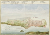
Manuscripts 4687820500715 De stadt Macao Vinckeboons, Joan, 1617-1670 … |
Manuscripts 687800354612A North Indian Ocean, China Se … Homem, Diogo, ca. 1520-1576, … |
Manuscripts 3687800354615D North Atlantic Ocean Homem, Diogo, ca. 1520-1576, … |
Manuscripts 3687800354617F Caribbean Sea and South Atla … Homem, Diogo, ca. 1520-1576, … |
Manuscripts 3687800354614C North-East Atlantic, North S … Homem, Diogo, ca. 1520-1576, … |
Manuscripts 3687800354643E North Indian Ocean with Arab … [Homem, Lopo, fl. 1517-1565, |
Manuscripts 3687800354645G Central Atlantic Ocean with … [Homem, Lopo, fl. 1517-1565, |
Manuscripts 3687800354648J Chart of the Pacific Ocean Albernaz, João Teixeira, I, … |
Manuscripts 4687820501037 [Magnus Sinus] [Homem, Lopo, fl. 1517-1565, |
Manuscripts 3687800354649K Title page with the arms of … [Homem, Lopo, fl. 1517-1565, |
Manuscripts 3687800354646H World chart [Homem, Lopo, fl. 1517-1565, |
Manuscripts 4687820501089 Northeast Atlantic Ocean and … [Homem, Lopo, fl. 1517-1565, |
Manuscripts 4687820501035 South Indian Ocean with insu … [Homem, Lopo, fl. 1517-1565, |
Manuscripts 4687820501034 Southwest Atlantic Ocean wit … [Homem, Lopo, fl. 1517-1565, |
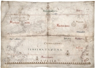
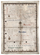
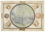
Manuscripts 3687800354651D World map in 24 time zones d … Velho, Bartolomeu, fl. 1560- … |
Manuscripts 3687800354650C Nautical chart of the Indian … Gijsbertsz, Evert, d. 1625, … |
Manuscripts 3687800354655H Nautical chart of the Easter … |

Manuscripts 4687820500771 China ao sul de Cantão [Pacia, Vicente, 1880-1940, |
Manuscripts 3687800354656I Fragment of a nautical chart … Teixeira, Luís, 1564-1604, c … |
Manuscripts 4687820501092 [Planisphère] [Lopes, Sebastião, fl. ca. 1 |
Manuscripts 4687820501091 [Planisphère] [Lopes, Sebastião, fl. ca. 1 |
Manuscripts 3687800317476H Gulf of Tonkin to Luzon and … Thornton, John, 1641-1708, c … |
Manuscripts 3687800354661E Chart of the coasts of China … |
Manuscripts 3687800354663G Caverio, Nicolo di, fl. 1502 … |
Manuscripts 687800354663G Caverio, Nicolo di, fl. 1502 … |
Manuscripts 3687800354662F Nautical chart of the Medite … Roselli, Pietro, fl. 1446-14 … |
Manuscripts 3687800354664H Universa ac navigabilis toti … Homem, André, fl. 1559-1586, … |
Manuscripts 3687800354665I Universa ac navigabilis toti … Homem, André, fl. 1559-1586, … |