|
Barcode
36878003712068
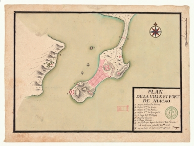
Title
Plan de la ville et port de Macao
Contributor
Froger, François, 1676-1715, cartographer
Type
Manuscripts
Barcode
3687800354308C
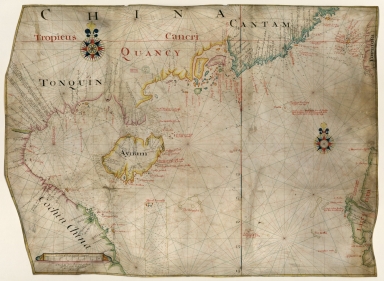
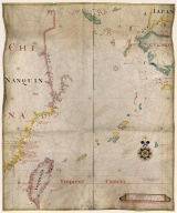
Title
Gulf of Tonkin to Luzon and Formosa
Contributor
Thornton, John, 1641-1708, hydrographer
Type
Manuscripts
Barcode
3687800354564G
Title
Chart of the China Sea
Contributor
Thornton, John, 1641-1708, cartographer
Type
Manuscripts
Barcode
3687800354571E
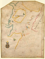
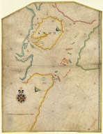
Title
Island of Amoy
Contributor
Thornton, John, 1641-1708, cartographer
Type
Manuscripts
Barcode
4687820500829
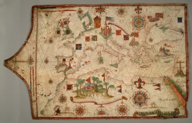
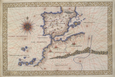
Title
Carta da Europa e do Mediterraneo
Contributor
Teixeira, Luís, active 16th century
Type
Manuscripts
Barcode
4687820500836
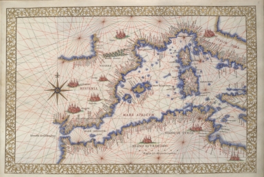
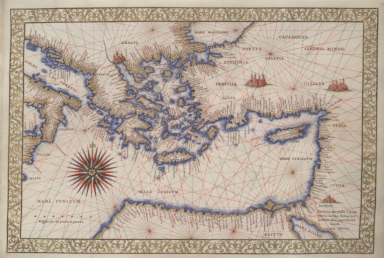
Title
Western Mediterranean
Contributor
Ghisolfi, Francesco
Type
Manuscripts
Barcode
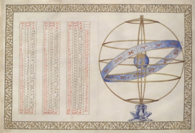
4687820500837
Title
Table of declinations and armillary sphere
Contributor
Ghisolfi, Francesco
Type
Manuscripts
Barcode
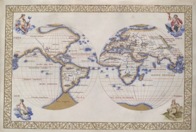
4687820500838
Title
The two hemispheres
Contributor
Ghisolfi, Francesco
Type
Manuscripts
Barcode
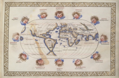
4687820500839
Title
Oval map of the world with wind heads
Contributor
Ghisolfi, Francesco
Type
Manuscripts
Barcode
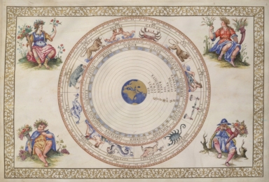
4687820500840
Title
Planisphere with signs of zodiac and allegorical figures representing seasons
Contributor
Ghisolfi, Francesco
Type
Manuscripts
Barcode
4687820500841
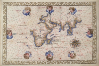
Title
Indian Ocean, Africa, Arabia, India, and part of Asia
Contributor
Ghisolfi, Francesco
Type
Manuscripts
Barcode
4687820500842
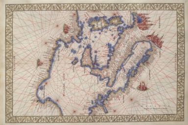
Title
Central Mediterranean and Italy
Contributor
Ghisolfi, Francesco
Type
Manuscripts
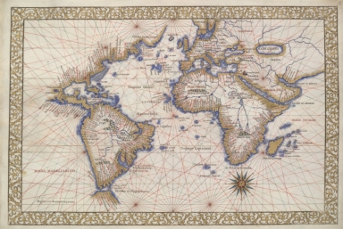
Barcode
4687820500843
Title
The Pacific Ocean with portions of North and South America, East Indies, part of China
Contributor
Ghisolfi, Francesco
Type
Manuscripts
Barcode
4687820500844
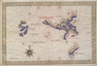
Title
Eastern Mediterranean and Aegean Sea
Contributor
Ghisolfi, Francesco
Type
Manuscripts
Barcode
4687820500845
Title
Western Mediterranean, Iberian peninsula, Northwest Africa
Contributor
Ghisolfi, Francesco
Type
Manuscripts
Barcode
4687820500846
Title
Eastern coast of North America, South America, Atlantic Ocean, Europe ( including Scandinavia), Africa, the Near East
Contributor
Ghisolfi, Francesco
Type
Manuscripts
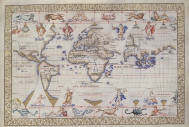
Barcode
4687820500847
Title
The World in five gores (decorated at top and bottom with signs of the zodiac and other figures)
Contributor
Ghisolfi, Francesco
Type
Manuscripts
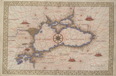
Barcode
4687820500848
Title
Black Sea
Contributor
Ghisolfi, Francesco
Type
Manuscripts
Barcode
4687820500578
Title
Kaart van een gedeelte der Chineese Zee en Kust, van Punta Lampa cao tot de Overveens Eilanden, het Eiland Formosa enz. Hierop komt mede voor de rivier van Canton, van den mond tot Fangsucis
Contributor
Anonymous
Type
Manuscripts
Barcode
4687820500579
Title
Kaart van de Kust van Quinam, Tonquin en Cochin-China, van R. Cantaon tot aan Punta Lamtaon, benevens het Eyland Aynam en Isla de Pracel
Contributor
Anonymous
Type
Manuscripts
Barcode
4687820501263
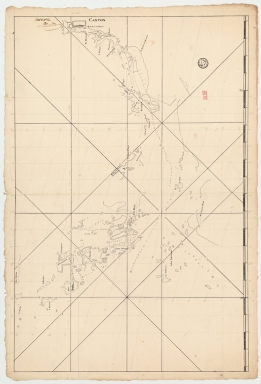
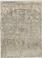
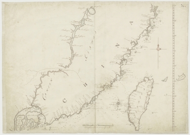
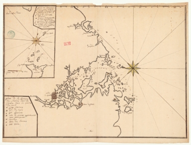
Title
[Vues de cotes des mers de Chine]. 4.e
Contributor
Surville, Jean-François de, 1717-1770, author
Type
Manuscripts
Barcode
4687820500461
Title
大明九邊萬國人跡路程全圖
Contributor
Umemura, Yahaku
Type
Manuscripts
Barcode
4687820501004
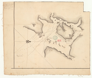
Title
Plan de la baye de Taipas
Contributor
Anonymous
Type
Manuscripts
Barcode
4687820501200
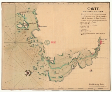
Title
Carte de l'entrée de Canton où sont marquez exactement tous les mouillages, que nous fîmes depuis l'isle de Sanciam, les bancs, les roches et autres dangers que j'ay pu reconnoitre
Contributor
Anonymous
Type
Manuscripts
Barcode
4687820501208
Title
Plan de la rivière de Canton dans la Chinne dans la partie du nord
Contributor
Anonymous
Type
Manuscripts
Barcode
4687820501205
Title
Carte de l'entrée de Canton où sont marquez exactement tous les mouillages, que nous fismes depuis l'isle de Sanciam, les bancs, les roches et autres dangers que j'ay pu reconnoître
Contributor
Anonymous
Type
Manuscripts
Barcode
4687820501199
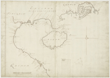
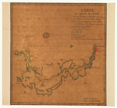
Title
Carte de la rivière de Canton et de ses environs du costé du sud est [corrigé :] ouest
Type
Manuscripts
Barcode
4687820501201
Title
Carte de la rivière de Canton et des îles
Contributor
Anonymous
Type
Manuscripts
Barcode
4687820501202
Title
Carte de la rivière de Canton et ses environs du costé de l'ouest
Contributor
Anonymous
Type
Manuscripts
Barcode
4687820501206
Title
Carte de l'entrée de Canton sur la côte de la Chine
Contributor
Anonymous
Type
Manuscripts
Barcode
4687820501003
Title
從澳門到黃埔的地圖
Contributor
Anonymous
Type
Manuscripts
Barcode
4687820500518
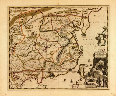
Title
Carte exacte de toutes les provinces, villes, bourgs, villages et rivières du vaste et puissant empire de la Chine : faite par les ambassadeurs hollandois dans leur voyage de Batavia à Peking
Contributor
[Nieuhof, Johannes, 1618-1672, Aa, Pieter van der, 1659-1733]
Type
Printed
Barcode
4687820500282
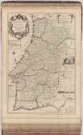
Title
Le Portugal
Contributor
Anonymous
Type
Printed
Barcode
4687820500350
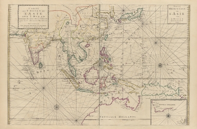
Title
Carte des costes de l'Asie sur l'Ocean : contenant les bancs isles et costes & c, levee sur les memoires les plus nouveau
Contributor
Mortier, Pierre, 1661-1711
Type
Printed
Barcode
4687820501103
Title
Island of Amoy
Contributor
Thornton, John
Type
Manuscripts
Barcode
3687800317476H
Title
Gulf of Tonkin to Luzon and Formosa
Contributor
Thornton, John, 1641-1708, cartographer
Type
Manuscripts
Barcode
4687820500347
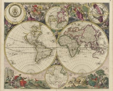
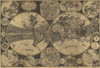
Title
Haemisphaeriorum tabula
Contributor
[Schenck, Peter, 1645-1715, Deur, Abraham]
Type
Printed
Barcode
4687820500488
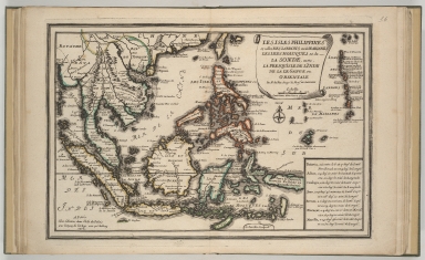
Title
Les Isles Philippines et celles des Larrons ou de Marianes, les Isles Moluques et de la Sonde, avec, la presqu'isle de l'Inde de là le Gange ou Orientale
Contributor
Fer, Nicolas de, 1646-1720
Type
Printed
Barcode
4687820500497
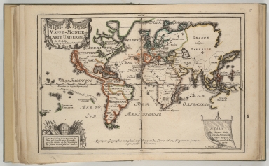
Title
Mappe-monde ou carte universelle
Contributor
Fer, Nicolas de, 1646-1720
Type
Printed
Barcode
4687820500606
Title
A new and correct map of the world : laid down according to the newest observations & discoveries in several different projections including the trade winds, monsoons, variation of the compass, and illustrated with a coelestial planisphere, the various systems of Ptolomy, Copernicus, and Tycho Brahe together with ye apearances of the planets &c.
Contributor
Godson, W. (William)
Type
Printed
Barcode
3687800354493H
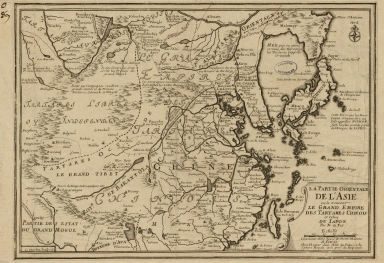
Title
La partie orientale de l'Asia ou se trouvent le grand Empire des Tartares Chinois et Celuy du Japon
Contributor
[Fer, Nicolás de, 1646-1720, cartographer, Inselin, Charles, fl. 1673-1715, engraver]
Type
Printed
Barcode
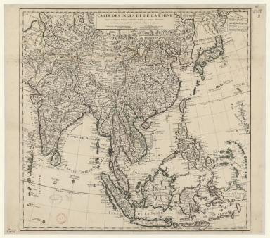
4687820501075
Title
Carte des Indes et de la Chine : dressée sur plusieurs relations particulières rectifiées par quelques observations
Contributor
[Delisle, Guillaume, 1675-1726, cartographer, publisher, Renard, Louis, ca. 1678-1746, publisher]
Type
Manuscripts
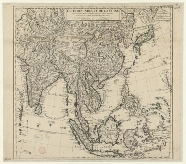
Barcode
3687800354316B
Title
Carte des Indes et de la Chine : dressée sur plusieurs relations particulières rectifiées par quelques observations
Contributor
[Delisle, Guillaume, 1675-1726, publisher, Renard, Louis, ca. 1678-1746, publisher]
Type
Printed
Barcode
4687820501109
Title
Carte des provinces de la Chine
Contributor
Anonymous
Type
Printed
Barcode
4687820500389
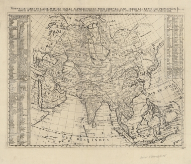
Title
Nouvelle carte de l'Asie, avec des tables alphabetiques pour trouver sans peine les etats des principaux princes de cette partie du monde : une table des villes principales et quelques remarques pour l'intelligence de l'histoire de l'Asie
Contributor
Chatelain, Henri Abraham
Type
Printed
Barcode
4687820500653
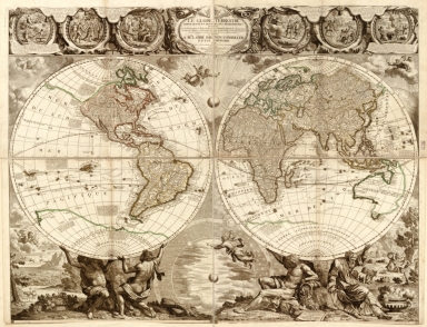
Title
Le globe terrestre représenté en deux plans-hémisphères : dressé sur la projection de Mr. de la Hyre de l'Académie Royale des Sciences, et sur plusieurs routiers et mémoires des plus habiles pilotes et savans voyageurs le tout rectifié et calculé selon les dernières observations, et dédié à Mgr. l'Abbé Bignon, conseiller d'état ordinaire
Contributor
[Nolin, Jean Baptiste, 1648-1708, Bocquet, Nicolas François, -1716]
Type
Printed
Barcode
4687820501250
Title
Plan de la Baye d'Emoy a la coste de la Chine
Type
Manuscripts
Barcode
4687820500307
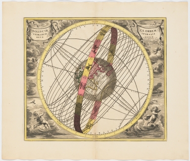
Title
Solis circa orbem Terrarum spiralis revolutio
Contributor
[Valck, G. (Gerard), 1651 or 1652-1726, Schenk, Peter, 1660-1718 or 1719]
Type
Printed
Barcode
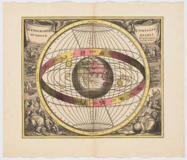
4687820500308
Title
Scenographia compagis mundanae Brahea
Contributor
[Valck, G. (Gerard), 1651 or 1652-1726, Schenk, Peter, 1660-1718 or 1719]
Type
Printed
|

![[Vues de cotes des mers de Chine]. 4.e](http://lunamap.must.edu.mo:80/MediaManager/srvr?mediafile=/Size2/MUST~2~2/54/GE+SH+18+PF+183+DIV+1+P+1+%28PL4%29.jpg)
![Carte de la rivière de Canton et de ses environs du costé du sud est [corrigé :] ouest](http://lunamap.must.edu.mo:80/MediaManager/srvr?mediafile=/Size2/MUST~2~2/63/GE+SH+18+PF+179+DIV+9+P+131+D+-+Carte+de+la+rivi%C3%83%C2%A8re+de+Canton+-+sud+est.jpg)