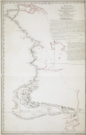
WHERE
|
Barcode
4687820500138
Title
Plan of the coast of China from Kittow point to Limpo River
Contributor
Wallis, Ferdinando
Type
Printed
Barcode
4687820500422
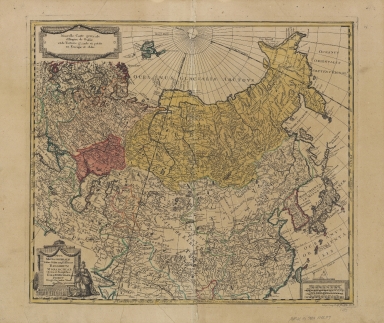
Title
Nova mappa generalis totius orbis amplissimae Russorum Monarchiae = Nouvelle carte d'Empire de Russie et de Tartarie, grande et petite en Europe et en Asie
Contributor
[Probst, Johann Michael, -1809, Probst, Johann Georg, 1759-1809]
Type
Printed
Barcode
4687820500217
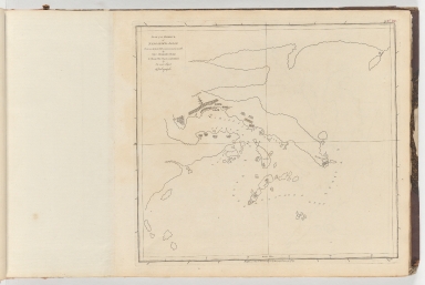
Title
Plan of Limpo or Ning-Po in the province of Tchekiang in China = Plan of the entrance of Limpo River on double the scale
Contributor
Clement, John
Type
Printed
Barcode
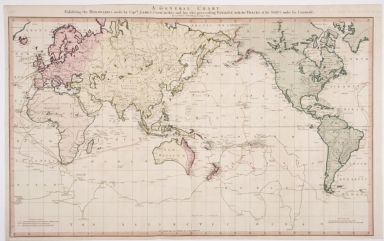
4687820500854
Title
General Chart exhibiting the Discoveries made by Captain James Cook in this and his Two Proceeding Voyages, with the tracks of the Ships under his command, by Lieutenant Roberts of His Majesty's Royal Navy.
Contributor
[Roberts, Henry, Faden, William]
Type
Printed
Barcode
4687820500929
Title
Map of the Pacific Ocean between the coast of California and Mexico and Japan, Philippines, and the coast of China
Contributor
Anonymous
Type
Manuscripts
Barcode
4687820500316
Title
Map of the Typa and Macao
Contributor
[Bligh, Williams, 1754-1817, Harrison, William, about 1750-1803]
Type
Printed
Barcode
4687820500120
Title
Plan of the entrance of Aimoey Harbour of Chinchew River &c.
Contributor
Keulen, Johannes van, 1654-1715
Type
Printed
Barcode
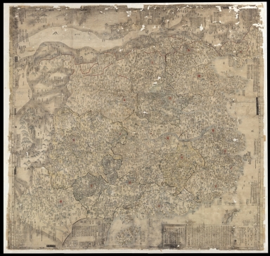
4687820500672
Title
山海輿地全圖 = Sankai yochi zenzu
Contributor
[Nagakubo, Sekisui, 1717-1801, Ricci, Matteo, 1552-1610]
Type
Printed
Barcode
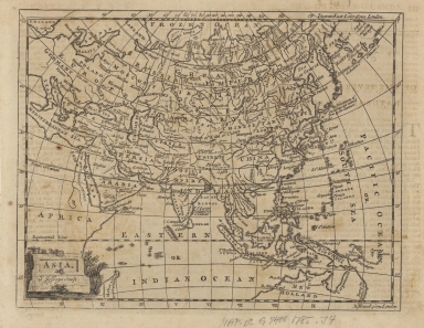
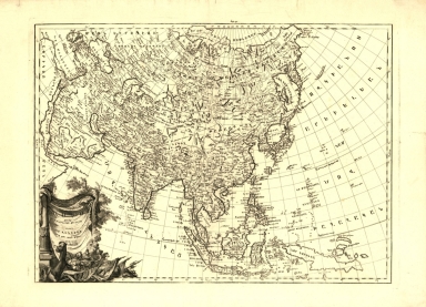
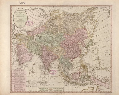
4687820500129
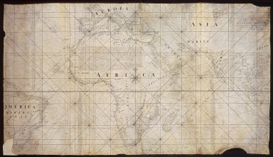
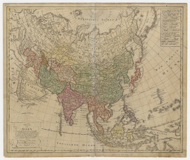
Title
Asia
Contributor
Jefferys, Thomas, -1771
Type
Printed
Barcode
4687820501108
Title
大清廣輿圖 = Carte de la Chine sous la dynastie Ts'ing
Contributor
[Nagakubo, Sekisui, 1717-1801, 程赤城, 蔡方炳, 1626-1709]
Type
Printed
Barcode
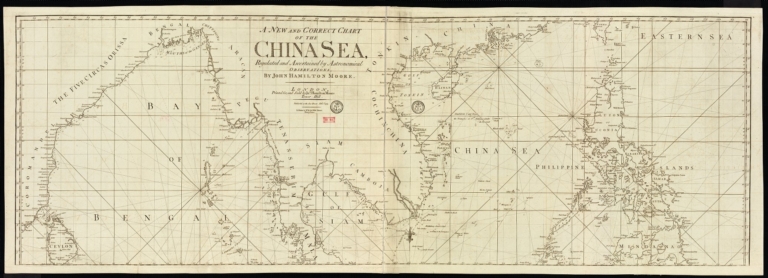
4687820501178
Title
A new and correct chart of the China Sea
Contributor
[Moore, John Hamilton, 1738-1807, cartographer, Blake, T. J., fl. 1785-1785, engraver]
Type
Printed
Barcode
3687800354505B
Title
Chart of the southern coasts of the Islands between S.t Johns and the Ladrone taken on board the Nassau, Capt. Arthur Gore, and inscribed to Nathaniel Smith Esq.r
Contributor
[Larkins, John Pascal, 17---1794, cartographer, Dalrymple, Alexander, 1737-1808, publisher, Harrison, William, ca. 1750-1803, engraver, Smith, Nathaniel, 1730-1794, dedicatee]
Type
Printed
Barcode
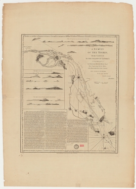
4687820501102
Title
A survey of the Tigris from Canton to the island of Lankeet
Contributor
Huddart, Joseph, 1741-1816
Type
Printed
Barcode
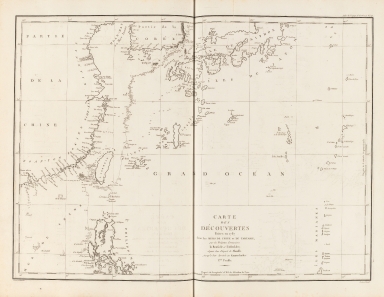
4687820500132
Title
Carte Générale Des Découvertes faites en 1787 dans les Mers De Chine et De Tartarie ou depuis Manille jusqu'à Avatscha : par les Frégates Françaises la Boussole et l'Astrolabe
Contributor
La Pérouse, Jean-François de Galaup, comte de, 1741-1788
Type
Printed
Barcode
4687820500212
Title
Carte des découvertes faites en 1787 dans les mers de Chine et de Tartarie : par les frégates françaises la Boussole et l'Astrolabe, depuis leur départ de Manille jusqu'à leur arrivée au Kamtschatka
Contributor
La Pérouse, Jean-François de Galaup, comte de, 1741-1788
Type
Printed
Barcode
4687820500599
Title
Asia, ěst nor ashkharhagrakan znnut'eants' : p'oragreal i Vēnētik i Vans Srboyn Ghazaru i t'uis merum 1236
Contributor
[Endasian, Elia, Vank' Srboyn Ghazaru (Venice, Italy)]
Type
Printed
Barcode
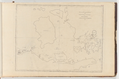
4687820501172
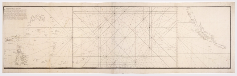
Title
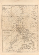
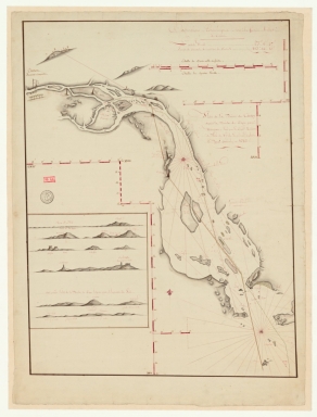
[Route de M. de Richery en 1787 de Pondichery a Canton]
Type
Manuscripts
Barcode
3687800354126A
Title
Plan de la riviere de Canton depuis la bouche du Tigre, jusqu'à Wampou
Contributor
Huddart, Joseph, 1741-1816, cartographer
Type
Manuscripts
Barcode
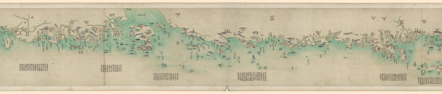
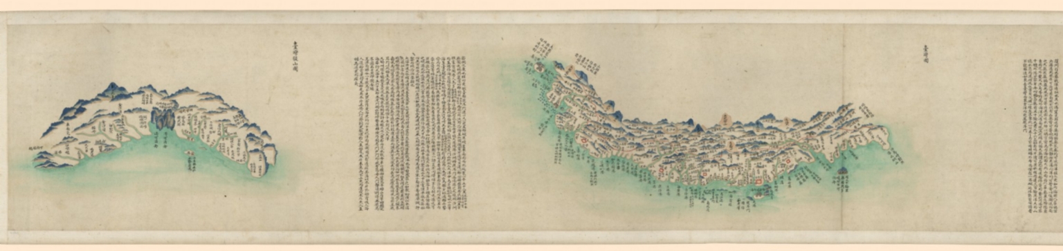
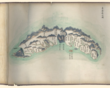
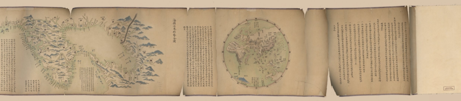
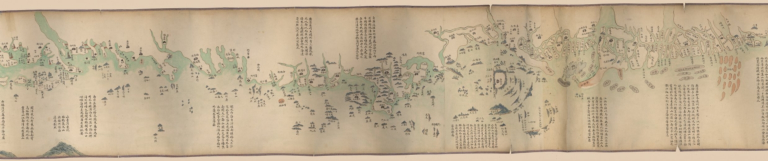
4687820500553
Title
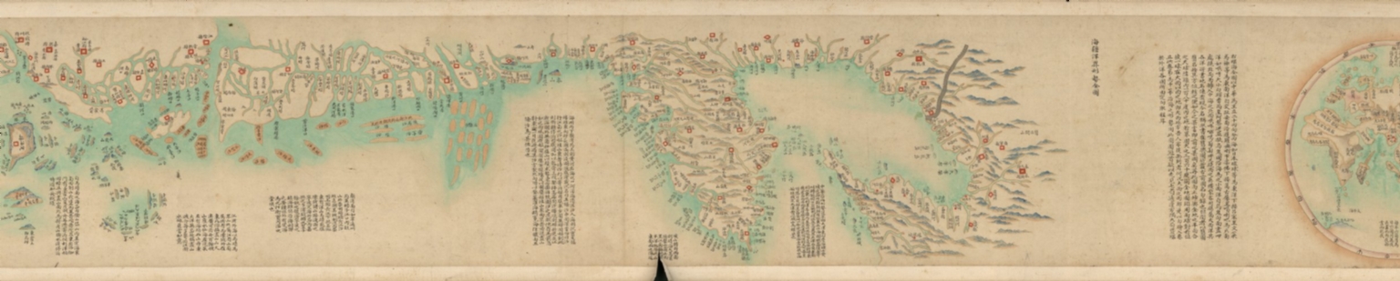
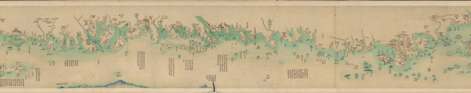
海疆洋界形勢全圖.Part 1 = Coastal map of China.Part 1
Contributor
Anonymous
Type
Manuscripts
Barcode
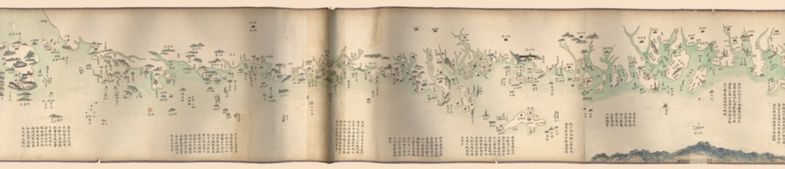
4687820500554
Title
海疆洋界形勢全圖.Part 2 = Coastal map of China.Part 2
Contributor
Anonymous
Type
Manuscripts
Barcode
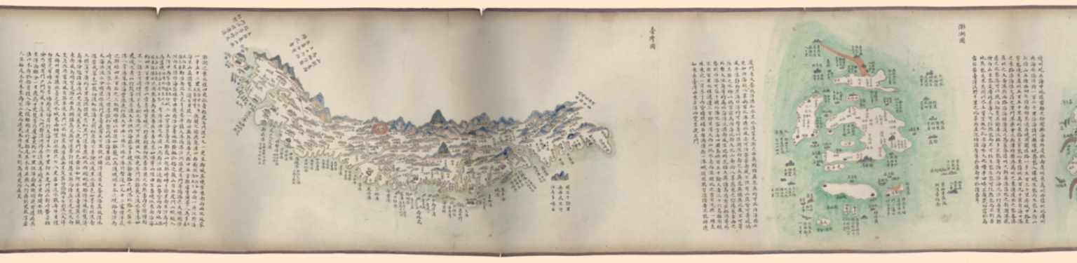
4687820500555
Title
海疆洋界形勢全圖.Part 3 = Coastal map of China.Part 3
Contributor
Anonymous
Type
Manuscripts
Barcode
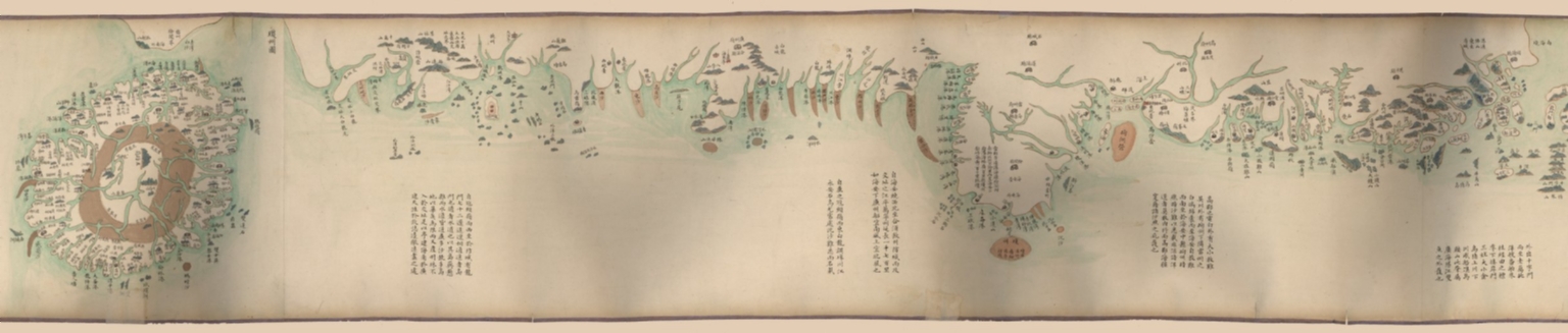
4687820500556
Title
海疆洋界形勢全圖.Part 4 = Coastal map of China.Part 4
Contributor
Anonymous
Type
Manuscripts
Barcode
4687820500557
Title
海疆洋界形勢全圖.Part 5 = Coastal map of China.Part 5
Contributor
Anonymous
Type
Manuscripts
Barcode
4687820500558
Title
海疆洋界形勢全圖.Part 6 = Coastal map of China.Part 6
Contributor
Anonymous
Type
Manuscripts
Barcode
4687820500564
Title
海疆洋界形勢圖.Part 6
Contributor
Hummel, Arthur W. (Arthur William), 1884-1975
Type
Manuscripts
Barcode
4687820500559
Title
海疆洋界形勢圖.Part 1
Contributor
Hummel, Arthur W. (Arthur William), 1884-1975
Type
Manuscripts
Barcode
4687820500560
Title
海疆洋界形勢圖.Part 2
Contributor
Hummel, Arthur W. (Arthur William), 1884-1975
Type
Manuscripts
Barcode
4687820500561
Title
海疆洋界形勢圖.Part 3
Contributor
Hummel, Arthur W. (Arthur William), 1884-1975
Type
Manuscripts
Barcode
4687820500563
Title
海疆洋界形勢圖.Part 5
Contributor
Hummel, Arthur W. (Arthur William), 1884-1975
Type
Manuscripts
Barcode
4687820500562
Title
海疆洋界形勢圖.Part 4
Contributor
Hummel, Arthur W. (Arthur William), 1884-1975
Type
Manuscripts
Barcode
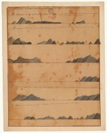
4687820501204
Title
Vues des Iles a la sortie de Macao = 進出水道島嶼側面圖. Part 2
Contributor
Locmaria, Kergariou
Type
Manuscripts
Barcode
4687820501203
Title
Vues des Iles a la sortie de Macao = 進出水道島嶼側面圖. Part 1
Contributor
Locmaria, Kergariou
Type
Manuscripts
Barcode
4687820500303
Title
Plan of the harbour of Nangasaky in Japan : from an ancient MS communicated in 1762
Contributor
Hume, Alexande
Type
Printed
Barcode
4687820501079
Title
Carte reduzida que conten os dous oceannos, Atlantico e Oriental por José Fernandes Portugal na Bahia de todos o Santos no Anno de 1789
Contributor
Portugal, José Fernandes
Type
Manuscripts
Barcode
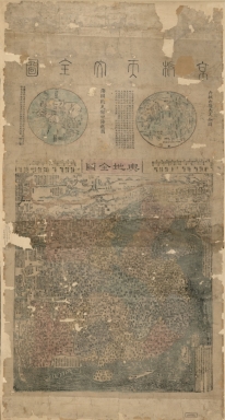
4687820500677
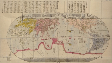
Title
京版天文全圖 = Complete map of astronomy and the Qing Empire
Contributor
[馬俊良, active 18th century-19th century, 黄宗羲, 1610-1695]
Type
Printed
Barcode
4687820500525
Title
Bowles's new one-sheet map of Asia, divided into its empires, kingdoms, states, and other subdivisions : laid down from observations of the most celebrated geographers
Contributor
Bowles, Carington, 1724-1793
Type
Printed
Barcode
36878003222312
Title
To the Society of Managing Owners of the Ships in the English East India Company's Service, This Chart of the China Sea, Including the Philippina Molluca and Banda Islands, Shewing al the same time all the Tracks into the Pacific Ocean, commonly known by the name of the Eastern Passage to China
Contributor
[Robertson, George, 1748-1788, cartographer, Harmer, Thomas, fl. 1784-1814, engraver]
Type
Printed
Barcode
36878003542306
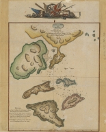
Title
Plano del rio por el qual se navega con e[m]barcacion[e]s menores entre Ma[c]ao y Canton
Contributor
[Agote y Bonechea, Manuel de, 1755-1803, cartographer, Guignes, Joseph de, 1721-1800, dedicatee]
Type
Manuscripts
Barcode
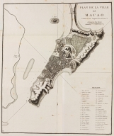
3687800354497L
Title
Plan de la ville de Macao : latitude 22º 12' 44'', longitude à l'Est de Paris mº 5.
Contributor
[Guignes, Chrétien-Louis-Joseph de, 1759-1845, cartographer, Houdan, François d', 1747-1828, engraver]
Type
Printed
Barcode
3687800371299K
Title
Plano del rio por el qual se navega con embarcaciones menores entre Macao y Canton
Contributor
[Agote y Bonechea, Manuel de, 1755-1803., Guignes, Joseph de, 1721-1800, dedicatee.]
Type
Manuscript
Barcode
4687820500391
Title
Charte von Asien : nach den bewährtesten astronomischen Beobachtungen den neuesten Reisen, und den vorzüglichsten Charten, insonderheit aber der Geographie de Hrn I.C. Gatterers. gemäss
Contributor
[Güssefeld, F. L. (Franz Ludwig), 1744-1807, Homann Erben (Firm)]
Type
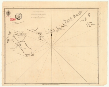
Printed
Barcode
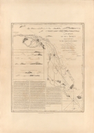
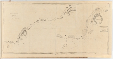
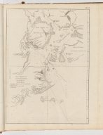
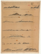
4687820500989
Title
[Plan of Mirs Bay on the coast of China, Chart of the island Lamock, Lamon, Plan of Ping Hai Bay]
Contributor
Murphy, Edward
Type
Manuscripts
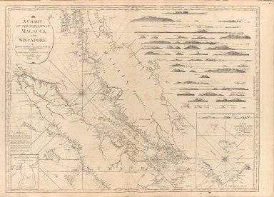
Barcode
4687820500256
Title
A chart of the Straits of Malacca and Sincapore
Contributor
Thomas, Jeffrey
Type
Printed
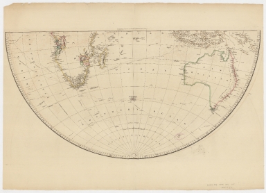
Barcode
4687820500433
Title
Map of the world on a globular projection : exhibiting particularly the nautical researches of Capn. James Cook, F.R.S. with all the recent discoveries to the present time.Part 2
Contributor
[Arrowsmith, Aaron, 1750-1823, Foot, T. (Thomas)]
Type
Printed
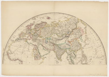
Barcode
4687820500432
Title
Map of the world on a globular projection : exhibiting particularly the nautical researches of Capn. James Cook, F.R.S. with all the recent discoveries to the present time.Part 1
Contributor
[Arrowsmith, Aaron, 1750-1823, Foot, T. (Thomas)]
Type
Printed
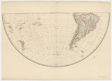
Barcode
4687820500435
Title
Map of the world on a globular projection : exhibiting particularly the nautical researches of Capn. James Cook, F.R.S. with all the recent discoveries to the present time.Part 4
Contributor
[Arrowsmith, Aaron, 1750-1823, Foot, T. (Thomas)]
Type
Printed
Barcode
4687820500434
Title
Map of the world on a globular projection : exhibiting particularly the nautical researches of Capn. James Cook, F.R.S. with all the recent discoveries to the present time.Part 3
Contributor
[Arrowsmith, Aaron, 1750-1823, Foot, T. (Thomas)]
Type
Printed
Barcode
4687820500526
Title
A new general map of the East Indies : exhibiting in the Peninsula on this side of the Ganges, or Hindoostan, the several partitions of the Mogul's Empire ; and the dominions of the English East India Company in the provinces of Bengal, Bahar, Orixa, as well as upon the coasts of Malabar and Coromandel ; with the French and Dutch possessions according to the peace of 1783 : and in the peninsula beyond the Ganges, the kingdoms of Assam, Cashar, Aua, Aracan, Mien, Pegu, Siam, Lao and Cambodia, &c.
Contributor
[Jefferys, Thomas, -1771, Rennell, James, 1742-1830]
Type
Printed
Barcode
4687820500260
Title
A chart of the China Sea, and Philippine Islands with the Archipelagos of Felicia and Soloo : shewing the whole tract comprized, between Canton and Balambangan, with the soundings, shoals, rocks, & ca.
Contributor
Whittle & Laurie, publisher
Type
Printed
Barcode
4687820500232
Title
A survey of the Tigris, from Canton to the Island of Lankeet : to William Henry Pigou Esq.r first supercargo for the Affairs of the Honourable East India Company
Contributor
[Huddart, Joseph, 1741-1816, hydragrapher, Pigou, William Henry, dedicatee, Whittle & Laurie, publisher]
Type
Printed
|
![[Route de M. de Richery en 1787 de Pondichery a Canton]](http://lunamap.must.edu.mo:80/MediaManager/srvr?mediafile=/Size2/MUST~2~2/54/GE+SH+18+PF+182+P+6+D_Routes+de+M+de+Richery+en+1787.jpg)


![Plano del rio por el qual se navega con e[m]barcacion[e]s menores entre Ma[c]ao y Canton](http://lunamap.must.edu.mo:80/MediaManager/srvr?mediafile=/Size1/MUST~2~2/325/36878003542306%28174-c-par-71_0001%29.jpg)
![[Plan of Mirs Bay on the coast of China, Chart of the island Lamock, Lamon, Plan of Ping Hai Bay]](http://lunamap.must.edu.mo:80/MediaManager/srvr?mediafile=/Size2/MUST~2~2/54/GE+SH+18+PF+179+DIV+14+P+1+D+-+Plan+of+Mirs+Bay+on+the+coast+of+China+-+Plan+of+Ping+Hai+Bay.jpg)