|
Barcode
4687820500553
Title
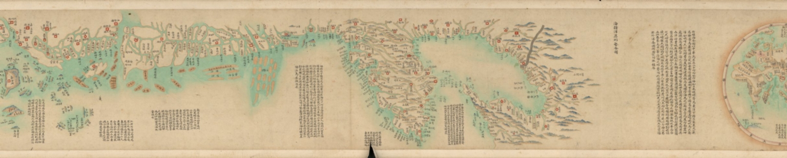
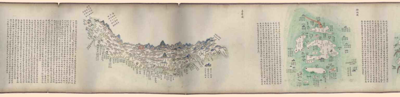
海疆洋界形勢全圖.Part 1 = Coastal map of China.Part 1
Contributor
Anonymous
Type
Manuscripts
Barcode
4687820500554
Title
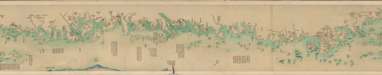
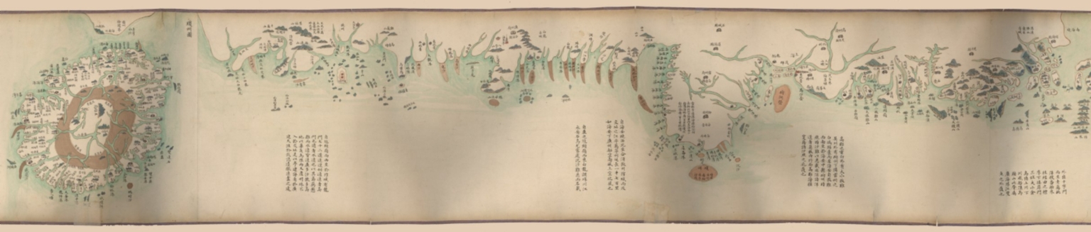
海疆洋界形勢全圖.Part 2 = Coastal map of China.Part 2
Contributor
Anonymous
Type
Manuscripts
Barcode
4687820500555
Title
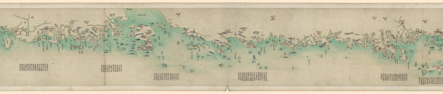
海疆洋界形勢全圖.Part 3 = Coastal map of China.Part 3
Contributor
Anonymous
Type
Manuscripts
Barcode
4687820500556
Title
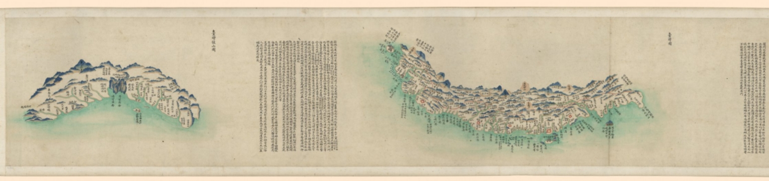
海疆洋界形勢全圖.Part 4 = Coastal map of China.Part 4
Contributor
Anonymous
Type
Manuscripts
Barcode
4687820500557
Title
海疆洋界形勢全圖.Part 5 = Coastal map of China.Part 5
Contributor
Anonymous
Type
Manuscripts
Barcode
4687820500558
Title
海疆洋界形勢全圖.Part 6 = Coastal map of China.Part 6
Contributor
Anonymous
Type
Manuscripts
Barcode
4687820500564
Title
海疆洋界形勢圖.Part 6
Contributor
Hummel, Arthur W. (Arthur William), 1884-1975
Type
Manuscripts
Barcode
4687820500559
Title
海疆洋界形勢圖.Part 1
Contributor
Hummel, Arthur W. (Arthur William), 1884-1975
Type
Manuscripts
Barcode
4687820500560
Title
海疆洋界形勢圖.Part 2
Contributor
Hummel, Arthur W. (Arthur William), 1884-1975
Type
Manuscripts
Barcode
4687820500561
Title
海疆洋界形勢圖.Part 3
Contributor
Hummel, Arthur W. (Arthur William), 1884-1975
Type
Manuscripts
Barcode
4687820500563
Title
海疆洋界形勢圖.Part 5
Contributor
Hummel, Arthur W. (Arthur William), 1884-1975
Type
Manuscripts
Barcode
4687820500562
Title
海疆洋界形勢圖.Part 4
Contributor
Hummel, Arthur W. (Arthur William), 1884-1975
Type
Manuscripts
Barcode
36878003222312
Title
To the Society of Managing Owners of the Ships in the English East India Company's Service, This Chart of the China Sea, Including the Philippina Molluca and Banda Islands, Shewing al the same time all the Tracks into the Pacific Ocean, commonly known by the name of the Eastern Passage to China
Contributor
[Robertson, George, 1748-1788, cartographer, Harmer, Thomas, fl. 1784-1814, engraver]
Type
Printed
Barcode
4687820500336
Title
A new chart of the China Sea, with its several entrances : drawn from a great number of draughts, journals, and other National documents, regulated by astronomical observations
Contributor
[Laurie & Whittle, author, publisher, Larkins, John Pascal, 17---1794, cartographer, Rees, Captain, cartographer]
Type
Printed
Barcode
3687800354267G
Title
A new chart of the China Sea, with its several entrances : drawn from a great number of draughts, journals, and other National documents, regulated by astronomical observation
Contributor
[Laurie & Whittle, author, publisher, Larkins, John Pascal, 17---1794, cartographer, Rees, Captain, cartographer]
Type
Printed
Barcode
3687800354473F
Title
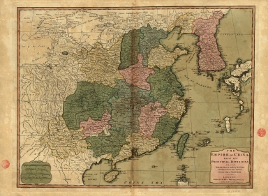
The Empire of China with its principal divisions : drawn from the surveys made by the Jesuits, with improvements and additions from the maps of Mons.r D'Anville.
Contributor
[Anville, Jean Baptiste Bourguignon d', 1697-1782, bibliographic antecedent, Bowen, Maurice, fl. ca. 1780-1794, engraver, Whittle & Laurie, publisher]
Type
Printed
Barcode
3687800301756B
Title
A new chart of the oriental seas and islands with the coasts of the continent from the Isle of Ceylon to Amoye in China
Contributor
[Après de Mannevillette, Jean-Baptiste-Nicolas-Denis d', 1707-1780, cartographer, Laurie & Whittle, publisher]
Type
Printed
Barcode
4687820500131
Title
Carte des côtes de l'Amérique et de l'Asie : depuis la Californie jusqu'à Macao
Contributor
La Pérouse, Jean-François de Galaup, comte de, 1741-1788
Type
Printed
Barcode
3687800354289K
Title
To the Honorable the Court of Directors of the United Company of Merchants of England trading to the East Indies, this Chart of the China Seas
Contributor
[Heather, William, 1764-1812, hydrographer, Stephenson, John,, fl. 1791-1817, engraver, Norie, John William, 1772-1843, illustrator, Heather and Williams, publisher]
Type
Printed
Barcode
36878003222402
Title
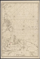
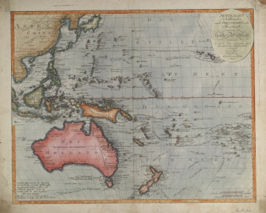
Australien (Südland) auch Polynesien oder Inselwelt, insgemein der fünfte Welttheil genannt : nach den neuesten und bewährtesten Hülfsmitteln entworfen
Contributor
Walch, Johannes, 1757-1816, cartographer
Type
Printed
Barcode
4687820500450
Title
To John Reeves Esq.re F.R.S. for the liberal aid of his Chinese m.s.s. and the benefit derived from his excellent map of that Empire presented by him to the Hon.ble East India Company this Chart of the East Coast of China
Contributor
[Horsburgh, James, 1762-1836, author, publisher, J. & C. Walker (Firm), engraver, Ross, Daniel, 1780-1849, cartographer, Hall, Basil, 1788-1844, cartographer, Crawford, James H., fl. 18--, cartographer, Rancliffe, George Augustus Henry Anne Parkyns, Baron, 1785-1850, cartographer, Rees, Thomas, 1790-1870, cartographer, Dayot, Félix, 1772-1821, cartographer, Sturgis, Josiah, 1773-1850, cartographer, Rees, John, 1752-18--, cartographer, Hoskiaer, Jacob, 1808-1836, cartographer, Dalrymple, Alexander, 1737-1808, bibliographic antecedent, Reeves, John, 1774-1856, dedicatee]
Type
Printed
Barcode
4687820500105
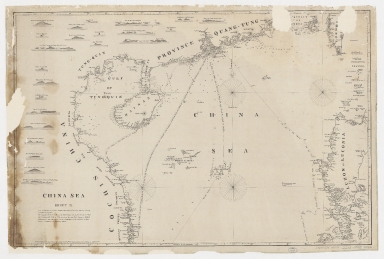
Title
China Sea. Sheet II
Contributor
Horsburgh, James, 1762-1836, cartographer, publisher
Type
Printed
Barcode
3687800354468J
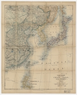
Title
Stanford's map of eastern China, Japan and Korea : the seat of war in 1894
Contributor
Edward Stanford Ltd., author, publisher
Type
Printed
Barcode
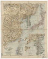
3687800354469K
Title
Stanford's map of Eastern China, Japan and Korea : 1898.
Contributor
Edward Stanford Ltd., author, publisher
Type
Printed
Barcode
3687800354496K
Title
Missionary map of China
Contributor
[Beach, Harlan Page, 1854-1933, cartographer, Servoss, R. D., publisher]
Type
Printed
Barcode
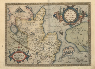
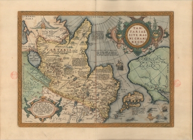
3687800354453D
Title
Map of Tartaria or the kingdom of the great Cham
Contributor
Ortelius, Abraham, 1527-1598, author
Type
Printed
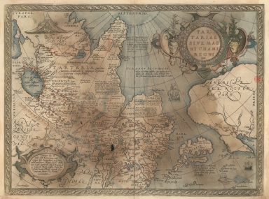
Barcode
3687800354446F
Title
Map of Tartaria or the kingdom of the great Cham
Contributor
[Ortelius, Abraham, 1527-1598, author, Cónegos Regrantes de Santo Agostinho. Mosteiro de São Vicente de Fora (Lisboa), former owner]
Type
Printed
Barcode
3687800354513A
Title
Map of the coast of China and part of Formosa Island between 2.d and 30.d 30.m north latitude
Type
Manuscripts
Barcode
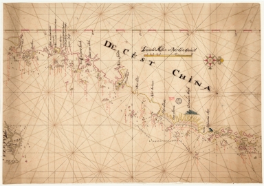
36878003545129
Title
De Cust China
Type
Manuscripts
Barcode
3687800354567J
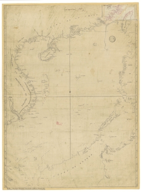
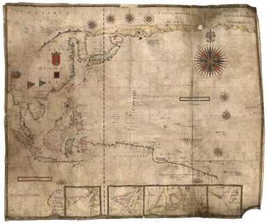
Title
[Chart of the Sea of Canton to Cambodia and the Philippines]
Type
Manuscripts
Barcode
36878003544117
Title
Map of Tartaria or the kingdom of the great Cham.
Contributor
[Ortelius, Abraham, 1527-1598, author, Plantijnsche Drukkerij, printer]
Type
Printed
Barcode
3687800354459J
Title
Particular map of a part of the coast of China with the island of Pakas and surrounding islands, up to the southernmost part of Japan
Contributor
[Dudley, Robert, Sir, 1574-1649, cartographer, Lucini, Antonio Francesco, 1605-1640, engraver, Onofri, Francesco, fl. 1631-1679, printer]
Type
Printed
Barcode
3687800354648J
Title
Chart of the Pacific Ocean
Contributor
Albernaz, João Teixeira, I, fl. 1602-1649, cartographer
Type
Manuscripts
Barcode
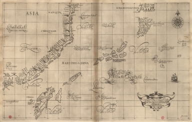
3687800354436E
Title
The Eastern part of East Indies stretching from Ceylon to Japan and New Holland
Contributor
Doncker, Hendrick, 1626-1699, cartographer
Type
Printed
Barcode
3687800354457H
Title
A Map of the 15 Provinces and 155 Capital Cities of the Chinese Empire
Contributor
[Couplet, Philippe, 1623-1692, cartographer, Louvemont, François de, 1648-ca. 1690, engraver, Nolin, Jean-Baptiste, 1648-1708, printer]
Type
Printed
Barcode
3687800317483F
Title
Dutch Chart of the China Sea
Type
Manuscripts
Barcode
4687820500248
Title
Parte orientale della China : divisa nelle sue Provincie, se dedicata al motto rev. Padre Antonio Baldigiani della Compagnia di Gesù
Contributor
Coronelli, Vincenzo, 1650-1718, cartographer
Type
Printed
Barcode
36878003016649
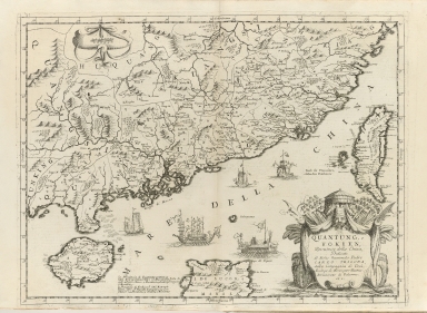
Title
Quantung, e Fokien : provincie della China
Contributor
Coronelli, Vincenzo, 1650-1718, cartographer
Type
Printed
Barcode
4687820501195
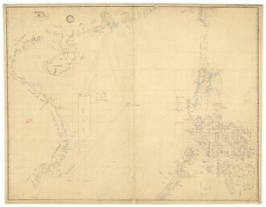
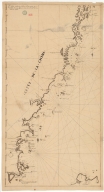
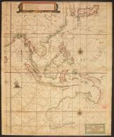
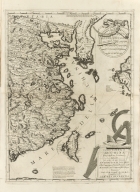
Title
[Carte côtes de la Chine]
Type
Manuscripts
Barcode
3687800354261A
Title
Carte de côte de la Chine depuis les 22.e jusqu'au 25.e 30.m de latitude nord comprenant la partie de Ouest de l'Isle Formose
Type
Manuscripts
Barcode
3687800317478J
Title
Dutch nautical chart of the 18th century, including the coasts of Annam, Tonkin, China, Hainan Island and part of Luzon
Contributor
Saffroy, Amand, 1844-1905, former owner
Type
Manuscripts
Barcode
3687800354499N
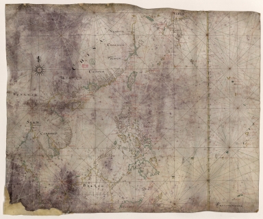
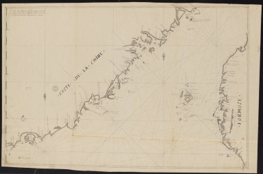
Title
[Map of the southeast coast of China]
Type
Manuscripts
Barcode
3687800354262B
Title
Southern part of the China Se
Type
Manuscripts
Barcode
3687800354259H
Title
Chart of the seas of Canton to Cambodia and the Philippines
Type
Manuscripts
Barcode
4687820500202
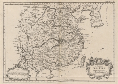
Title
L'Empire de la Chine
Contributor
Bellin, Jacques-Nicolas, 1703-1772, cartographer
Type
Printed
Barcode
3687800354419F
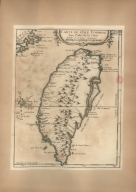
Title
Carte de l'Isle Formose aux costes de la Chine
Contributor
Bellin, Jacques-Nicolas, 1703-1772, cartographer
Type
Printed
Barcode
4687820500218
Title
A chart of the China Sea : inscribed to Mons.r D'Aprés de Mannevillette the ingenious author of the Neptune Oriental, as a tribute due to his labours for the benefit of Navigation, and in acknowledgement of his many signal favours to Dalrymple.
Contributor
[Dalrymple, Alexander, 1737-1808, hydrographer, Demonville, Antoine Guénard, ca. 1733-1797, printer, Malassis, Romain-Nicolas, 1737-1813, printer, Après de Mannevillette, Jean-Baptiste-Nicolas-Denis d', 1707-1780, dedicatee]
Type
Printed
Barcode
36878003544319
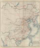
Title
Railway map of China : Peking, Oct. 1918
Contributor
[United States. Bureau of Foreign and Domestic Commerce, author, Whitham, Paul Page, 1878-1941, author, L.L. Poates Engr'g Co., printer]
Type
Printed
Barcode
687800354612A
Title
North Indian Ocean, China Sea and part of the Pacific Ocean
Contributor
Homem, Diogo, ca. 1520-1576, cartographer
Type
Manuscripts
|


![[Chart of the Sea of Canton to Cambodia and the Philippines]](http://lunamap.must.edu.mo:80/MediaManager/srvr?mediafile=/Size2/MUST~2~2/54/GE+SH+18+PF+181+P+21+RES+Carte+des+mers+de+Canton.jpg)
![[Carte côtes de la Chine]](http://lunamap.must.edu.mo:80/MediaManager/srvr?mediafile=/Size2/MUST~2~2/63/GE+SH+18+PF+181+P+12+D_Carte+C%C3%83%C2%B4tes+de+la+Chine.jpg)

![[Map of the southeast coast of China]](http://lunamap.must.edu.mo:80/MediaManager/srvr?mediafile=/Size2/MUST~2~2/54/SH+18+PF+181+P+16+D.jpg)