|
REFINE
Browse All : China -- Maps and Printed
1-11 of 11
Barcode
4687820500966
Title
China
Contributor
Anonymous
Type
Printed
Barcode
4687820500852
Title
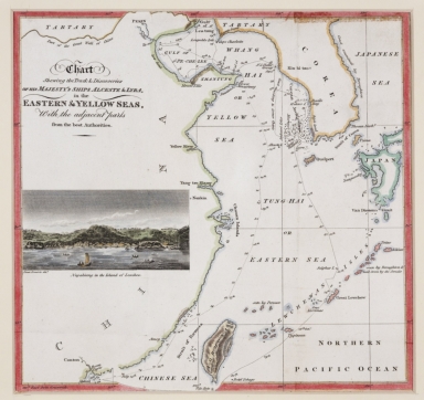
Chart shewing the track & discoveries of his Majesty's ships Alceste & Lyra, in the Eastern & Yellow Seas, with the adjacent parts from the best authorities.
Contributor
[Murray, John, 1778-1843, author, printer, Dwarris, Fortunatus, Sir, 1786-1860, illustrator]
Type
Printed
Barcode
4687820501174
Title
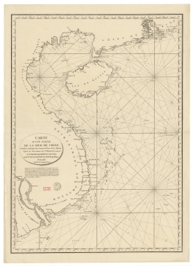
Carte d'une partie de la mer de Chine
Contributor
Rosili Mesros, François Etienne de, 1748-1832, bibliographic antecedent
Type
Printed
Barcode
3687800354287I
Title
To the Honorable the Court of Directors of the United Company of Merchants of England trading to the East Indies, this Chart of the China Seas
Contributor
[Heather, William, 1764-1812, hydrographer, Stephenson, John,, fl. 1791-1817, engraver, Norie, John William, 1772-1843, illustrator, Heather and Williams, publisher]
Type
Printed
Barcode
4687820501078
Title
Carte generale de la Chine : dressée sur les cartes particulieres que l'Empereur Cang-hi a fait lever sur les lieux par les RR. PP. Jesuites mission[n]aires dans cet Empire
Contributor
[Anville, Jean Baptiste Bourguignon d', 1697-1782, cartographer, Gravelot, Hubert-François, 1699-1773, illustrator, engraver, Delahaye, Jean Baptiste, fl. 1721-1723, engraver]
Type
Printed
Barcode
4687820500965
Title
Carte du voyage des ambassadeurs de la Compagnie orientale des Provinces Unies, vers le Tartare empereur de la Chine, les années 1655, 1656 et 1657, tirée de celle de Jean Nieuhoff
Contributor
[Duval, Pierre,1619-1683, cartographer, Nieuhof, Johannes, 1618-1672, bibliographic antecedent]
Type
Printed
Barcode
4687820501105
Title
Il regno della China detto presentemente Catay, e Mangin, diviso sopra le Carte piú esatte nelle sue Principle Provincie
Contributor
[Cantelli, Giacomo, 1643-1695, cartographer, Grueber, Johann, 1623-1680 bibliographic antecedent, Góis, Bento de, 1562-1607, bibliographic antecedent, Martini, Martino, 1614-1661, bibliographic antecedent, Tavernier, Jean-Baptiste, 1605-1689, bibliographic antecedent, Widman, Georgio, fl. 1705, engraver, Rossi, Giovanni Giacomo de, 1627-1691, printer]
Type
Printed
Barcode
3687800354504A
Title
Chart of the south coast of China from Macao to The Brothers
Contributor
[Inverarity, David, 17---18--, cartographer, Dalrymple, Alexander, 1737-1808, editor, publisher, Harmer, Thomas, fl. 1784-1814, engraver]
Type
Printed
Barcode
3687800354509F
Title
Map of the coasts of China and neighboring islands with some additions
Contributor
Anville, Jean Baptiste Bourguignon d', 1697-1782, cartographer
Type
Printed
Barcode
4687820501175
Title
A chart of the China Sea : inscribed to Mons.r d'Aprés de Mannevillette the ingenious author of the Neptune Oriental, as a tribute due to his labours for the benefit of navigation, and in acknowledgment of his many signal favours to A. Dalrymple.
Contributor
[Dalrymple, Alexander, 1737-1808, hydrographer, Henry, B., fl. 1770-1775, engraver, Whitchurch, William, fl. 18th century, engraver, Lane, Bartholomew, fl. 19th century, engraver, Après de Mannevillette, Jean-Baptiste-Nicolas-Denis d', 1707-1780, dedicatee]
Type
Printed
Barcode
36878003222312
Title
To the Society of Managing Owners of the Ships in the English East India Company's Service, This Chart of the China Sea, Including the Philippina Molluca and Banda Islands, Shewing al the same time all the Tracks into the Pacific Ocean, commonly known by the name of the Eastern Passage to China
Contributor
[Robertson, George, 1748-1788, cartographer, Harmer, Thomas, fl. 1784-1814, engraver]
Type
Printed
1-11 of 11
|

![Carte generale de la Chine : dressée sur les cartes particulieres que l'Empereur Cang-hi a fait lever sur les lieux par les RR. PP. Jesuites mission[n]aires dans cet Empire](http://lunamap.must.edu.mo:80/MediaManager/srvr?mediafile=/Size2/MUST~2~2/54/GE+DD-2987+%287155+B%29.jpg)