|
REFINE
Search Results: All Fields similar to 'Macao in Asia Maps' and What equal to 'Sea Charts' and Where equal to 'China'
1-16 of 16
Barcode
4687820500855
Title
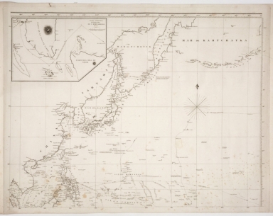
Map of the western Pacific ocean and the Asiatic coast
Contributor
Anonymous
Type
Printed
Barcode
4687820500782
Title
A chart of the East India Islands with the coasts of the continent from Caliminera Point to Amoye in China
Contributor
Anonymous
Type
Printed
Barcode
4687820500650
Title
明代東西洋航海圖 = The Selden Map
Contributor
Anonymous
Type
Manuscripts
Barcode
4687820500132
Title
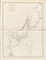
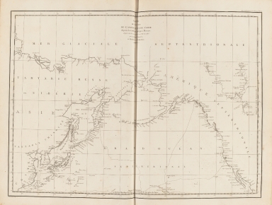
Carte Générale Des Découvertes faites en 1787 dans les Mers De Chine et De Tartarie ou depuis Manille jusqu'à Avatscha : par les Frégates Françaises la Boussole et l'Astrolabe
Contributor
La Pérouse, Jean-François de Galaup, comte de, 1741-1788
Type
Printed
Barcode
4687820500212
Title
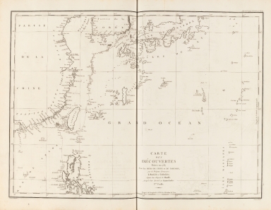
Carte des découvertes faites en 1787 dans les mers de Chine et de Tartarie : par les frégates françaises la Boussole et l'Astrolabe, depuis leur départ de Manille jusqu'à leur arrivée au Kamtschatka
Contributor
La Pérouse, Jean-François de Galaup, comte de, 1741-1788
Type
Printed
Barcode
4687820500215
Title
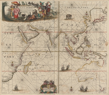
Nieuwe pascaert van Oost Indien
Contributor
Keulen, Johannes van, 1654-1715
Type
Printed
Barcode
4687820500131
Title
Carte des côtes de l'Amérique et de l'Asie : depuis la Californie jusqu'à Macao
Contributor
La Pérouse, Jean-François de Galaup, comte de, 1741-1788
Type
Printed
Barcode
3687800354287I
Title
To the Honorable the Court of Directors of the United Company of Merchants of England trading to the East Indies, this Chart of the China Seas
Contributor
[Heather, William, 1764-1812, hydrographer, Stephenson, John,, fl. 1791-1817, engraver, Norie, John William, 1772-1843, illustrator, Heather and Williams, publisher]
Type
Printed
Barcode
4687820501071
Title
Seconde partie de la carte d'Asie : contenant la Chine, et partie de la Tartarie, l'Inde au delà du Gange, les Isles Sumatra, Java, Borneo, Moluques, Philippines et du Japon. Publiée sous les auspices de Monseigneur Louis-Philippe D'Orléans, Duc D'Orléans, prémier Prince du Sang
Contributor
Anville, Jean Baptiste Bourguignon d', 1697-1782, cartographer
Type
Manuscripts
Barcode
4687820500976
Title
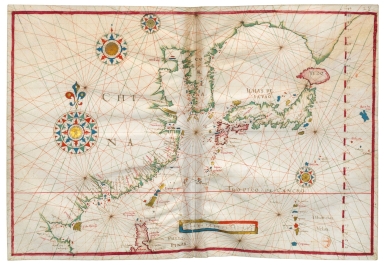
North China Sea and West Pacific Ocean
Contributor
Albernaz, João Teixeira, fl. 1602-1649, cartographer
Type
Manuscripts
Barcode
3687800317478J
Title
Dutch nautical chart of the 18th century, including the coasts of Annam, Tonkin, China, Hainan Island and part of Luzon
Contributor
Saffroy, Amand, 1844-1905, former owner
Type
Manuscripts
Barcode
3687800354308C
Title
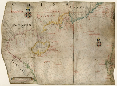
Gulf of Tonkin to Luzon and Formosa
Contributor
Thornton, John, 1641-1708, hydrographer
Type
Manuscripts
Barcode
3687800317476H
Title
Gulf of Tonkin to Luzon and Formosa
Contributor
Thornton, John, 1641-1708, cartographer
Type
Manuscripts
Barcode
4687820500209
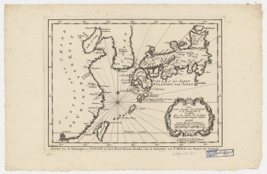
Title
Carte des isles du Japon et la presqu'isle de Coree, avec les costes de la Chine depuis Pekin jusqu'a Canton = Kaart van de Eilanden van Japan, en van't Half-Eiland Koréa ; met de Kusten van China van Pekin tot Canton
Contributor
[Bellin, Jacques Nicolas, 1703-1772, Schley, Jacobus van der, 1715-1779]
Type
Printed
Barcode
4687820500489
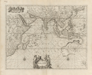
Title
Mar di India
Contributor
Anonymous
Type
Printed
1-16 of 16
|


![[Asia]](http://lunamap.must.edu.mo:80/MediaManager/srvr?mediafile=/Size2/MUST~2~2/41/G1015+.T4+1630-12.jpg)