|
REFINE
Search Results: All Fields similar to 'Macao and its Surroundings' and What equal to 'Sea Charts' and What equal to 'Printed' and Where equal to 'Philippines'
1-6 of 6
Barcode
4687820500782
Title
A chart of the East India Islands with the coasts of the continent from Caliminera Point to Amoye in China
Contributor
Anonymous
Type
Printed
Barcode
4687820500105
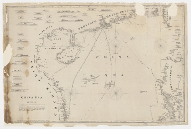
Title
China Sea. Sheet II
Contributor
Horsburgh, James, 1762-1836, cartographer, publisher
Type
Printed
Barcode
3687800354509F
Title
Map of the coasts of China and neighboring islands with some additions
Contributor
Anville, Jean Baptiste Bourguignon d', 1697-1782, cartographer
Type
Printed
Barcode
4687820500108
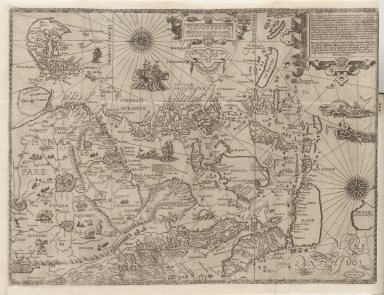
Title
The Nauigation of the Portingales into the East Indies, containing their trauels by Sea, into East India, and from the East Indies into Portingall, also from the Portingall Indies to Malacca, China, Iapon, the Islands of Iaua and Sunda ...
Contributor
[Wolfe, John, Phillip, William, Linschoten, Jan Huygen van, 1563-1611]
Type
Printed
Barcode
4687820500336
Title
A new chart of the China Sea, with its several entrances : drawn from a great number of draughts, journals, and other National documents, regulated by astronomical observations
Contributor
[Laurie & Whittle, author, publisher, Larkins, John Pascal, 17---1794, cartographer, Rees, Captain, cartographer]
Type
Printed
Barcode
3687800354267G
Title
A new chart of the China Sea, with its several entrances : drawn from a great number of draughts, journals, and other National documents, regulated by astronomical observation
Contributor
[Laurie & Whittle, author, publisher, Larkins, John Pascal, 17---1794, cartographer, Rees, Captain, cartographer]
Type
Printed
1-6 of 6
|