|
Barcode
4687820500662
Title
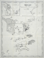
Território de Macau
Contributor
Macau. Direcção dos Serviços de Cartografia e Cadastro
Type
Printed
Barcode
4687820501072
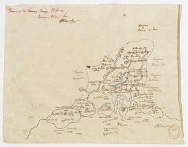
Title
De Eӯlanden van Macaoủ, loopende van, t’Eӯlandt S.t Jủan totaande Stadt Canton
Contributor
De Graaf, Isaac, 1667-1743
Type
Manuscripts
Barcode
4687820501215
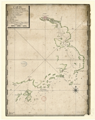
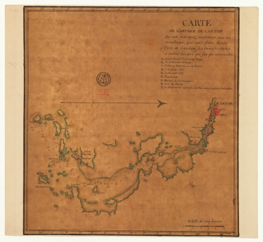
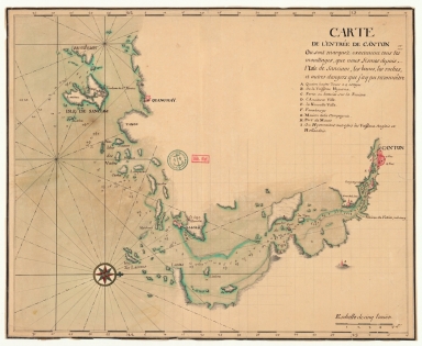
Title
Carte de l'entrée de Canton ou sont marquez exactement tous les mouillages que nous fimes depuis l'isle de Sanciam, les bancs, les roches et autres dangers que j'ay pu remarquer
Contributor
Anonymous
Type
Manuscripts
Barcode
4687820500508
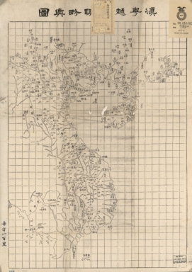
Title
滇粤, 越南聯界與圖
Contributor
湖北省 (中國). 官書局
Type
Printed
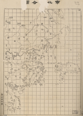
Barcode
4687820500512
Title
南北洋合圖 = Coastal map of Imperial Qing
Contributor
湖北省 (中國). 官書局
Type
Printed
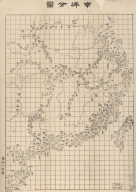
Barcode
4687820500513
Title
南洋分圖 = Coastal map of the South China
Contributor
湖北省 (中國). 官書局
Type
Printed
Barcode
4687820500515
Title
廣東省輿圖 = Map of Guangdong Province
Contributor
Anonymous
Type
Manuscripts
Barcode
4687820500532
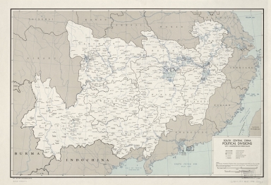
Title
South central China political divisions with administrative (Hsien) seats
Contributor
United States. Central Intelligence Agency
Type
Printed
Barcode
4687820500533
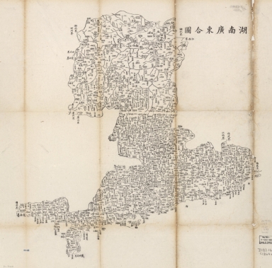
Title
湖南廣東合圖
Contributor
湖北省 (中國). 官書局
Type
Printed
Barcode
4687820500541
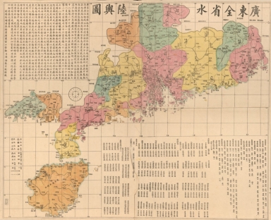
Title
廣東全省水陸與圖 = Map of the waterways and roads in Guangdong Province
Contributor
Li, Zhongpei, active 19th century
Type
Printed
Barcode
4687820501003
Title
從澳門到黃埔的地圖
Contributor
Anonymous
Type
Manuscripts
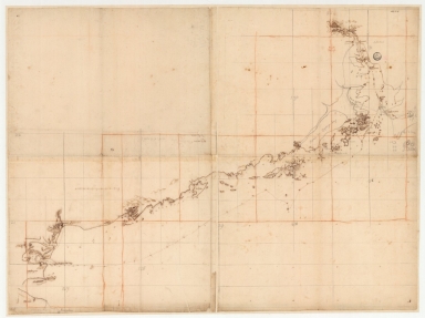
Barcode
3687800354678M
Title
South China Coast from St. John Island to the Lamma Islands
Type
Manuscripts
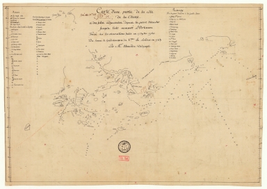
Barcode
3687800354681G
Title
Carte d'une partie de la côte de la Chine et des îles adjacentes depuis la pierre blanche jusqu'à l'isle nommée l'Artimon tracée sur les observations faites en 1759 & 1760 du senau Le Goudelours du v.au Le Londres en 1764
Contributor
Dalrymple, Alexander, 1737-1808, cartographer
Type
Manuscripts
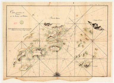
Barcode
3687800354676K
Title
Carte particuliere de l'entrée de la Riviere de Canton
Type
Manuscripts
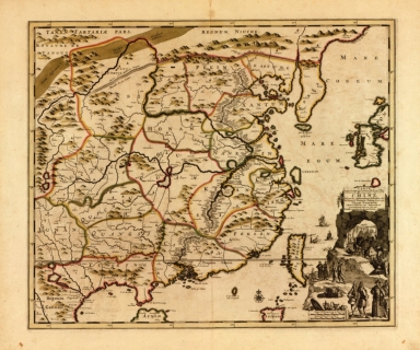
Barcode
4687820500518
Title
Carte exacte de toutes les provinces, villes, bourgs, villages et rivières du vaste et puissant empire de la Chine : faite par les ambassadeurs hollandois dans leur voyage de Batavia à Peking
Contributor
[Nieuhof, Johannes, 1618-1672, Aa, Pieter van der, 1659-1733]
Type
Printed
Barcode
4687820500529
Title
廣東全圖 = Kuangtung
Contributor
[Regis, Jean Baptiste, 1664-1738, Fuchs, Walter, 1902-1979, Jartoux, Pierre, 1669-1720, 康熙, Emperor of China, 1654-1722]
Type
Printed
Barcode
4687820500536
Title
廣東全圖 = Complete map of Guangdong Province
Contributor
湖北省 (中國). 官書局
Type
Printed
Barcode
4687820500556
Title
海疆洋界形勢全圖.Part 4 = Coastal map of China.Part 4
Contributor
Anonymous
Type
Manuscripts
Barcode
4687820500561
Title
海疆洋界形勢圖.Part 3
Contributor
Hummel, Arthur W. (Arthur William), 1884-1975
Type
Manuscripts
Barcode
4687820500545
Title
皇朝直省輿地全圖 = Qing Empire's complete map of all provinces
Contributor
Xujiahui tian zhu tang (Shanghai, China)
Type
Printed
Barcode
4687820501200
Title
Carte de l'entrée de Canton où sont marquez exactement tous les mouillages, que nous fîmes depuis l'isle de Sanciam, les bancs, les roches et autres dangers que j'ay pu reconnoitre
Contributor
Anonymous
Type
Manuscripts
Barcode
4687820501208
Title
Plan de la rivière de Canton dans la Chinne dans la partie du nord
Contributor
Anonymous
Type
Manuscripts
Barcode
4687820501199
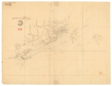
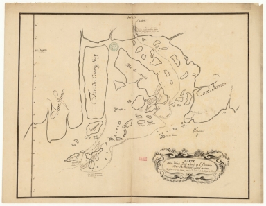
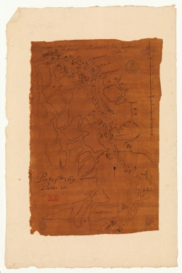
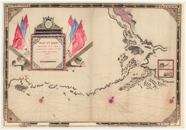
Title
Carte de la rivière de Canton et de ses environs du costé du sud est [corrigé :] ouest
Type
Manuscripts
Barcode
4687820501201
Title
Carte de la rivière de Canton et des îles
Contributor
Anonymous
Type
Manuscripts
Barcode
4687820501206
Title
Carte de l'entrée de Canton sur la côte de la Chine
Contributor
Anonymous
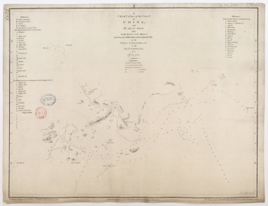
Type
Manuscripts
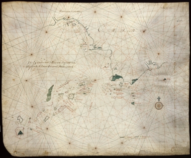
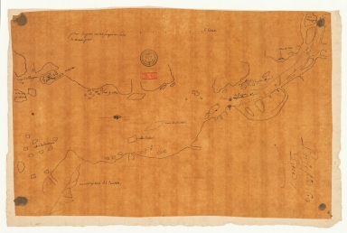
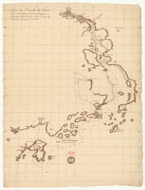
Title
[Carta marítima de grande grupo insular dos mares da China]
Type
Manuscript
Barcode
36878003222435
Contributor
Dolcé, Charles, 16---17--, cartographer
Type
Manuscripts
Barcode
4687820501140
Title
廣東省地圖 = Carte de la province de Canton. Part 8
Contributor
Anonymous
Type
Printed
Barcode
4687820500439
Title
Chart of Choo Keang or Canton river
Contributor
Horsburgh, James
Type
Printed
Barcode
4687820500444
Title
Carte réduite de l'ocean oriental depuis le Cap de Bonne Espérance jusqu'à l'isle Formose
Contributor
Après de Mannevillette, Jean-Baptiste-Nicolas-Denis d', 1707-1780
Type
Printed
Barcode
4687820500465
Title
Stanford's library map of Asia. Part 4
Contributor
[Johnston, Alexander Keith, 1804-1871, Stanford, Edward, 1827-1904]
Type
Printed
Barcode
4687820500474
Title
Carte de la Chine dressee d'apres les materiaux Chinois les plus authentiques
Contributor
Klaproth, Julius von, 1783-1835
Type
Printed
Barcode
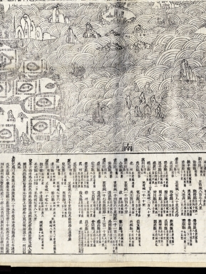
4687820500041
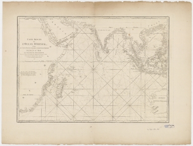
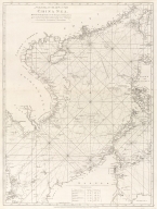
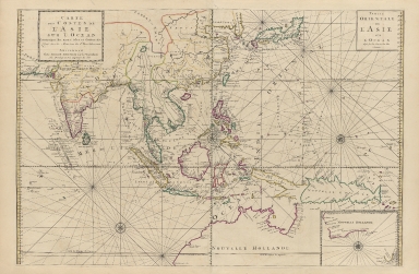
Title
[Chart of the China Sea]
Contributor
Norie, J. W. (John William), 1772-1843
Type
Printed
Barcode
4687820500703
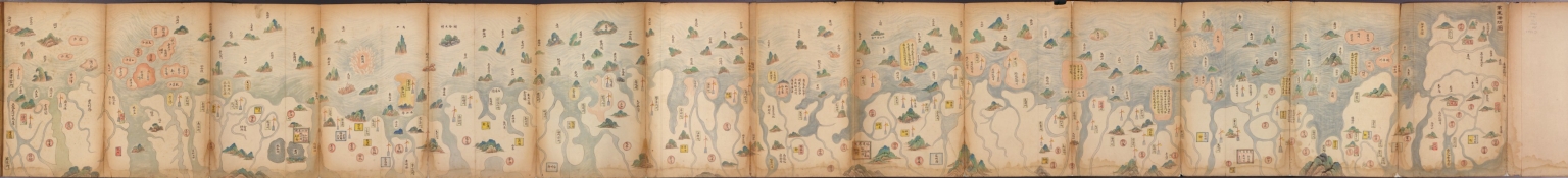
Title
萬里海防圖說 = Illustrated map of Qing Empire coastal fortifications. Part 2
Contributor
[Tan, Jiuchou, active 17th century, Zhang, Qianyi, jin shi 1712, Hummel, Arthur W. (Arthur William), 1884-1975]
Type
Manuscripts
Barcode
4687820500782
Title
A chart of the East India Islands with the coasts of the continent from Caliminera Point to Amoye in China
Contributor
Anonymous
Type
Printed
Barcode
4687820500783
Title
A general chart of the China Sea : drawn from the journals of the European navigators, particularly from those collected by Capt. Hayter
Contributor
Anonymous
Type
Printed
Barcode
4687820500791
Title
Laurie and Whittle's New chart of the Indian and Pacific Oceans between the Cape of Good Hope, New Holland and Japan : comprehending New Zealand, New Caledonia, New Britain, New Ireland, New Guinea &c., Louisiade and New Georgia; also The Pelew, New Caroline, Ladrone and Philippine Islands &c. with the most remarkable tracks of the English, Spanish, French and Dutch navigators and chiefly the track of the Walpole, EastIndiaman, Captn. Thos. Butler, 1794 from the Cape of Good Hope to Van Diemen's Land and from thence to China, and the track of the Royal Admiral Captn. Henr. Bond in 1792 and 93 from the Cape to Port Jackson and China
Contributor
Laurie & Whittle
Type
Printed
Barcode
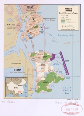
4687820500659
Title
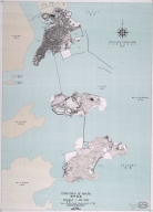
Macau (Macao) Special Administrative Region
Contributor
United States. Central Intelligence Agency, author, publisher
Type
Printed
Barcode
4687820501177
Title
A chart of part of the coast of China, and the adjacent islands from Pedro Blanco to the Mizen : laid down from observations made in 1759 and 1760, in the Schooner Cuddalore, and in the Ship London, 1764
Contributor
[Dalrymple, Alexander, 1737-1808, hydrographer, publisher, Henry, B., fl. 1770-1775, engraver, Lerpinière, Daniel, 1745-1785, engraver, Whitchurch, William, fl. 18th century, engraver, Lane, Bartholomew, fl. 19th century, engraver]
Type
Printed
Barcode
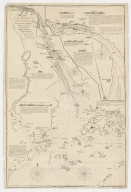
4687820500849
Title
[Carta náutica de Macau e das ilhas de Cantão]
Contributor
Anonymous
Type
Manuscripts
Barcode
36878003541327
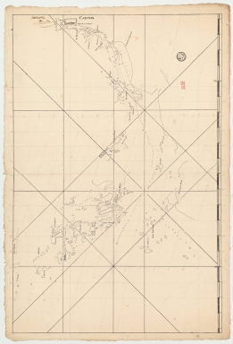
Title
Riviere de Canton.
Type
Manuscripts
Barcode
4687820501101
Title
Carte plate d'une partie de la coste de Chine, depuis les isles Pulo-Taya au nord est de l'isle de Haynam, et toutes les isles tant de la la partie de l'ouest que celles de l'e[st] servant de reconnoissance pour l'entrée de la rivière de Canton
Contributor
Dauge, Philippe
Type
Manuscripts
Barcode
4687820501205
Title
Carte de l'entrée de Canton où sont marquez exactement tous les mouillages, que nous fismes depuis l'isle de Sanciam, les bancs, les roches et autres dangers que j'ay pu reconnoître
Contributor
Anonymous
Type
Manuscripts
Barcode
4687820500952
Title
Kouang-tcheou-fou.
Contributor
Klaproth, Julius von, 1783-1835, cartographer
Type
Manuscripts
Barcode
3687800354661E
Title
Chart of the coasts of China from Hainan Island to Guangzhou
Type
Manuscripts
Barcode
36878003541204
Title
Plan et carte particuliere de la riviere de Cantong et ses environs et depuis l'isle de Sancien jusque a celle de Makao
Contributor
La Grange-Chancel, Louis de, 1678-1747, cartographer
Type
Manuscripts
Barcode
4687820500350
Title
Carte des costes de l'Asie sur l'Ocean : contenant les bancs isles et costes & c, levee sur les memoires les plus nouveau
Contributor
Mortier, Pierre, 1661-1711
Type
Printed
Barcode
4687820500712
Title
Macao
Contributor
Great Britain. War Office. General Staff. Geographical Section
Type
Printed
Barcode
4687820500800
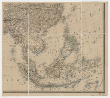
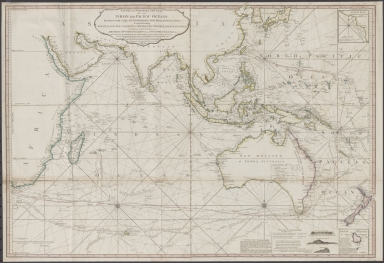
Title
[Map of the East Indies]
Contributor
Anonymous
Type
Printed
|
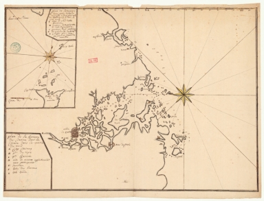
![Carte de la rivière de Canton et de ses environs du costé du sud est [corrigé :] ouest](http://lunamap.must.edu.mo:80/MediaManager/srvr?mediafile=/Size2/MUST~2~2/63/GE+SH+18+PF+179+DIV+9+P+131+D+-+Carte+de+la+rivi%C3%83%C2%A8re+de+Canton+-+sud+est.jpg)
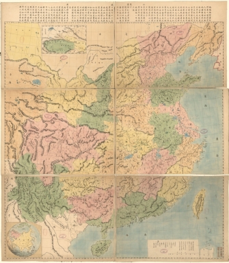
![[Carta marítima de grande grupo insular dos mares da China]](http://lunamap.must.edu.mo:80/MediaManager/srvr?mediafile=/Size3/MUST~2~2/350/d-90-r_0001.jpg)
![[Chart of the China Sea]](http://lunamap.must.edu.mo:80/MediaManager/srvr?mediafile=/Size2/MUST~2~2/25/G7822_P4_1840_N6.jpg)

![[Carta náutica de Macau e das ilhas de Cantão]](http://lunamap.must.edu.mo:80/MediaManager/srvr?mediafile=/Size2/MUST~2~2/46/D89r.jpg)
![Carte plate d'une partie de la coste de Chine, depuis les isles Pulo-Taya au nord est de l'isle de Haynam, et toutes les isles tant de la la partie de l'ouest que celles de l'e[st] servant de reconnoissance pour l'entrée de la rivière de Canton](http://lunamap.must.edu.mo:80/MediaManager/srvr?mediafile=/Size2/MUST~2~2/54/GE+SH+18+PF+179+DIV+9+P+9+-+Carte+plate+d%27une+partie+de+la+coste+de+Chine.jpg)
![[Map of the East Indies]](http://lunamap.must.edu.mo:80/MediaManager/srvr?mediafile=/Size2/MUST~2~2/41/RBRS+N+910.91+T418-69.jpg)