|
REFINE
Browse All : Images of China and Hainan Sheng (China) and South China Sea
1-14 of 14
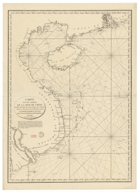
Barcode
4687820501174
Title
Carte d'une partie de la mer de Chine
Contributor
Rosili Mesros, François Etienne de, 1748-1832, bibliographic antecedent
Type
Printed
Barcode
3687800354286H
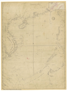
Title
[Carte d'une partie de la mer de Chine]
Type
Manuscripts
Barcode
3687800354287I
Title
To the Honorable the Court of Directors of the United Company of Merchants of England trading to the East Indies, this Chart of the China Seas
Contributor
[Heather, William, 1764-1812, hydrographer, Stephenson, John,, fl. 1791-1817, engraver, Norie, John William, 1772-1843, illustrator, Heather and Williams, publisher]
Type
Printed
Barcode
3687800354265E
Title
Tracé des routes, vray et estimée, de la résolution depuis Macao jusqu'a Pulo Timon.
Type
Manuscripts
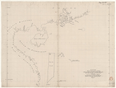
Barcode
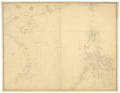
4687820501172
Title
[Route de M. de Richery en 1787 de Pondichery a Canton]
Type
Manuscripts
Barcode
4687820501071
Title
Seconde partie de la carte d'Asie : contenant la Chine, et partie de la Tartarie, l'Inde au delà du Gange, les Isles Sumatra, Java, Borneo, Moluques, Philippines et du Japon. Publiée sous les auspices de Monseigneur Louis-Philippe D'Orléans, Duc D'Orléans, prémier Prince du Sang
Contributor
Anville, Jean Baptiste Bourguignon d', 1697-1782, cartographer
Type
Manuscripts
Barcode
4687820501015
Title
Carte pour la navigation des mers entre les cotes de Chine et du Blanc le Paracel et de celles du Golfe de Cochinchine : dressée sur une carte MS.te a M.r Bouvet qui contenoit depuis le 2.e deg. jusq.' 24.e dont cette 1.ere feuille ne comprend que du 24.e au 13.e degré.
Contributor
Bouvet, 16---17--, bibliographic antecedent
Type
Manuscripts
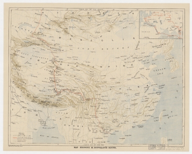
Barcode
4687820500335
Title
Map showing M. Bonvalot's route
Contributor
Erhard Bros. (Firm), engraver
Type
Printed
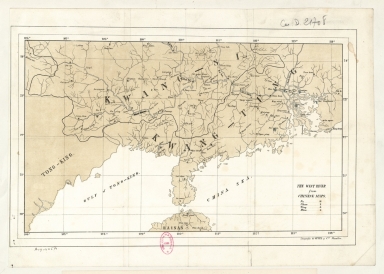
Barcode
4687820501167
Title
The West River from Chinese maps
Contributor
Litografía de Oppel y Compañía (Manila) lithographer
Type
Printed
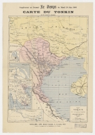
Barcode
3687800354357G
Title
Carte du Tonkin
Contributor
[Lassailly, Charles, fl. 18--, cartographer, Challamel, Pierre-Joseph, 1813-1892, editor, Dufour, F., fl. 18--, engraver, Dufrenoy, fl. 18--, printer]
Type
Printed
Barcode
3687800317478J
Title
Dutch nautical chart of the 18th century, including the coasts of Annam, Tonkin, China, Hainan Island and part of Luzon
Contributor
Saffroy, Amand, 1844-1905, former owner
Type
Manuscripts
Barcode
3687800354308C
Title
Gulf of Tonkin to Luzon and Formosa
Contributor
Thornton, John, 1641-1708, hydrographer
Type
Manuscripts
Barcode
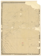
3687800354262B
Title
Southern part of the China Se
Type
Manuscripts
1-14 of 14
|
![[Carte d'une partie de la mer de Chine]](http://lunamap.must.edu.mo:80/MediaManager/srvr?mediafile=/Size2/MUST~2~2/54/GE+SH+18+PF+182+P+11+D_Carte+d%27une+partie+de+la+mer+de+Chine.jpg)

![[Route de M. de Richery en 1787 de Pondichery a Canton]](http://lunamap.must.edu.mo:80/MediaManager/srvr?mediafile=/Size2/MUST~2~2/54/GE+SH+18+PF+182+P+6+D_Routes+de+M+de+Richery+en+1787.jpg)