|
REFINE
Browse All : Sea Charts and Printed of China and Paracel Islands
1-9 of 9
Barcode
4687820500218
Title
A chart of the China Sea : inscribed to Mons.r D'Aprés de Mannevillette the ingenious author of the Neptune Oriental, as a tribute due to his labours for the benefit of Navigation, and in acknowledgement of his many signal favours to Dalrymple.
Contributor
[Dalrymple, Alexander, 1737-1808, hydrographer, Demonville, Antoine Guénard, ca. 1733-1797, printer, Malassis, Romain-Nicolas, 1737-1813, printer, Après de Mannevillette, Jean-Baptiste-Nicolas-Denis d', 1707-1780, dedicatee]
Type
Printed
Barcode
4687820501174
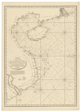
Title
Carte d'une partie de la mer de Chine
Contributor
Rosili Mesros, François Etienne de, 1748-1832, bibliographic antecedent
Type
Printed
Barcode
3687800354287I
Title
To the Honorable the Court of Directors of the United Company of Merchants of England trading to the East Indies, this Chart of the China Seas
Contributor
[Heather, William, 1764-1812, hydrographer, Stephenson, John,, fl. 1791-1817, engraver, Norie, John William, 1772-1843, illustrator, Heather and Williams, publisher]
Type
Printed
Barcode
4687820501007
Title
[[Carte portugaise de la mer des Indes entre le Cap de Bonne Espérance et le Cap Comorin] ; [Carte portugaise de la mer qui comprend le Golfe du bengale, les côtes de la Chine et les îles du Japon, Philippines, de la Sonde et Moluques], [Carte portugaise de la mer qui comprend le Golfe du bengale, les côtes de la Chine et les îles du Japon, Philippines, de la Sonde et Moluques]]
Contributor
Albernaz, João Teixeira, fl. 1602-1649, cartographer
Type
Printed
Barcode
3687800354509F
Title
Map of the coasts of China and neighboring islands with some additions
Contributor
Anville, Jean Baptiste Bourguignon d', 1697-1782, cartographer
Type
Printed
Barcode
4687820501175
Title
A chart of the China Sea : inscribed to Mons.r d'Aprés de Mannevillette the ingenious author of the Neptune Oriental, as a tribute due to his labours for the benefit of navigation, and in acknowledgment of his many signal favours to A. Dalrymple.
Contributor
[Dalrymple, Alexander, 1737-1808, hydrographer, Henry, B., fl. 1770-1775, engraver, Whitchurch, William, fl. 18th century, engraver, Lane, Bartholomew, fl. 19th century, engraver, Après de Mannevillette, Jean-Baptiste-Nicolas-Denis d', 1707-1780, dedicatee]
Type
Printed
Barcode
36878003222312
Title
To the Society of Managing Owners of the Ships in the English East India Company's Service, This Chart of the China Sea, Including the Philippina Molluca and Banda Islands, Shewing al the same time all the Tracks into the Pacific Ocean, commonly known by the name of the Eastern Passage to China
Contributor
[Robertson, George, 1748-1788, cartographer, Harmer, Thomas, fl. 1784-1814, engraver]
Type
Printed
Barcode
3687800317471C
Title
A new and correct chart of the coast of China : from latitude 12° north to 26° including Formosa, Hayman and the Philippine Islands.
Contributor
W. and J. Mount, T. and T. Page, 1747-1763, publisher, bookseller
Type
Printed
Barcode
3687800301756B
Title
A new chart of the oriental seas and islands with the coasts of the continent from the Isle of Ceylon to Amoye in China
Contributor
[Après de Mannevillette, Jean-Baptiste-Nicolas-Denis d', 1707-1780, cartographer, Laurie & Whittle, publisher]
Type
Printed
1-9 of 9
|


![[[Carte portugaise de la mer des Indes entre le Cap de Bonne Espérance et le Cap Comorin] ; [Carte portugaise de la mer qui comprend le Golfe du bengale, les côtes de la Chine et les îles du Japon, Philippines, de la Sonde et Moluques], [Carte portugaise de la mer qui comprend le Golfe du bengale, les côtes de la Chine et les îles du Japon, Philippines, de la Sonde et Moluques]]](http://lunamap.must.edu.mo:80/MediaManager/srvr?mediafile=/Size2/MUST~2~2/54/GE+DD-2987+Carte+portugaise+de+la+mer+des+Indes+-2+.jpg)


