|
Barcode
3687800354675J
Title
Carte marine de la mer Baltique, de la mer du Nord, de l'océan Atlantique Est, de la mer Méditerranée, de la mer Noire et de la mer Rouge
Contributor
Dulcert, Angelino, 1350-1400, cartographer
Type
Manuscripts
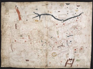
Barcode
4687820500620
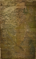
Title
Asiento present hordenat a payon les responsions dels pezos e mezures : delahun boch al altre de tots los presents bochs nnomenats los quals son cap e regiment de la mercadoria hordenat : [Mediterraneo e Europa]
Contributor
[Domenech, Arnald, Roselli, Piero]
Type
Manuscripts
Barcode
4687820500642
Title
Portolan chart of the Mediterranean
Contributor
Maggiolo, Vesconte, active 1504-1549
Type
Manuscripts
Barcode
4687820500481
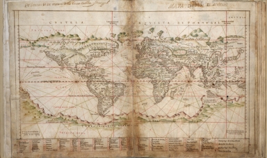
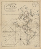
Title
Carta Universal en que se contiene todo lo que del mundo se ha descubierto fasta agora / hizola Diego Ribero cosmographo de Su magestad, Anõ de 1529. e[n] Sevilla. La qual se devide en dos partes conforme ala capitulaçion que hizieron los catholicos Reyes de españa [y] el Rey don Juan de portogual en Tordesillas, Anõ de 1494.
Contributor
[Ribeiro, Diogo, fl. 1519-1533, cartographer, Griggs, William, 1832-1911]
Type
Manuscripts
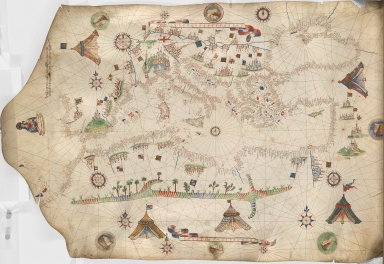
Barcode
4687820500612
Title
Portolan chart of the Mediterranean and connecting seas
Contributor
Anonymous
Type
Manuscripts
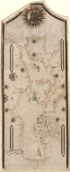
Barcode
4687820500491
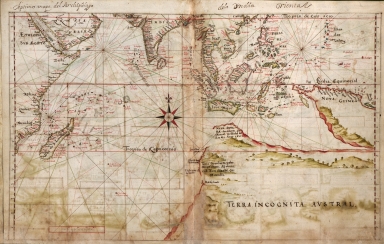
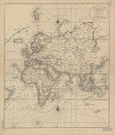
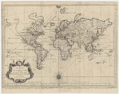
Title
[World map by Battista Agnese]
Contributor
Agnese, Battista, active 16th century
Type
Printed
Barcode
4687820501240
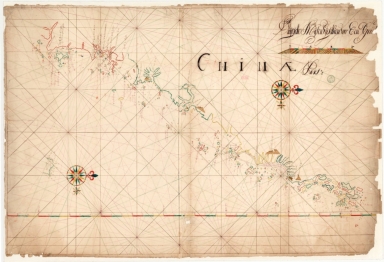
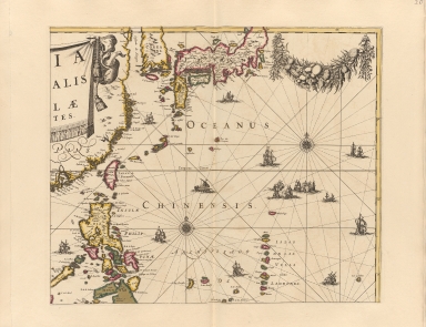
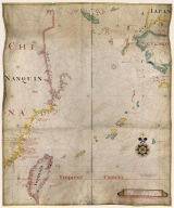
Title
Chinae pars
Contributor
Anonymous
Type
Manuscripts
Barcode
4687820500650
Title
明代東西洋航海圖 = The Selden Map
Contributor
Anonymous
Type
Manuscripts
Barcode
4687820500566
Title
Albernaz coast map of world
Contributor
[Albernaz, João Teixeira, active 1602-1648, Attayde, Jeronimo de]
Type
Manuscripts
Barcode
4687820500567
Title
Albernaz coast map of Indian Ocean
Contributor
[Albernaz, João Teixeira, active 1602-1648, Attayde, Jeronimo de]
Type
Manuscripts
Barcode
4687820500267
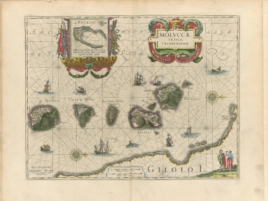
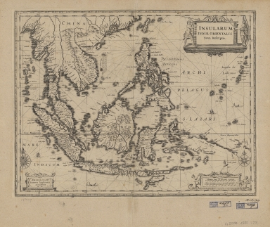
Title
Moluccae insulae celeberrimae
Contributor
[Blaeu, Willem Janszoon, 1571-1638, Hondius, Jodocus, 1594 or 1595-1629]
Type
Printed
Barcode
4687820500339
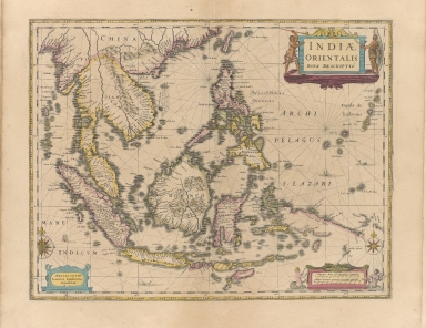
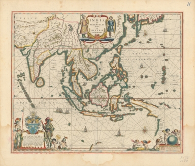
Title
Indiae Orientalis nova descriptio
Contributor
Jansson, Jan, 1588-1664
Type
Printed
Barcode
4687820500287
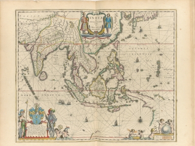
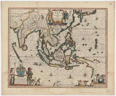
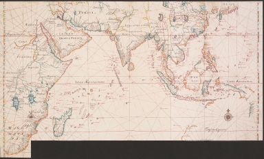
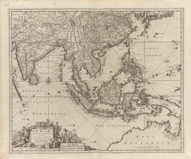
Title
India quae Orientalis dicitur, et insulae adiacentes
Contributor
Blaeu, Willem Janszoon, 1571-1638
Type
Printed
Barcode
4687820500294
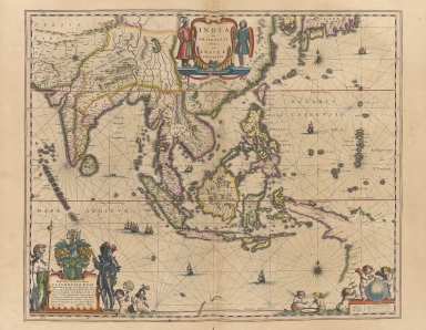
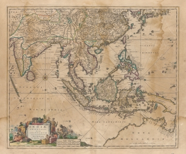
Title
India quae Orientalis dicitur, et insulae adiacentes
Contributor
Blaeu, Willem Janszoon, 1571-1638
Type
Printed
Barcode
4687820500011
Title
Blaeu map of Southeast Asia and the surrounding areas
Contributor
Blaeu, Willem Janszoon, 1571-1638
Type
Printed
Barcode
4687820500534
Title
Blaeu map of Southeast Asia and the surrounding areas
Contributor
Blaeu, Willem Janszoon, 1571-1638
Type
Printed
Barcode
4687820500080
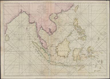
Title
Map of the Indian Ocean
Contributor
Jansson, Jan, 1588-1664
Type
Printed
Barcode
4687820500371
Title
Insularum Indiae Orientalis : nova descriptio
Contributor
Jansson, Jan, 1588-1664
Type
Printed
Barcode
4687820500094
Title
Map of the Indian Ocean
Contributor
Vinckeboons, Joan
Type
Printed
Barcode
4687820500331
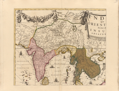
Title
India quae orientalis dicitur, et insulae adiacentes.Part 1
Contributor
Danckerts, Justus
Type
Printed
Barcode
4687820500334
Title
India quae orientalis dicitur, et insulae adiacentes.Part 4
Contributor
Danckerts, Justus
Type
Printed
Barcode
4687820500333
Title
India quae orientalis dicitur, et insulae adiacentes.Part 3
Contributor
Danckerts, Justus
Type
Printed
Barcode
4687820500332
Title
India quae orientalis dicitur, et insulae adiacentes.Part 2
Contributor
Danckerts, Justus
Type
Printed
Barcode
4687820500785
Title
A chart of the eastermost part of the East Indies from the island Zeloan to Amoy in China : with the adjacent islands adjusted according to the most accurate astronomical observations
Contributor
Seller, John, active 1658-1698
Type
Printed
Barcode
4687820500215
Title
Nieuwe pascaert van Oost Indien
Contributor
Keulen, Johannes van, 1654-1715
Type
Printed
Barcode
4687820500489
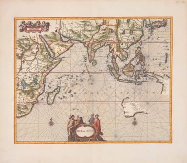
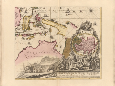
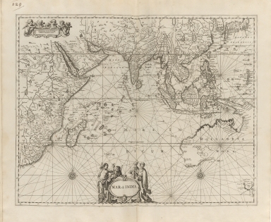
Title
Mar di India
Contributor
Anonymous
Type
Printed
Barcode
4687820500317
Title
Indiae orientalis nec non insularum adiacentium nova descriptio
Contributor
Visscher, Nicolaes, 1649-1702
Type
Printed
Barcode
4687820500323
Title
Indiae orientalis nec non insularum adiacentium nova descriptio
Contributor
Visscher, Nicolaes, 1618-1679
Type
Printed
Barcode
3687800354564G
Title
Chart of the China Sea
Contributor
Thornton, John, 1641-1708, cartographer
Type
Manuscripts
Barcode
3687800354571E
Title
Island of Amoy
Contributor
Thornton, John, 1641-1708, cartographer
Type
Manuscripts
Barcode
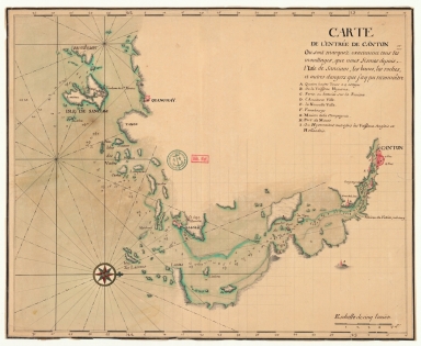
4687820501205
Title
Carte de l'entrée de Canton où sont marquez exactement tous les mouillages, que nous fismes depuis l'isle de Sanciam, les bancs, les roches et autres dangers que j'ay pu reconnoître
Contributor
Anonymous
Type
Manuscripts
Barcode
4687820500350
Title
Carte des costes de l'Asie sur l'Ocean : contenant les bancs isles et costes & c, levee sur les memoires les plus nouveau
Contributor
Mortier, Pierre, 1661-1711
Type
Printed
Barcode
4687820500241
Title
Orientaliora Indiarum Orientalium cum insulis adjacentibus a promontorio C. Comorin ad Japan = Pascaert van t'Ooster gedeelte van Oost Indien van C. Comorin tot Japan
Contributor
Renard, Louis
Type
Printed
Barcode
4687820500509
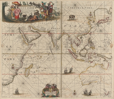
Title
Mappemonde a l'usage du roy
Contributor
Delisle, Guillaume, 1675-1726, cartographer
Type
Printed
Barcode
4687820500376
Title
Carte generale de toutes les costes du Monde : et les pays nouvellement decouvert.Part 1
Contributor
[Cóvens et Mortier, Witsen, Nicolaas, 1641-1717, Halley, Edmond, 1656-1742]
Type
Printed
Barcode
4687820500377
Title
Carte generale de toutes les costes du Monde : et les pays nouvellement decouvert.Part 2
Contributor
[Cóvens et Mortier, Witsen, Nicolaas, 1641-1717, Halley, Edmond, 1656-1742]
Type
Printed
Barcode
4687820500490
Title
Carte particulière de l'entrée de Canton
Contributor
Anonymous
Type
Printed
Barcode
4687820500209
Title
Carte des isles du Japon et la presqu'isle de Coree, avec les costes de la Chine depuis Pekin jusqu'a Canton = Kaart van de Eilanden van Japan, en van't Half-Eiland Koréa ; met de Kusten van China van Pekin tot Canton
Contributor
[Bellin, Jacques Nicolas, 1703-1772, Schley, Jacobus van der, 1715-1779]
Type
Printed
Barcode
4687820500386
Title
An essay of a new and compact map containing the known parts of the terrestrial globe = Essay d’une carte reduite contenant les parties connues du globe terrestre = Proef van eene aan-eengeschakelde kaart der bekende-deelen des gantschen aardbols
Contributor
[Bellin, Jacques Nicolas, 1703-1772, Hondt, Pieter de, Schley, Jacobus van der, 1715-1779]
Type
Printed
Barcode
4687820500211
Title
Carte d'une partie des côtes de la Chine et des Isles adjacentes : depuis l'Isle nommée la Pierre Blanche, jusqu'a celle de l'Artimon
Contributor
Dalrymple, Alexander, 1737-1808
Type
Printed
Barcode
4687820500444
Title
Carte réduite de l'ocean oriental depuis le Cap de Bonne Espérance jusqu'à l'isle Formose
Contributor
Après de Mannevillette, Jean-Baptiste-Nicolas-Denis d', 1707-1780
Type
Printed
Barcode
4687820500782
Title
A chart of the East India Islands with the coasts of the continent from Caliminera Point to Amoye in China
Contributor
Anonymous
Type
Printed
Barcode
4687820500256
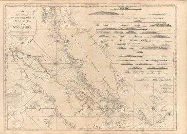
Title
A chart of the Straits of Malacca and Sincapore
Contributor
Thomas, Jeffrey
Type
Printed
Barcode
4687820500260
Title
A chart of the China Sea, and Philippine Islands with the Archipelagos of Felicia and Soloo : shewing the whole tract comprized, between Canton and Balambangan, with the soundings, shoals, rocks, & ca.
Contributor
Whittle & Laurie, publisher
Type
Printed
Barcode
4687820500255
Title
A chart of the south coast of Hay-nan, from Tinhosa to Guichou
Contributor
[Haldane, John, captain, fl. 177-, cartographer, Laurie & Whittle, publisher]
Type
Printed
Barcode
4687820500336
Title
A new chart of the China Sea, with its several entrances : drawn from a great number of draughts, journals, and other National documents, regulated by astronomical observations
Contributor
[Laurie & Whittle, author, publisher, Larkins, John Pascal, 17---1794, cartographer, Rees, Captain, cartographer]
Type
Printed
Barcode
3687800354267G
Title
A new chart of the China Sea, with its several entrances : drawn from a great number of draughts, journals, and other National documents, regulated by astronomical observation
Contributor
[Laurie & Whittle, author, publisher, Larkins, John Pascal, 17---1794, cartographer, Rees, Captain, cartographer]
Type
Printed
Barcode
687800354127B
Title
A chart of the China Sea from the Island of Sanciam to Pedra Branca with the course of the River Tigris from Canton to Macao
Contributor
[Après de Mannevillette, Jean-Baptiste-Nicolas-Denis d', 1707-1780, cartographer, Larkins, John Pascal, 17---1794, author, bibliographic antecedent, Anson, George Anson, baron, 1697-1762, author, Huddart, Joseph, 1741-1816, bibliographic antecedent]
Type
Printed
Barcode
3687800301756B
Title
A new chart of the oriental seas and islands with the coasts of the continent from the Isle of Ceylon to Amoye in China
Contributor
[Après de Mannevillette, Jean-Baptiste-Nicolas-Denis d', 1707-1780, cartographer, Laurie & Whittle, publisher]
Type
Printed
|
![Asiento present hordenat a payon les responsions dels pezos e mezures : delahun boch al altre de tots los presents bochs nnomenats los quals son cap e regiment de la mercadoria hordenat : [Mediterraneo e Europa]](http://lunamap.must.edu.mo:80/MediaManager/srvr?mediafile=/Size1/MUST~2~2/41/G5672.M4P5+1484+.D6.jpg)
![Carta Universal en que se contiene todo lo que del mundo se ha descubierto fasta agora / hizola Diego Ribero cosmographo de Su magestad, Anõ de 1529. e[n] Sevilla. La qual se devide en dos partes conforme ala capitulaçion que hizieron los catholicos Reyes de españa [y] el Rey don Juan de portogual en Tordesillas, Anõ de 1494.](http://lunamap.must.edu.mo:80/MediaManager/srvr?mediafile=/Size3/MUST~2~2/26/G3201.S12_1529_.R5_1893.jpg)
![[World map by Battista Agnese]](http://lunamap.must.edu.mo:80/MediaManager/srvr?mediafile=/Size2/MUST~2~2/41/G1026_R33_1871_17_F_02%C3%A5%C2%89%C2%AF%C3%A6%C2%9C%C2%AC.jpg)