|
REFINE
Browse All : China -- Maps and Manuscripts of Taiwan and Hainan Sheng (China)
1-4 of 4
Barcode
4687820501077
Title
Carte generale de la Chine : dressée sur les cartes particulieres que l'Empereur Cang-hi a fait lever sur les lieux par les RR. PP. Jesuites mission[n]aires dans cet Empire
Contributor
[Anville, Jean Baptiste Bourguignon d', 1697-1782, cartographer, Gravelot, Hubert-François, 1699-1773, illustrator, engraver, Delahaye, Jean Baptiste, fl. 1721-1723, engraver]
Type
Manuscripts
Barcode
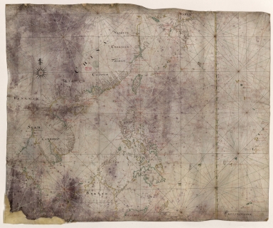
3687800317478J
Title
Dutch nautical chart of the 18th century, including the coasts of Annam, Tonkin, China, Hainan Island and part of Luzon
Contributor
Saffroy, Amand, 1844-1905, former owner
Type
Manuscripts
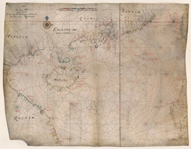
Barcode
3687800317483F
Title
Dutch Chart of the China Sea
Type
Manuscripts
1-4 of 4
|
![Carte generale de la Chine : dressée sur les cartes particulieres que l'Empereur Cang-hi a fait lever sur les lieux par les RR. PP. Jesuites mission[n]aires dans cet Empire](http://lunamap.must.edu.mo:80/MediaManager/srvr?mediafile=/Size2/MUST~2~2/54/GE+C-8817.jpg)