|
REFINE
Browse All : General Maps by Linschoten, Jan Huygen van, 1563-1611, cartographer and Langren, Arnold Florent van, 1580-1644, illustrator and Claesz, Cornelis, ca. 1546-1609, printer and Langren, Hendrik Floris van, ca.1574-1648, engraver of China and Papua New Guinea and Cambodia and Hainan Sheng (China) and Borneo
1-1 of 1
Barcode
3687800354505B
Title
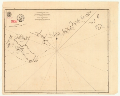
Chart of the southern coasts of the Islands between S.t Johns and the Ladrone taken on board the Nassau, Capt. Arthur Gore, and inscribed to Nathaniel Smith Esq.r
Contributor
[Larkins, John Pascal, 17---1794, cartographer, Dalrymple, Alexander, 1737-1808, publisher, Harrison, William, ca. 1750-1803, engraver, Smith, Nathaniel, 1730-1794, dedicatee]
Type
Printed
1-1 of 1
|