REMOVEWHATWHEN |
REFINE
Browse All : Nautical charts and Sea Charts and Printed by Reeves, John, 1774-1856, dedicatee and J. & C. Walker (Firm), engraver and Hall, Basil, 1788-1844, cartographer and Crawford, James H., fl. 18--, cartographer of East China Sea and Yellow Sea
1-1 of 1
Barcode
3687800354473F
Title
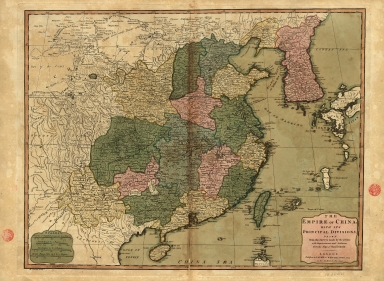
The Empire of China with its principal divisions : drawn from the surveys made by the Jesuits, with improvements and additions from the maps of Mons.r D'Anville.
Contributor
[Anville, Jean Baptiste Bourguignon d', 1697-1782, bibliographic antecedent, Bowen, Maurice, fl. ca. 1780-1794, engraver, Whittle & Laurie, publisher]
Type
Printed
1-1 of 1
|