|
REFINE
Browse All : Images of Timor Island and Southeast Asia
1-4 of 4
Barcode
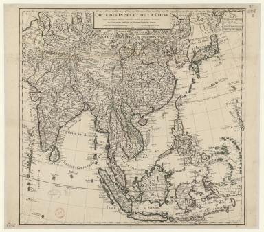
4687820501075
Title
Carte des Indes et de la Chine : dressée sur plusieurs relations particulières rectifiées par quelques observations
Contributor
[Delisle, Guillaume, 1675-1726, cartographer, publisher, Renard, Louis, ca. 1678-1746, publisher]
Type
Manuscripts
Barcode
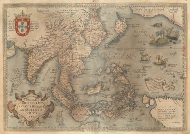
3687800354449I
Title
A map of the East Indies and surrounding islands.
Contributor
[Ortelius, Abraham, 1527-1598, author, Cónegos Regrantes de Santo Agostinho. Mosteiro de São Vicente de Fora (Lisboa), former owner]
Type
Printed
Barcode
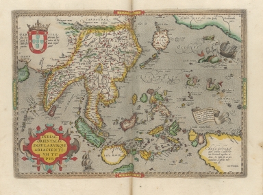
3687800301587D
Title
A map of the East Indies and surrounding islands
Contributor
[Ortelius, Abraham, 1527-1598, author, Norton, John, 15---1612, printer]
Type
Printed
Barcode
36878003222312
Title
To the Society of Managing Owners of the Ships in the English East India Company's Service, This Chart of the China Sea, Including the Philippina Molluca and Banda Islands, Shewing al the same time all the Tracks into the Pacific Ocean, commonly known by the name of the Eastern Passage to China
Contributor
[Robertson, George, 1748-1788, cartographer, Harmer, Thomas, fl. 1784-1814, engraver]
Type
Printed
1-4 of 4
|