WHAT
|
REFINE
Browse All : Images of Southeast Asia and Paracel Islands and Borneo and China and Cambodia
1-11 of 11
Barcode
4687820500218
Title
A chart of the China Sea : inscribed to Mons.r D'Aprés de Mannevillette the ingenious author of the Neptune Oriental, as a tribute due to his labours for the benefit of Navigation, and in acknowledgement of his many signal favours to Dalrymple.
Contributor
[Dalrymple, Alexander, 1737-1808, hydrographer, Demonville, Antoine Guénard, ca. 1733-1797, printer, Malassis, Romain-Nicolas, 1737-1813, printer, Après de Mannevillette, Jean-Baptiste-Nicolas-Denis d', 1707-1780, dedicatee]
Type
Printed
Barcode
4687820501075
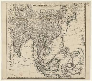
Title
Carte des Indes et de la Chine : dressée sur plusieurs relations particulières rectifiées par quelques observations
Contributor
[Delisle, Guillaume, 1675-1726, cartographer, publisher, Renard, Louis, ca. 1678-1746, publisher]
Type
Manuscripts
Barcode
3687800354409E
Title
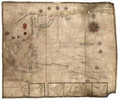
Exacta & accurata delineatio cum orarum maritimarum tum etiam locorum terrestrium quae in regionibus China, Cauchinchina, Camboja sive Champa, Syao, Malac[c]a, Arracan & Pegu, una cum omnium vicinarum insularum descriptione ut sunt Samatra, Java utraq[ue], Timora, Moluccae, Philippinae, Luconia & de Lequeos dictae, nec non insulae Japan & Corea, reliquaeq[ue] omnes adjacentes, ubi etiam adnotavimus scopulos, brevia, omniaq[ue] vadosa loca, & siquae alia a quibus periculum navigantibus. Que madmodum singula hoc aevo à Lusitanis navium gubernatoribus comperta, indigetata, & in tabulas relata fuere. E quorum recentibus ac emendatis tabulis perquàm studiosè haec describi exprimiq[ue] curavimus, in eorum hominum co[m]modum quibus ista usui volupatiq[ue] esse consueuerunnt = The trew description of all the coasts of China, Cauchinchina Camboya, Sӱao, malacca, Arracan, and Pegu, together with all the islands there abowts, both great and smale, with the cliffes, breaches, sands, droughts and shallowes, all perfectly drawne and examined with the most expert cardes of the Portingales pilots.
Contributor
[Linschoten, Jan Huygen van, 1563-1611, cartographer, Beckit, Robert, engraver, Wolfe, John, ca. 1547-1601, printer]
Type
Printed
Barcode
3687800354439H
Title
Exacta et accurata delineatio cùm orarum maritimarum tùm etiam locorum terrestrium quae in regionibus China, Cauchinchina, Camboja sive Champa, Syao, Malacca, Arracan et Pegu, unà cum omnium vicinarum insularum descriptione ut sunt Samatra, Java utraq[ue], Timora, Molucca, Philippina, Luconia et de Lequeos dictae, nec non insulae Japan et Corea, reliquaeq[ue] omnes adjacentes, ubi etiam adnotavimus scopulos, brevia, omniaq[ue] vadosa loca, et siqua alia à quibus periculum navigantibus. Que madmodum singula hoc aevo à Lusitanis navium gubernatoribus comperta, indigetata, et in tabulas relata fuere. E quorum recentibus ac emendatis tabulis perquàm studiosè haec describi exprimiq[ue] curavimus, in eorum hominum co[m]modum quibus ista usui volupatiq[ue] esse consueueru[n]t = Waarachtige wtworpinghe oste afbeeldinge van alle die custen ende landen van China, Cauchinchina, Camboja, Sÿao, Malacca, Arracan ende Pegu, mitsgaders alle die biileggende eÿlanden groote ende cleinen, mit noch die clippen, riffen, sanden, droochten ende ondiepten, alles wt de alder correckste pas ende Lees-caarten getrocken die de Portugaloissche Stvÿrlviiden huiidendaechs gebruiicken.
Contributor
[Linschoten, Jan Huygen van, 1563-1611, cartographer, Langren, Arnold Florent van, 1580-1644, illustrator, Langren, Hendrik Floris van, ca.1574-1648, engraver, Claesz, Cornelis, ca. 1546-1609, printer]
Type
Printed
Barcode
4687820500479
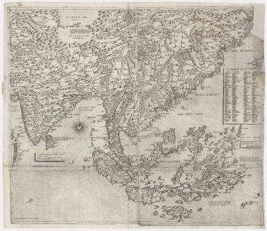
Title
The Design of the Third Part of Asia
Contributor
[Gastaldi, Giacomo, ca. 1500-ca. 1565, cartographer, Licinius, Fabius, 1521-1565, engraver, Libraria di San Marco (Venice), bookseller, Fugger, Marcus, 1529-1597, dedicatee, Hauslab, Franz, Ritter von, 1798-1883, former owner, Liechtenstein, House of, former owner]
Type
Printed
Barcode
3687800354506C
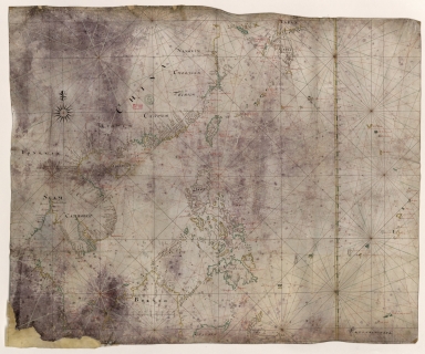
Title
Map of the China Sea
Contributor
Blaeu, Joan, 1596-1673, cartographer
Type
Manuscripts
Barcode
3687800317483F
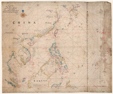
Title
Dutch Chart of the China Sea
Type
Manuscripts
Barcode
4687820501175
Title
A chart of the China Sea : inscribed to Mons.r d'Aprés de Mannevillette the ingenious author of the Neptune Oriental, as a tribute due to his labours for the benefit of navigation, and in acknowledgment of his many signal favours to A. Dalrymple.
Contributor
[Dalrymple, Alexander, 1737-1808, hydrographer, Henry, B., fl. 1770-1775, engraver, Whitchurch, William, fl. 18th century, engraver, Lane, Bartholomew, fl. 19th century, engraver, Après de Mannevillette, Jean-Baptiste-Nicolas-Denis d', 1707-1780, dedicatee]
Type
Printed
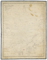
Barcode
36878003222312
Title
To the Society of Managing Owners of the Ships in the English East India Company's Service, This Chart of the China Sea, Including the Philippina Molluca and Banda Islands, Shewing al the same time all the Tracks into the Pacific Ocean, commonly known by the name of the Eastern Passage to China
Contributor
[Robertson, George, 1748-1788, cartographer, Harmer, Thomas, fl. 1784-1814, engraver]
Type
Printed
Barcode
3687800301756B
Title
A new chart of the oriental seas and islands with the coasts of the continent from the Isle of Ceylon to Amoye in China
Contributor
[Après de Mannevillette, Jean-Baptiste-Nicolas-Denis d', 1707-1780, cartographer, Laurie & Whittle, publisher]
Type
Printed
1-11 of 11
|
![Exacta & accurata delineatio cum orarum maritimarum tum etiam locorum terrestrium quae in regionibus China, Cauchinchina, Camboja sive Champa, Syao, Malac[c]a, Arracan & Pegu, una cum omnium vicinarum insularum descriptione ut sunt Samatra, Java utraq[ue], Timora, Moluccae, Philippinae, Luconia & de Lequeos dictae, nec non insulae Japan & Corea, reliquaeq[ue] omnes adjacentes, ubi etiam adnotavimus scopulos, brevia, omniaq[ue] vadosa loca, & siquae alia a quibus periculum navigantibus. Que madmodum singula hoc aevo à Lusitanis navium gubernatoribus comperta, indigetata, & in tabulas relata fuere. E quorum recentibus ac emendatis tabulis perquàm studiosè haec describi exprimiq[ue] curavimus, in eorum hominum co[m]modum quibus ista usui volupatiq[ue] esse consueuerunnt = The trew description of all the coasts of China, Cauchinchina Camboya, Sӱao, malacca, Arracan, and Pegu, together with all the islands there abowts, both great and smale, with the cliffes, breaches, sands, droughts and shallowes, all perfectly drawne and examined with the most expert cardes of the Portingales pilots.](http://lunamap.must.edu.mo:80/MediaManager/srvr?mediafile=/Size2/MUST~2~2/325/3687800354409E%28bpe-gav2-pastaC-n55_0001%29.jpg)
![Exacta et accurata delineatio cùm orarum maritimarum tùm etiam locorum terrestrium quae in regionibus China, Cauchinchina, Camboja sive Champa, Syao, Malacca, Arracan et Pegu, unà cum omnium vicinarum insularum descriptione ut sunt Samatra, Java utraq[ue], Timora, Molucca, Philippina, Luconia et de Lequeos dictae, nec non insulae Japan et Corea, reliquaeq[ue] omnes adjacentes, ubi etiam adnotavimus scopulos, brevia, omniaq[ue] vadosa loca, et siqua alia à quibus periculum navigantibus. Que madmodum singula hoc aevo à Lusitanis navium gubernatoribus comperta, indigetata, et in tabulas relata fuere. E quorum recentibus ac emendatis tabulis perquàm studiosè haec describi exprimiq[ue] curavimus, in eorum hominum co[m]modum quibus ista usui volupatiq[ue] esse consueueru[n]t = Waarachtige wtworpinghe oste afbeeldinge van alle die custen ende landen van China, Cauchinchina, Camboja, Sÿao, Malacca, Arracan ende Pegu, mitsgaders alle die biileggende eÿlanden groote ende cleinen, mit noch die clippen, riffen, sanden, droochten ende ondiepten, alles wt de alder correckste pas ende Lees-caarten getrocken die de Portugaloissche Stvÿrlviiden huiidendaechs gebruiicken.](http://lunamap.must.edu.mo:80/MediaManager/srvr?mediafile=/Size2/MUST~2~2/346/3687800354439H%28cc-804-v_0001%29.jpg)
