|
REFINE
Browse All : Images of China Sea and Paracel Islands
1-12 of 12
Barcode
4687820500105
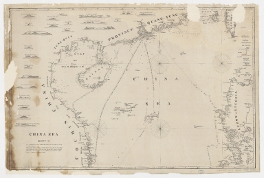
Title
China Sea. Sheet II
Contributor
Horsburgh, James, 1762-1836, cartographer, publisher
Type
Printed
Barcode
4687820500050
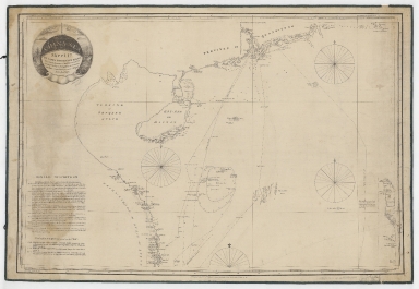
Title
China Sea. Sheet 1.st to James Drummond Esquire in acknowledgement for his laudable endeavours towards perfecting the navigation of the China Sea
Contributor
[Horsburgh, James, 1762-1836, cartographer, publisher, James Drummond, 8th Viscount Strathallan, 1767-1851, dedicatee]
Type
Printed
Barcode
4687820500218
Title
A chart of the China Sea : inscribed to Mons.r D'Aprés de Mannevillette the ingenious author of the Neptune Oriental, as a tribute due to his labours for the benefit of Navigation, and in acknowledgement of his many signal favours to Dalrymple.
Contributor
[Dalrymple, Alexander, 1737-1808, hydrographer, Demonville, Antoine Guénard, ca. 1733-1797, printer, Malassis, Romain-Nicolas, 1737-1813, printer, Après de Mannevillette, Jean-Baptiste-Nicolas-Denis d', 1707-1780, dedicatee]
Type
Printed
Barcode
3687800354506C
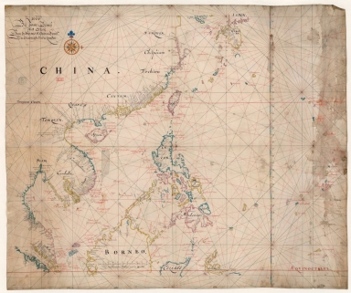
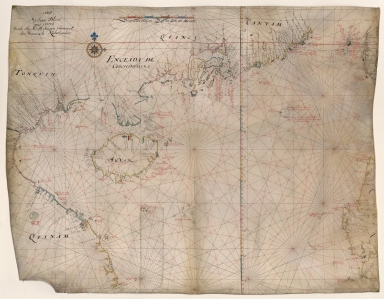
Title
Map of the China Sea
Contributor
Blaeu, Joan, 1596-1673, cartographer
Type
Manuscripts
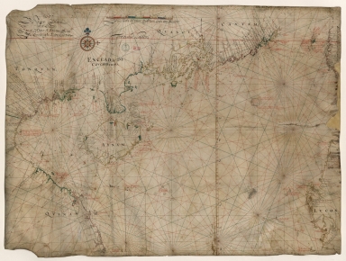
Barcode
3687800354509F
Title
Map of the coasts of China and neighboring islands with some additions
Contributor
Anville, Jean Baptiste Bourguignon d', 1697-1782, cartographer
Type
Printed
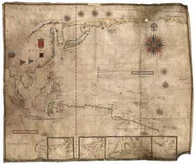
Barcode
3687800317483F
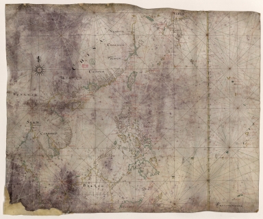
Title
Dutch Chart of the China Sea
Type
Manuscripts
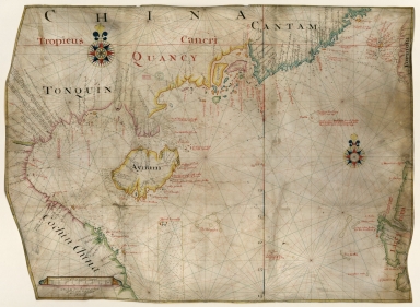
Barcode
3687800354228D
Title
Gulf of Tonkin
Contributor
Blaeu, Joan, 1596-1673, cartographer
Type
Manuscripts
Barcode
3687800354566I
Title
Gulf of Tonkin
Contributor
Blaeu, Joan, 1650-1712, cartographer
Type
Manuscripts
Barcode
4687820501175
Title
A chart of the China Sea : inscribed to Mons.r d'Aprés de Mannevillette the ingenious author of the Neptune Oriental, as a tribute due to his labours for the benefit of navigation, and in acknowledgment of his many signal favours to A. Dalrymple.
Contributor
[Dalrymple, Alexander, 1737-1808, hydrographer, Henry, B., fl. 1770-1775, engraver, Whitchurch, William, fl. 18th century, engraver, Lane, Bartholomew, fl. 19th century, engraver, Après de Mannevillette, Jean-Baptiste-Nicolas-Denis d', 1707-1780, dedicatee]
Type
Printed
Barcode
36878003222312
Title
To the Society of Managing Owners of the Ships in the English East India Company's Service, This Chart of the China Sea, Including the Philippina Molluca and Banda Islands, Shewing al the same time all the Tracks into the Pacific Ocean, commonly known by the name of the Eastern Passage to China
Contributor
[Robertson, George, 1748-1788, cartographer, Harmer, Thomas, fl. 1784-1814, engraver]
Type
Printed
Barcode
3687800354648J
Title
Chart of the Pacific Ocean
Contributor
Albernaz, João Teixeira, I, fl. 1602-1649, cartographer
Type
Manuscripts
1-12 of 12
|