|
REFINE
Browse All : Images of Australia and Indonesia
1-7 of 7
Barcode
4687820500802
Title
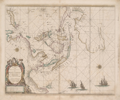
Paskaerte Zynde t'Oosterdeel Van Oost Indien : met alle de Eylanden deer ontrendt geleegen van C. Comorin tot aen Japan
Contributor
Goos, Pieter, approximately 1616-1675
Type
Printed
Barcode
3687800354436E
Title
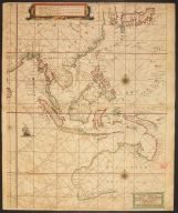
The Eastern part of East Indies stretching from Ceylon to Japan and New Holland
Contributor
Doncker, Hendrick, 1626-1699, cartographer
Type
Printed
Barcode
3687800239546I
Title
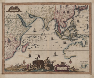
Nova tabula India Orientalis
Contributor
Allard, Carel, 1648-ca. 1709, cartographer
Type
Printed
Barcode
36878003222402
Title
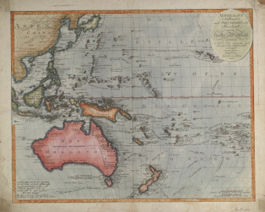
Australien (Südland) auch Polynesien oder Inselwelt, insgemein der fünfte Welttheil genannt : nach den neuesten und bewährtesten Hülfsmitteln entworfen
Contributor
Walch, Johannes, 1757-1816, cartographer
Type
Printed
Barcode
36878003222312
Title
To the Society of Managing Owners of the Ships in the English East India Company's Service, This Chart of the China Sea, Including the Philippina Molluca and Banda Islands, Shewing al the same time all the Tracks into the Pacific Ocean, commonly known by the name of the Eastern Passage to China
Contributor
[Robertson, George, 1748-1788, cartographer, Harmer, Thomas, fl. 1784-1814, engraver]
Type
Printed
Barcode
36878003222413
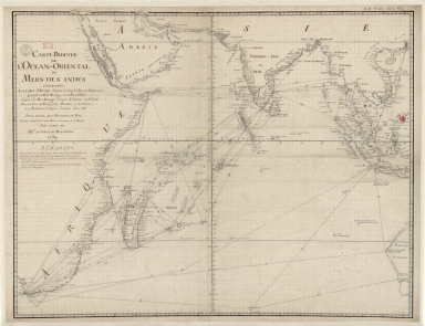
Title
Carte reduite de l'Ocean-Oriental ou Mers des Indes : contenant les costes d Afrique dépuis le cap de Bonne-Espérance, jusqu'a la Mer Rouge, et celles d'Asie dépuis la Mer Rouge, jusqu'a Canton en Chine : Avec les Isles de Madagascar, Bourbon, et de France, les Maldives, I. Ceylan, Sumatra, Java, &.a Pour servir aux vaisseaux du Roy
Contributor
[Le Moyne, François-Pierre, 1713-1795, cartographer, Maurepas, Jean-Frédéric Phélypeaux, comte de, 1701-1781, patron]
Type
Manuscripts
Barcode
3687800301756B
Title
A new chart of the oriental seas and islands with the coasts of the continent from the Isle of Ceylon to Amoye in China
Contributor
[Après de Mannevillette, Jean-Baptiste-Nicolas-Denis d', 1707-1780, cartographer, Laurie & Whittle, publisher]
Type
Printed
1-7 of 7
|