|
REFINE
Browse All : Waterways and Sea Charts and Coasts
1-4 of 4
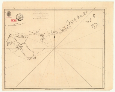
Barcode
3687800354505B
Title
Chart of the southern coasts of the Islands between S.t Johns and the Ladrone taken on board the Nassau, Capt. Arthur Gore, and inscribed to Nathaniel Smith Esq.r
Contributor
[Larkins, John Pascal, 17---1794, cartographer, Dalrymple, Alexander, 1737-1808, publisher, Harrison, William, ca. 1750-1803, engraver, Smith, Nathaniel, 1730-1794, dedicatee]
Type
Printed
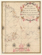
Barcode
36878003541248
Title
Plan de la riviere de Canton, Macao, et autres isles circonvoisines
Contributor
Liébaut, 16---17--, catographer
Type
Manuscripts
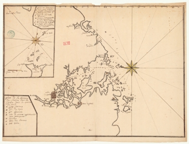
Barcode
4687820501208
Title
Plan de la rivière de Canton dans la Chinne dans la partie du nord
Contributor
Anonymous
Type
Manuscripts
1-4 of 4
|
![[Map of the southeast coast of China]](http://lunamap.must.edu.mo:80/MediaManager/srvr?mediafile=/Size2/MUST~2~2/54/SH+18+PF+181+P+16+D.jpg)