|
REFINE
Browse All : Voyages and travels
1-9 of 9
Barcode
4687820500262
Title
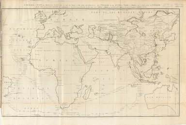
A general chart, on Mercator's projection, to shew the track of the Lion and Hindostan from England to the Gulph of Pekin in China, and of their return to England
Contributor
Barrow, John
Type
Printed
Barcode
4687820500517
Title
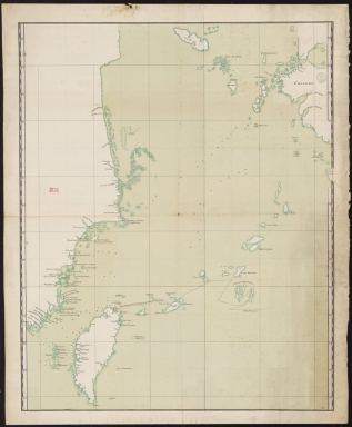
China: Swatow. Track chart, possibly based on Admiralty Chart 854, of the Naval Brigade and Boats commanded by Commodore Oliver J Jones against towns near Swatow, showing both shores of the Han river and the Chao Chao Foo creek.
Type
Manuscripts
Barcode
4687820500646
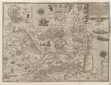
Title
[A world map from Portolan atlas]
Contributor
Agnese, Battista, active 16th century
Type
Manuscripts
Barcode
4687820500791
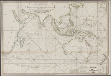
Title
Laurie and Whittle's New chart of the Indian and Pacific Oceans between the Cape of Good Hope, New Holland and Japan : comprehending New Zealand, New Caledonia, New Britain, New Ireland, New Guinea &c., Louisiade and New Georgia; also The Pelew, New Caroline, Ladrone and Philippine Islands &c. with the most remarkable tracks of the English, Spanish, French and Dutch navigators and chiefly the track of the Walpole, EastIndiaman, Captn. Thos. Butler, 1794 from the Cape of Good Hope to Van Diemen's Land and from thence to China, and the track of the Royal Admiral Captn. Henr. Bond in 1792 and 93 from the Cape to Port Jackson and China
Contributor
Laurie & Whittle
Type
Printed
Barcode
4687820500792
Title
A general chart, on Mercator's projection, to shew the track of the Lion and Hindostan from England to the Gulph of Pekin in China, and of their return to England : with the daily statement of the barometer and thermometer as observed at noon: containing also the limits of the Chinese Empire as extended by the conquests of the present Emperor Tchien-Lung
Contributor
[Barrow, John, Baker, B. (Benjamin), active 1766-1824]
Type
Printed
Barcode
4687820500108
Title
The Nauigation of the Portingales into the East Indies, containing their trauels by Sea, into East India, and from the East Indies into Portingall, also from the Portingall Indies to Malacca, China, Iapon, the Islands of Iaua and Sunda ...
Contributor
[Wolfe, John, Phillip, William, Linschoten, Jan Huygen van, 1563-1611]
Type
Printed
Barcode
3687800301789H
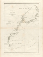
Title
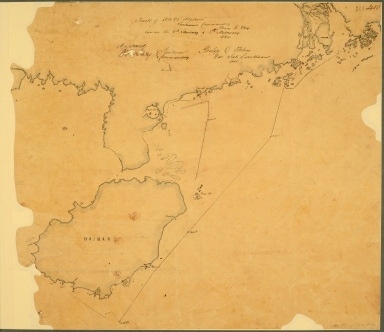
Sketch of a journey from Hang-Tchoo-Foo to Quang-Tchoo-Foo or Canton in China
Contributor
[Barrow, John, 1764-1848, cartographer, Baker, Benjamin, fl. 1780-1824, engraver, Nicol, George, 1740?-1828, publisher]
Type
Printed
Barcode
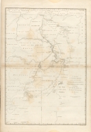
3687800301791A
Title
A chart, on Mercator's projection, containing the track and soundings of the Lion, the Hindostan and Tenders, from Turon-Bay in Cochin-China to the mouth of the Pei-Ho River in the Gulph of Pe-Tche-Lee or Pekin
Contributor
[Barrow, John, 1764-1848, cartographer, Baker, Benjamin, fl. 1780-1824, engraver, Nicol, George, ca. 1740-1828, publisher]
Type
Printed
1-9 of 9
|
![[A world map from Portolan atlas]](http://lunamap.must.edu.mo:80/MediaManager/srvr?mediafile=/Size2/MUST~2~2/30/G1001+.A4+1544-14.jpg)