|
REFINE
Browse All : Sea Charts of Australia
1-13 of 13
Barcode
4687820500208
Title
Carte du Grand Océan ou Mer du Sud : dressée pour la Relation du voyage de découvertes faites par les frégates françaises la Boussole et l'Astrolabe dans les années 1785, 86, 87, et 88
Contributor
La Pérouse, Jean-François de Galaup, comte de, 1741-1788
Type
Printed
Barcode
4687820500241
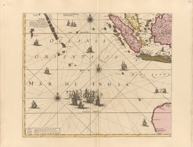
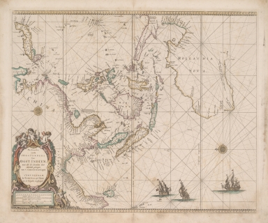
Title
Orientaliora Indiarum Orientalium cum insulis adjacentibus a promontorio C. Comorin ad Japan = Pascaert van t'Ooster gedeelte van Oost Indien van C. Comorin tot Japan
Contributor
Renard, Louis
Type
Printed
Barcode
4687820500331
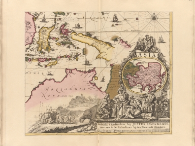
Title
India quae orientalis dicitur, et insulae adiacentes.Part 1
Contributor
Danckerts, Justus
Type
Printed
Barcode
4687820500334
Title
India quae orientalis dicitur, et insulae adiacentes.Part 4
Contributor
Danckerts, Justus
Type
Printed
Barcode
4687820500379
Title
Carte de la Mer du Sud et de la Mer du Nord : ou se trouve les costes d'Amerique, d'Asie, d'Europe et d'Afrique situées sur ces mers. Part 6
Contributor
Fer, Nicolas de, 1646-1720
Type
Printed
Barcode
4687820500333
Title
India quae orientalis dicitur, et insulae adiacentes.Part 3
Contributor
Danckerts, Justus
Type
Printed
Barcode
4687820500332
Title
India quae orientalis dicitur, et insulae adiacentes.Part 2
Contributor
Danckerts, Justus
Type
Printed
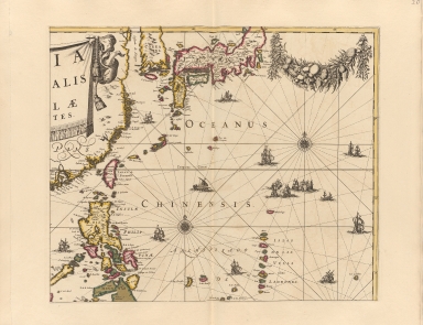
Barcode
4687820500802
Title
Paskaerte Zynde t'Oosterdeel Van Oost Indien : met alle de Eylanden deer ontrendt geleegen van C. Comorin tot aen Japan
Contributor
Goos, Pieter, approximately 1616-1675
Type
Printed
Barcode
3687800354289K
Title
To the Honorable the Court of Directors of the United Company of Merchants of England trading to the East Indies, this Chart of the China Seas
Contributor
[Heather, William, 1764-1812, hydrographer, Stephenson, John,, fl. 1791-1817, engraver, Norie, John William, 1772-1843, illustrator, Heather and Williams, publisher]
Type
Printed
Barcode
4687820501030
Title
[Carte de l'Océan Indien, des cotes de l'Afrique et de l'Asie depuis le cap de Bonne-Espérance jusqu'au Japon]
Contributor
Albernaz, João Teixeira, fl. 1602-1649, cartographer
Type
Manuscripts
Barcode
36878003222312
Title
To the Society of Managing Owners of the Ships in the English East India Company's Service, This Chart of the China Sea, Including the Philippina Molluca and Banda Islands, Shewing al the same time all the Tracks into the Pacific Ocean, commonly known by the name of the Eastern Passage to China
Contributor
[Robertson, George, 1748-1788, cartographer, Harmer, Thomas, fl. 1784-1814, engraver]
Type
Printed
Barcode
36878003222413
Title
Carte reduite de l'Ocean-Oriental ou Mers des Indes : contenant les costes d Afrique dépuis le cap de Bonne-Espérance, jusqu'a la Mer Rouge, et celles d'Asie dépuis la Mer Rouge, jusqu'a Canton en Chine : Avec les Isles de Madagascar, Bourbon, et de France, les Maldives, I. Ceylan, Sumatra, Java, &.a Pour servir aux vaisseaux du Roy
Contributor
[Le Moyne, François-Pierre, 1713-1795, cartographer, Maurepas, Jean-Frédéric Phélypeaux, comte de, 1701-1781, patron]
Type
Manuscripts
Barcode
3687800301756B
Title
A new chart of the oriental seas and islands with the coasts of the continent from the Isle of Ceylon to Amoye in China
Contributor
[Après de Mannevillette, Jean-Baptiste-Nicolas-Denis d', 1707-1780, cartographer, Laurie & Whittle, publisher]
Type
Printed
1-13 of 13
|
![[Carte de l'Océan Indien, des cotes de l'Afrique et de l'Asie depuis le cap de Bonne-Espérance jusqu'au Japon]](http://lunamap.must.edu.mo:80/MediaManager/srvr?mediafile=/Size2/MUST~2~2/54/GE+SH+18+PF+213+DIV+3+P+2-2.jpg)