|
REFINE
Browse All : Printed of Korea and Philippines and China from 1598
1-2 of 2
Barcode
4687820500108
Title
The Nauigation of the Portingales into the East Indies, containing their trauels by Sea, into East India, and from the East Indies into Portingall, also from the Portingall Indies to Malacca, China, Iapon, the Islands of Iaua and Sunda ...
Contributor
[Wolfe, John, Phillip, William, Linschoten, Jan Huygen van, 1563-1611]
Type
Printed
Barcode
3687800354409E
Title
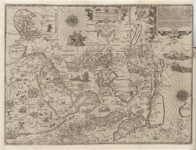
Exacta & accurata delineatio cum orarum maritimarum tum etiam locorum terrestrium quae in regionibus China, Cauchinchina, Camboja sive Champa, Syao, Malac[c]a, Arracan & Pegu, una cum omnium vicinarum insularum descriptione ut sunt Samatra, Java utraq[ue], Timora, Moluccae, Philippinae, Luconia & de Lequeos dictae, nec non insulae Japan & Corea, reliquaeq[ue] omnes adjacentes, ubi etiam adnotavimus scopulos, brevia, omniaq[ue] vadosa loca, & siquae alia a quibus periculum navigantibus. Que madmodum singula hoc aevo à Lusitanis navium gubernatoribus comperta, indigetata, & in tabulas relata fuere. E quorum recentibus ac emendatis tabulis perquàm studiosè haec describi exprimiq[ue] curavimus, in eorum hominum co[m]modum quibus ista usui volupatiq[ue] esse consueuerunnt = The trew description of all the coasts of China, Cauchinchina Camboya, Sӱao, malacca, Arracan, and Pegu, together with all the islands there abowts, both great and smale, with the cliffes, breaches, sands, droughts and shallowes, all perfectly drawne and examined with the most expert cardes of the Portingales pilots.
Contributor
[Linschoten, Jan Huygen van, 1563-1611, cartographer, Beckit, Robert, engraver, Wolfe, John, ca. 1547-1601, printer]
Type
Printed
1-2 of 2
|

![Exacta & accurata delineatio cum orarum maritimarum tum etiam locorum terrestrium quae in regionibus China, Cauchinchina, Camboja sive Champa, Syao, Malac[c]a, Arracan & Pegu, una cum omnium vicinarum insularum descriptione ut sunt Samatra, Java utraq[ue], Timora, Moluccae, Philippinae, Luconia & de Lequeos dictae, nec non insulae Japan & Corea, reliquaeq[ue] omnes adjacentes, ubi etiam adnotavimus scopulos, brevia, omniaq[ue] vadosa loca, & siquae alia a quibus periculum navigantibus. Que madmodum singula hoc aevo à Lusitanis navium gubernatoribus comperta, indigetata, & in tabulas relata fuere. E quorum recentibus ac emendatis tabulis perquàm studiosè haec describi exprimiq[ue] curavimus, in eorum hominum co[m]modum quibus ista usui volupatiq[ue] esse consueuerunnt = The trew description of all the coasts of China, Cauchinchina Camboya, Sӱao, malacca, Arracan, and Pegu, together with all the islands there abowts, both great and smale, with the cliffes, breaches, sands, droughts and shallowes, all perfectly drawne and examined with the most expert cardes of the Portingales pilots.](http://lunamap.must.edu.mo:80/MediaManager/srvr?mediafile=/Size2/MUST~2~2/325/3687800354409E%28bpe-gav2-pastaC-n55_0001%29.jpg)