|
REFINE
Browse All : Printed and Sea Charts of China
1-26 of 26
Barcode
4687820500132
Title
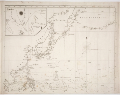
Carte Générale Des Découvertes faites en 1787 dans les Mers De Chine et De Tartarie ou depuis Manille jusqu'à Avatscha : par les Frégates Françaises la Boussole et l'Astrolabe
Contributor
La Pérouse, Jean-François de Galaup, comte de, 1741-1788
Type
Printed
Barcode
4687820500208
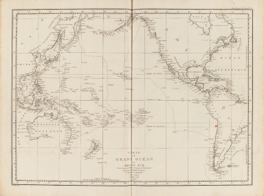
Title
Carte du Grand Océan ou Mer du Sud : dressée pour la Relation du voyage de découvertes faites par les frégates françaises la Boussole et l'Astrolabe dans les années 1785, 86, 87, et 88
Contributor
La Pérouse, Jean-François de Galaup, comte de, 1741-1788
Type
Printed
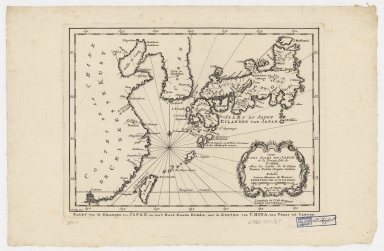
Barcode
4687820500209
Title
Carte des isles du Japon et la presqu'isle de Coree, avec les costes de la Chine depuis Pekin jusqu'a Canton = Kaart van de Eilanden van Japan, en van't Half-Eiland Koréa ; met de Kusten van China van Pekin tot Canton
Contributor
[Bellin, Jacques Nicolas, 1703-1772, Schley, Jacobus van der, 1715-1779]
Type
Printed
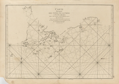
Barcode
4687820500211
Title
Carte d'une partie des côtes de la Chine et des Isles adjacentes : depuis l'Isle nommée la Pierre Blanche, jusqu'a celle de l'Artimon
Contributor
Dalrymple, Alexander, 1737-1808
Type
Printed
Barcode
4687820500212
Title
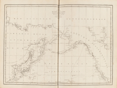
Carte des découvertes faites en 1787 dans les mers de Chine et de Tartarie : par les frégates françaises la Boussole et l'Astrolabe, depuis leur départ de Manille jusqu'à leur arrivée au Kamtschatka
Contributor
La Pérouse, Jean-François de Galaup, comte de, 1741-1788
Type
Printed
Barcode
4687820500215
Title
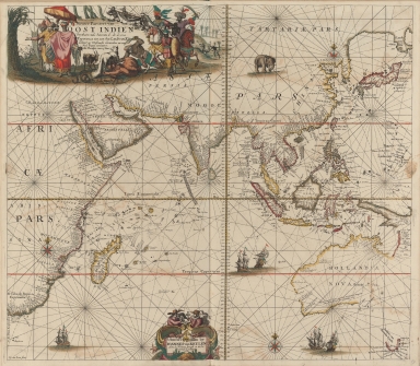
Nieuwe pascaert van Oost Indien
Contributor
Keulen, Johannes van, 1654-1715
Type
Printed
Barcode
4687820500380
Title
Carte de la Mer du Sud et de la Mer du Nord : ou se trouve les costes d'Amerique, d'Asie, d'Europe et d'Afrique situées sur ces mers. Part 1
Contributor
Fer, Nicolas de, 1646-1720
Type
Printed
Barcode
4687820500489
Title
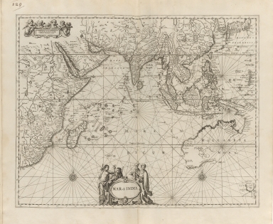
Mar di India
Contributor
Anonymous
Type
Printed
Barcode
4687820500604
Title
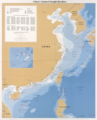
China's claimed straight baselines
Contributor
United States. Central Intelligence Agency
Type
Printed
Barcode
4687820500782
Title
A chart of the East India Islands with the coasts of the continent from Caliminera Point to Amoye in China
Contributor
Anonymous
Type
Printed
Barcode
4687820500855
Title
Map of the western Pacific ocean and the Asiatic coast
Contributor
Anonymous
Type
Printed
Barcode
4687820500131
Title
Carte des côtes de l'Amérique et de l'Asie : depuis la Californie jusqu'à Macao
Contributor
La Pérouse, Jean-François de Galaup, comte de, 1741-1788
Type
Printed
Barcode
4687820500108
Title
The Nauigation of the Portingales into the East Indies, containing their trauels by Sea, into East India, and from the East Indies into Portingall, also from the Portingall Indies to Malacca, China, Iapon, the Islands of Iaua and Sunda ...
Contributor
[Wolfe, John, Phillip, William, Linschoten, Jan Huygen van, 1563-1611]
Type
Printed
Barcode
4687820500450
Title
To John Reeves Esq.re F.R.S. for the liberal aid of his Chinese m.s.s. and the benefit derived from his excellent map of that Empire presented by him to the Hon.ble East India Company this Chart of the East Coast of China
Contributor
[Horsburgh, James, 1762-1836, author, publisher, J. & C. Walker (Firm), engraver, Ross, Daniel, 1780-1849, cartographer, Hall, Basil, 1788-1844, cartographer, Crawford, James H., fl. 18--, cartographer, Rancliffe, George Augustus Henry Anne Parkyns, Baron, 1785-1850, cartographer, Rees, Thomas, 1790-1870, cartographer, Dayot, Félix, 1772-1821, cartographer, Sturgis, Josiah, 1773-1850, cartographer, Rees, John, 1752-18--, cartographer, Hoskiaer, Jacob, 1808-1836, cartographer, Dalrymple, Alexander, 1737-1808, bibliographic antecedent, Reeves, John, 1774-1856, dedicatee]
Type
Printed
Barcode
4687820500218
Title
A chart of the China Sea : inscribed to Mons.r D'Aprés de Mannevillette the ingenious author of the Neptune Oriental, as a tribute due to his labours for the benefit of Navigation, and in acknowledgement of his many signal favours to Dalrymple.
Contributor
[Dalrymple, Alexander, 1737-1808, hydrographer, Demonville, Antoine Guénard, ca. 1733-1797, printer, Malassis, Romain-Nicolas, 1737-1813, printer, Après de Mannevillette, Jean-Baptiste-Nicolas-Denis d', 1707-1780, dedicatee]
Type
Printed
Barcode
4687820501174
Title
Carte d'une partie de la mer de Chine
Contributor
Rosili Mesros, François Etienne de, 1748-1832, bibliographic antecedent
Type
Printed
Barcode
3687800354287I
Title
To the Honorable the Court of Directors of the United Company of Merchants of England trading to the East Indies, this Chart of the China Seas
Contributor
[Heather, William, 1764-1812, hydrographer, Stephenson, John,, fl. 1791-1817, engraver, Norie, John William, 1772-1843, illustrator, Heather and Williams, publisher]
Type
Printed
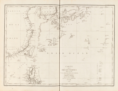
Barcode
4687820501007
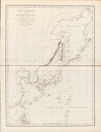
Title
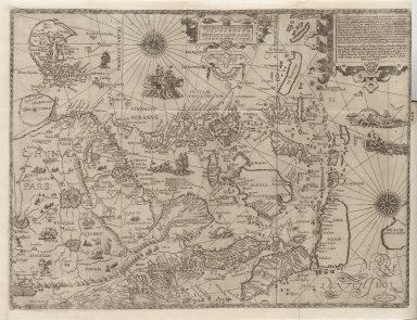
[[Carte portugaise de la mer des Indes entre le Cap de Bonne Espérance et le Cap Comorin] ; [Carte portugaise de la mer qui comprend le Golfe du bengale, les côtes de la Chine et les îles du Japon, Philippines, de la Sonde et Moluques], [Carte portugaise de la mer qui comprend le Golfe du bengale, les côtes de la Chine et les îles du Japon, Philippines, de la Sonde et Moluques]]
Contributor
Albernaz, João Teixeira, fl. 1602-1649, cartographer
Type
Printed
Barcode
4687820501178
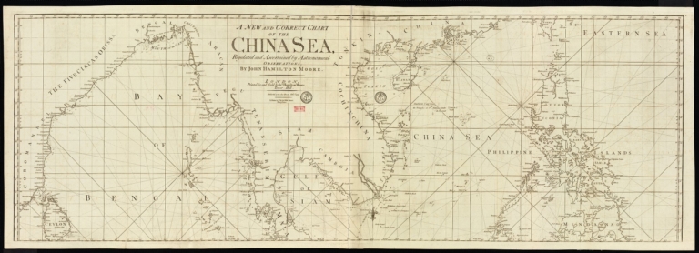
Title
A new and correct chart of the China Sea
Contributor
[Moore, John Hamilton, 1738-1807, cartographer, Blake, T. J., fl. 1785-1785, engraver]
Type
Printed
Barcode
4687820500373
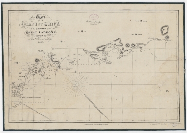
Title
Chart of the coast of China to the eastward of the great Ladrone
Contributor
[Ross, Daniel, 1780-1849, cartographer, Horsburgh, James, 1762-1836, publisher]
Type
Printed
Barcode
3687800354509F
Title
Map of the coasts of China and neighboring islands with some additions
Contributor
Anville, Jean Baptiste Bourguignon d', 1697-1782, cartographer
Type
Printed
Barcode
4687820501175
Title
A chart of the China Sea : inscribed to Mons.r d'Aprés de Mannevillette the ingenious author of the Neptune Oriental, as a tribute due to his labours for the benefit of navigation, and in acknowledgment of his many signal favours to A. Dalrymple.
Contributor
[Dalrymple, Alexander, 1737-1808, hydrographer, Henry, B., fl. 1770-1775, engraver, Whitchurch, William, fl. 18th century, engraver, Lane, Bartholomew, fl. 19th century, engraver, Après de Mannevillette, Jean-Baptiste-Nicolas-Denis d', 1707-1780, dedicatee]
Type
Printed
Barcode
36878003222312
Title
To the Society of Managing Owners of the Ships in the English East India Company's Service, This Chart of the China Sea, Including the Philippina Molluca and Banda Islands, Shewing al the same time all the Tracks into the Pacific Ocean, commonly known by the name of the Eastern Passage to China
Contributor
[Robertson, George, 1748-1788, cartographer, Harmer, Thomas, fl. 1784-1814, engraver]
Type
Printed
Barcode
3687800317471C
Title
A new and correct chart of the coast of China : from latitude 12° north to 26° including Formosa, Hayman and the Philippine Islands.
Contributor
W. and J. Mount, T. and T. Page, 1747-1763, publisher, bookseller
Type
Printed
Barcode
3687800301756B
Title
A new chart of the oriental seas and islands with the coasts of the continent from the Isle of Ceylon to Amoye in China
Contributor
[Après de Mannevillette, Jean-Baptiste-Nicolas-Denis d', 1707-1780, cartographer, Laurie & Whittle, publisher]
Type
Printed
1-26 of 26
|


![[[Carte portugaise de la mer des Indes entre le Cap de Bonne Espérance et le Cap Comorin] ; [Carte portugaise de la mer qui comprend le Golfe du bengale, les côtes de la Chine et les îles du Japon, Philippines, de la Sonde et Moluques], [Carte portugaise de la mer qui comprend le Golfe du bengale, les côtes de la Chine et les îles du Japon, Philippines, de la Sonde et Moluques]]](http://lunamap.must.edu.mo:80/MediaManager/srvr?mediafile=/Size2/MUST~2~2/54/GE+DD-2987+Carte+portugaise+de+la+mer+des+Indes+-2+.jpg)