|
REFINE
Browse All : Manuscripts and General Maps of China
1-13 of 13
Barcode
4687820501107
Title
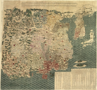
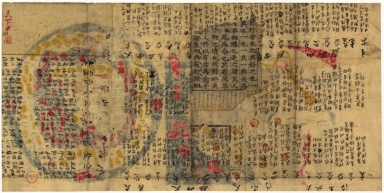
天下輿地圖 = Carte de l'Empire chinois
Contributor
王泮
Type
Manuscripts
Barcode
4687820500543
Title
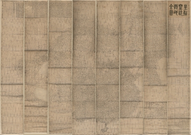
皇朝一統與地全圖 = Qing Empire's complete map of all under heaven
Contributor
[六嚴, active 19th century, 李兆洛, 1769-1841]
Type
Manuscripts
Barcode
4687820500649
Title
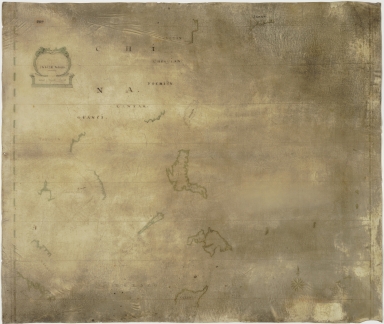
Indize Noord. Kaart van de Indische Noord. (Van Sumatra tot Japan om de Noord, de Philippynen, Mindanao, Borneo, Celebes enz.)
Contributor
Anonymous
Type
Manuscripts
Barcode
4687820500664
Title
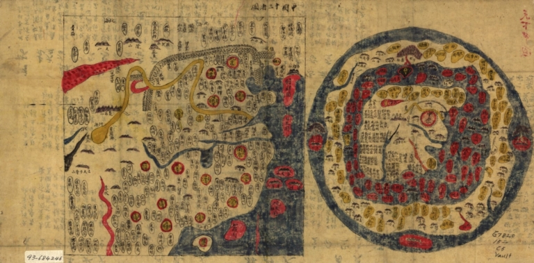
天下圖 = Cheonhado = Map of all under heaven. Part 1
Contributor
Anonymous
Type
Manuscripts
Barcode
4687820500665
Title
天下圖 = Cheonhado = Map of all under heaven. Part 2
Contributor
Anonymous
Type
Manuscripts
Barcode
4687820500669
Title
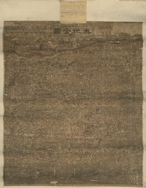
輿地全圖 = Complete map of imperial territory
Contributor
Hummel, Arthur W. (Arthur William), 1884-1975
Type
Manuscripts
Barcode
4687820500752
Title
大清分省輿圖總圖 = Provincial atlas of the great Qing Dynasty
Contributor
Anonymous
Type
Manuscripts
Barcode
4687820501242
Title
Carte generale de la Chine : dressée sur les cartes particulieres que l'Empereur Cang-hi a fait lever sur les lieux par les RR. PP. Jesuites mission[n]aires dans cet Empire
Contributor
Anville, Jean Baptiste Bourguignon d', 1697-1782, cartographer
Type
Manuscripts
Barcode
4687820501195
Title
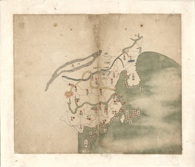
[Carte côtes de la Chine]
Type
Manuscripts
Barcode
3687800354262B
Title
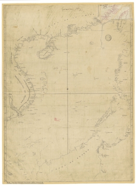
Southern part of the China Se
Type
Manuscripts
Barcode
3687800354259H
Title
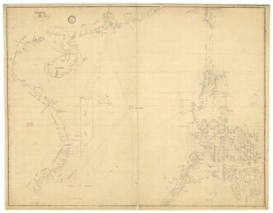
Chart of the seas of Canton to Cambodia and the Philippines
Type
Manuscripts
Barcode
3687800317467H
Title
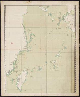
Chart of the China Sea
Type
Manuscripts
Barcode
36878003222323
Title
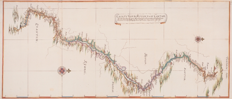
Chart of the river of Canton : taking Its origin, from the Tartar mountains, and passing through various Chinese provinces, until at last it discharges its water, into the great sea at Macau
Contributor
Vinckeboons, Joan, 1617-1670, cartographer
Type
Manuscripts
1-13 of 13
|
![Carte generale de la Chine : dressée sur les cartes particulieres que l'Empereur Cang-hi a fait lever sur les lieux par les RR. PP. Jesuites mission[n]aires dans cet Empire](http://lunamap.must.edu.mo:80/MediaManager/srvr?mediafile=/Size2/MUST~2~2/54/GE+D-10588.jpg)
![[Carte côtes de la Chine]](http://lunamap.must.edu.mo:80/MediaManager/srvr?mediafile=/Size2/MUST~2~2/63/GE+SH+18+PF+181+P+12+D_Carte+C%C3%83%C2%B4tes+de+la+Chine.jpg)