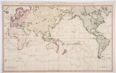
Detail View: Old Maps Collection: General Chart exhibiting the Discoveries made by Captain James Cook in this and his Two Proceeding Voyages, with the tracks of the Ships under his command, by Lieutenant Roberts of His Majesty's Royal Navy.

|
Barcode:
|
4687820500854
|
|
Title:
|
General Chart exhibiting the Discoveries made by Captain James Cook in this and his Two Proceeding Voyages, with the tracks of the Ships under his command, by Lieutenant Roberts of His Majesty's Royal Navy.
|
|
Original Title:
|
General Chart exhibiting the Discoveries made by Captain James Cook in this and his Two Preceeding Voyages, with the tracks of the Ships under his command, by Lieut't Roberts of His Majesty's Royal Navy.
|
|
Contributor:
|
Roberts, Henry
|
|
Contributor:
|
Faden, William
|
|
Category:
|
General Maps
|
|
Type:
|
Printed
|
|
Language:
|
English
|
|
Create Year:
|
1784
|
|
Format:
|
JPEG2000, 7200 × 4531, 24.1MB
|
|
Page No.:
|
1
|
|
Scale:
|
Scale not given
|
|
Physical Map Dimension (cm):
|
81.28 x 53.34 cm
|
|
Note:
|
Hand colored
|
|
Note:
|
Macao in Routes
|
|
Note:
|
Macao in World Maps
|
|
Subject:
|
World -- Maps
|
|
Geographic Area:
|
World
|
|
Provenance:
|
Huntington Library Collection
|