Detail View: Old Maps Collection: Indian Ocean, Africa, Arabia, India, and part of Asia
|
Barcode:
|
4687820500841
|
|
Title:
|
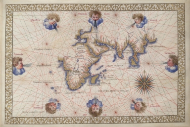
Indian Ocean, Africa, Arabia, India, and part of Asia
|
|
Original Title:
|
Portolan charts
|
|
Contributor:
|
Ghisolfi, Francesco
|
|
Category:
|
Sea Charts
|
|
Type:
|
Manuscripts
|
|
Language:
|
Italian
|
|
Language:
|
Latin
|
|
Create Year:
|
16th
|
|
Format:
|
JPEG2000, 32 MB
|
|
Scale:
|
Scale not given
|
|
Physical Map Dimension (cm):
|
277 × 410 mm
|
|
Note:
|
TN 66716
|
|
Note:
|
Atlas of the world in 11 charts. Italy, 1550<>1600.] See maps: 4, the two hemispheres; 5, oval map of the world; 9, Pacific Ocean with East Indies; 13, world map in five gores.
|
|
Geographic Area:
|
World
|
|
Provenance:
|
Huntington Library Collection
|