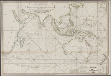
Detail View: Old Maps Collection: Laurie and Whittle's New chart of the Indian and Pacific Oceans between the Cape of Good Hope, New Holland and Japan : comprehending New Zealand, New Caledonia, New Britain, New Ireland, New Guinea &c., Louisiade and New Georgia; also The Pelew, New Caroline, Ladrone and Philippine Islands &c. with the most remarkable tracks of the English, Spanish, French and Dutch navigators and chiefly the track of the Walpole, EastIndiaman, Captn. Thos. Butler, 1794 from the Cape of Good Hope to Van Diemen's Land and from thence to China, and the track of the Royal Admiral Captn. Henr. Bond in 1792 and 93 from the Cape to Port Jackson and China
|
Barcode:
|
4687820500791
|
|
Title:
|
Laurie and Whittle's New chart of the Indian and Pacific Oceans between the Cape of Good Hope, New Holland and Japan : comprehending New Zealand, New Caledonia, New Britain, New Ireland, New Guinea &c., Louisiade and New Georgia; also The Pelew, New Caroline, Ladrone and Philippine Islands &c. with the most remarkable tracks of the English, Spanish, French and Dutch navigators and chiefly the track of the Walpole, EastIndiaman, Captn. Thos. Butler, 1794 from the Cape of Good Hope to Van Diemen's Land and from thence to China, and the track of the Royal Admiral Captn. Henr. Bond in 1792 and 93 from the Cape to Port Jackson and China
|
|
Original Title:
|
Laurie and Whittle's New chart of the Indian and Pacific Oceans between the Cape of Good Hope, New Holland and Japan : comprehending New Zealand, New Caledonia, New Britain, New Ireland, New Guinea &c., Louisiade and New Georgia; also The Pelew, New Caroline, Ladrone and Philippine Islands &c. with the most remarkable tracks of the English, Spanish, French and Dutch navigators and chiefly the track of the Walpole, EastIndiaman, Captn. Thos. Butler, 1794 from the Cape of Good Hope to Van Diemen's Land and from thence to China, and the track of the Royal Admiral Captn. Henr. Bond in 1792 and 93 from the Cape to Port Jackson and China
|
|
Contributor:
|
Laurie & Whittle
|
|
Category:
|
Thematic Maps
|
|
Type:
|
Printed
|
|
Language:
|
English
|
|
Create Year:
|
1797
|
|
Format:
|
JPEG2000, 10008 × 6864, 156.2MB
|
|
Scale:
|
[ca. 1:17,000,000]
|
|
Physical Map Dimension (cm):
|
71.2 × 104.5
|
|
Note:
|
Map of Indian and Pacific Oceans showing explorers' tracks. Includes 3 views and notes. Insets: Anson's road at the west end of Tinian, Isle of Norfolk or New Norfolk.
|
|
Note:
|
Macao in Routes
|
|
Note:
|
Macao and its Surroundings
|
|
Note:
|
Macao in Asia Maps; Macao in East Indies Maps
|
|
Reference:
|
Tooley, 1511. Phillips, 700.
|
|
Subject:
|
Voyages and travels
|
|
Geographic Area:
|
Pacific Ocean
|
|
Geographic Area:
|
Indian Ocean
|
|
Relation Note:
|
From: The complete East-India pilot. London : R. Laurie & J. Whittle, 1803.
|
|
Pub Title:
|
The complete East-India pilot
|
|
Pub Author:
|
Laurie & Whittle
|
|
Pub Year:
|
[1803]
|
|
Pub location:
|
London
|
|
Provenance:
|
National Library of Australia
|