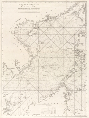
Detail View: Old Maps Collection: A general chart of the China Sea : drawn from the journals of the European navigators, particularly from those collected by Capt. Hayter
|
Barcode:
|
4687820500783
|
|
Title:
|
A general chart of the China Sea : drawn from the journals of the European navigators, particularly from those collected by Capt. Hayter
|
|
Original Title:
|
A general chart of the China Sea : drawn from the journals of the European navigators, particularly from those collected by Capt. Hayter
|
|
Contributor:
|
Anonymous
|
|
Category:
|
Sea Charts
|
|
Type:
|
Printed
|
|
Language:
|
English
|
|
Create Year:
|
1778
|
|
Format:
|
JPEG2000, 7440 × 9816, 87.3MB
|
|
Scale:
|
Scale not given
|
|
Note:
|
Macao and its Surroundings
|
|
Note:
|
Macao in Routes
|
|
Note:
|
Macao in China Maps
|
|
Geographic Area:
|
China Sea
|
|
Relation Note:
|
From: The Oriental pilot, or, A select collection of charts and plans ... for the navigation of the country trade in the seas beyond the Cape of Good Hope. London : Printed and sold by R. Sayer & J. Bennett, 1778.
|
|
Pub Title:
|
The Oriental pilot, or, A select collection of charts and plans ... for the navigation of the country trade in the seas beyond the Cape of Good Hope
|
|
Pub Author:
|
Après de Mannevillette, Jean-Baptiste-Nicolas-Denis d’, 1707-1780
|
|
Pub Year:
|
1778
|
|
Pub location:
|
London
|
|
Provenance:
|
National Library of Australia
|