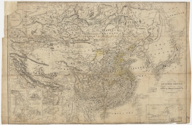
Detail View: Old Maps Collection: Map of the Chinese Empire : compiled from native & foreign authorities

|
Barcode:
|
4687820500030
|
|
Title:
|
Map of the Chinese Empire : compiled from native & foreign authorities
|
|
Original Title:
|
Map of the Chinese Empire : compiled from native & foreign authorities
|
|
Contributor:
|
Williams, S. Wells (Samuel Wells), 1812-1884
|
|
Contributor:
|
Atwood, John M., approximately 1818-
|
|
Category:
|
General Maps
|
|
Type:
|
Printed
|
|
Language:
|
English
|
|
Create Year:
|
1853
|
|
Format:
|
JPEG, 17234 × 11266, 67.1MB
|
|
Scale:
|
ca. 1:10,000,000
|
|
Physical Map Dimension (cm):
|
48 × 69
|
|
Note:
|
Hand colored. Insets: Passage up to Shanghai -- Passage up to Ningpo -- City of Canton & adjacent islands -- Harbor & island of Amoy -- River Min to Fuhchau Fu.
|
|
Note:
|
Macao and the surrounding islands were depicted in this map.
|
|
Note:
|
Macao in China Maps
|
|
Geographic Area:
|
China
|
|
Pub Title:
|
Map of the Chinese Empire : compiled from native & foreign authorities
|
|
Pub Author:
|
Williams, S. Wells (Samuel Wells), 1812-1884
|
|
Pub Year:
|
1853
|
|
Pub location:
|
New York
|
|
Provenance:
|
Harvard Map Collection - Harvard College Library
|
|
MUST holding:
|
http://10.20.100.239/record=b1390582
|