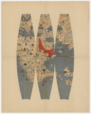
Detail View: Old Maps Collection: Martin Behaim’s Erdapfel, 1492. Part 2

|
Barcode:
|
4687820500633
|
|
Title:
|
Martin Behaim’s Erdapfel, 1492. Part 2
|
|
Original Title:
|
Martin Behaim’s Erdapfel, 1492. Part 2
|
|
Contributor:
|
Behaim, Martin, 1459-1507
|
|
Contributor:
|
Ravenstein, Ernst Georg, 1834-1913
|
|
Category:
|
Early Old Maps
|
|
Type:
|
Printed
|
|
Language:
|
German
|
|
Language:
|
Latin
|
|
Create Year:
|
1492
|
|
Format:
|
JPEG, 5000 × 6247, 12.9MB
|
|
Scale:
|
1:25,200,000
|
|
Physical Map Dimension (cm):
|
76 × 61
|
|
Note:
|
1 map on 4 sheets. Text in German and Latin, author (Ravenstein) supplied title in English. Facsim. of globe originally publ.: Behaim, Martin, 1445-1507. Nürnberg, 1492. 1 globe : col., vellum gores over paste-board and wood frame, mounted on iron floor stand with three legs supporting iron horizon circle and brass meridian ring ; 50.7 cm. in diam. In Germanisches National Museum, Nürnberg.
|
|
Note:
|
This is an early old map depicted the world.
|
|
Subject:
|
Early maps
|
|
Geographic Area:
|
World
|
|
Relation Note:
|
Part 1 : 4687820500632, Part 3 : 4687820500634, Part 4 : 4687820500635
|
|
Pub Author:
|
George Philip & Son
|
|
Pub Year:
|
1908
|
|
Pub location:
|
London
|
|
Provenance:
|
Harvard Map Collection - Harvard College Library
|