Detail View: Old Maps Collection: China: Offshore islands. 10-58
|
Barcode:
|
4687820500603
|
|
Title:
|
China: Offshore islands. 10-58
|
|
Original Title:
|
China: Offshore islands. 10-58
|
|
Contributor:
|
United States. Central Intelligence Agency
|
|
Category:
|
Thematic Maps
|
|
Type:
|
Printed
|
|
Language:
|
English
|
|
Create Year:
|
1958
|
|
Format:
|
JPEG2000, 7438 × 5738, 7.5MB
|
|
Scale:
|
Scales vary
|
|
Physical Map Dimension (cm):
|
32 × 42
|
|
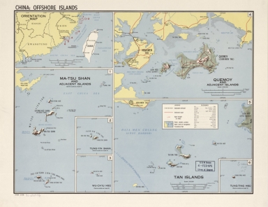
Note:
|
Relief shown by shading and spot heights. "27235."
|
|
Note:
|
Macao was marked on coast of Pearl River Estuary in this map.
|
|
Subject:
|
Islands
|
|
Geographic Area:
|
China
|
|
Pub Author:
|
United States. Central Intelligence Agency
|
|
Pub Year:
|
1958
|
|
Pub location:
|
Washington
|
|
Provenance:
|
Library of Congress Map Collections
|