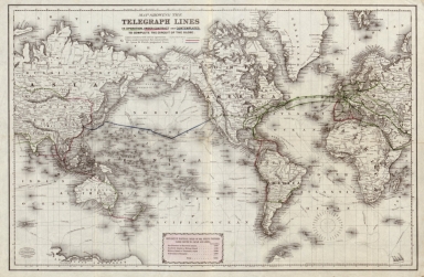
Detail View: Old Maps Collection: Map showing the telegraph lines in operation, under contract, and contemplated, to complete the circuit of the globe
|
Barcode:
|
4687820500602
|
|
Title:
|
Map showing the telegraph lines in operation, under contract, and contemplated, to complete the circuit of the globe
|
|
Original Title:
|
Map showing the telegraph lines in operation, under contract, and contemplated, to complete the circuit of the globe
|
|
Contributor:
|
J.H. Colton & Co.
|
|
Contributor:
|
Banks, Nathaniel Prentiss, 1816-1894
|
|
Contributor:
|
G.W. & C.B. Colton & Co.
|
|
Category:
|
Thematic Maps
|
|
Type:
|
Printed
|
|
Language:
|
English
|
|
Create Year:
|
1871
|
|
Format:
|
JPEG, 5198 × 3000, 10.9MB
|
|
Scale:
|
ca. 1:75,000,000
|
|
Physical Map Dimension (cm):
|
41 × 63
|
|
Note:
|
Includes distance list.
|
|
Note:
|
Macao was marked on coast of Pearl River Estuary in this map.
|
|
Note:
|
Macao in Routes
|
|
Note:
|
Macao in World Maps
|
|
Subject:
|
Telegraph
|
|
Geographic Area:
|
World
|
|
Pub Author:
|
G.W. & C.B. Colton & Co.
|
|
Pub Year:
|
1871
|
|
Pub location:
|
New York
|
|
Provenance:
|
Library of Congress Map Collections
|