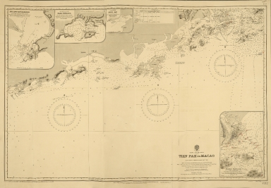
Detail View: Old Maps Collection: China-South Coast : Tien Pak to Macao : from various sketch surveys 1807-1882

|
Barcode:
|
4687820500573
|
|
Title:
|
China-South Coast : Tien Pak to Macao : from various sketch surveys 1807-1882
|
|
Original Title:
|
China-South Coast : Tien Pak to Macao : from various sketch surveys 1807-1882
|
|
Contributor:
|
Davies & Company
|
|
Category:
|
Sea Charts
|
|
Type:
|
Printed
|
|
Language:
|
English
|
|
Create Year:
|
1935
|
|
Format:
|
JPEG, 6400 × 4449, 12.3MB
|
|
Scale:
|
Scales differ; (E 111°5ʹ35ʺ--E 113°55ʹ12ʺ/N 22°15ʹ--N 20°30ʹ28ʺ)
|
|
Physical Map Dimension (cm):
|
61.5 x 88.5
|
|
Note:
|
Navigational chart. Engraved by Davies & Co. Includes detailed insets of Hui-Ling-San Harbour, Namo Harbour, Shito Bay on Sanican and Macao Harbour based on a Portuguese Government Plan of 1912.
|
|
Note:
|
Macao and the surrounding islands were depicted in this map.
|
|
Note:
|
局部圖
|
|
Note:
|
Macao in Routes
|
|
Note:
|
Macao and its Surroundings
|
|
Subject:
|
Nautical charts
|
|
Subject:
|
Coasts
|
|
Geographic Area:
|
Macao (China)
|
|
Geographic Area:
|
South China Sea
|
|
Pub Author:
|
Admiralty
|
|
Pub Year:
|
1912
|
|
Pub location:
|
London
|
|
Provenance:
|
The National Archives (United Kingdom)
|