Detail View: Old Maps Collection: A map of China : prepared for the China Inland Mission, 1905
|
Barcode:
|
4687820500449
|
|
Title:
|
A map of China : prepared for the China Inland Mission, 1905
|
|
Original Title:
|
A map of China : prepared for the China Inland Mission, 1905
|
|
Contributor:
|
China Inland Mission
|
|
Contributor:
|
Bretschneider, E., 1833-1901
|
|
Contributor:
|
Edward Stanford Ltd.
|
|
Category:
|
Thematic Maps
|
|
Type:
|
Printed
|
|
Language:
|
English
|
|
Create Year:
|
1905
|
|
Format:
|
JPEG, 17872 × 15289, 88.7MB
|
|
Scale:
|
[ca. 1:3,200,000]
|
|
Physical Map Dimension (cm):
|
90 × 106
|
|
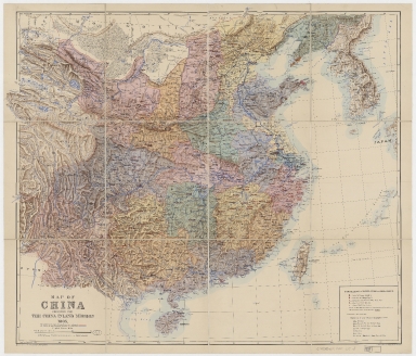
Note:
|
Shows China Inland Mission and other protestant missionary locations. Below lower right margin: "London: Stanford’s Geographical Establishment." Below lower left margin: "By permission of E. Bretschneider. With additions." Includes legend with "Significations of walled cities in China proper" and "Explanation of some Chinese geographical terms."
|
|
Note:
|
Macao and the surrounding islands were depicted in this map.
|
|
Note:
|
Macao in China Maps
|
|
Subject:
|
China Inland Mission
|
|
Subject:
|
Missions
|
|
Geographic Area:
|
China
|
|
Geographic Area:
|
Korea
|
|
Geographic Area:
|
Japan
|
|
Pub Author:
|
China Inland Mission
|
|
Pub Year:
|
1909
|
|
Pub location:
|
London
|
|
Provenance:
|
Harvard Map Collection - Harvard College Library
|