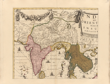
Detail View: Old Maps Collection: India quae orientalis dicitur, et insulae adiacentes.Part 1
|
Barcode:
|
4687820500331
|
|
Title:
|
India quae orientalis dicitur, et insulae adiacentes.Part 1
|
|
Original Title:
|
India quae orientalis dicitur, et insulae adiacentes.Part 1
|
|
Contributor:
|
Danckerts, Justus
|
|
Category:
|
Sea Charts
|
|
Type:
|
Printed
|
|
Language:
|
Latin
|
|
Create Year:
|
1670
|
|
Format:
|
JPEG, 10457 × 7989, 32.7MB
|
|
Scale:
|
Scale not given
|
|
Note:
|
"gedruckt t'Amsterdam, bij Justus Danckerts, voor aen in de Calverstraet bij ded Dam, inde Danckers". 1st state, identifiable by the imprint of Danckerts in the panel bottom right. This is replaced with a title in the second state of c. 1710. Inset of Asia. 1 map on 4 sheets.
|
|
Note:
|
Macao and the surrounding islands were depicted in this map.
|
|
Subject:
|
Nautical charts
|
|
Geographic Area:
|
Southeast Asia
|
|
Geographic Area:
|
East Indies
|
|
Geographic Area:
|
Australia
|
|
Relation Note:
|
Part 2 : 4687820500332, Part 3 : 4687820500333, Part 4 : 4687820500334
|
|
Pub Title:
|
Atlas minor sive geographia compendiosa in qua orbis terrarum Pavcis attamen Novissimis Tabulis ostenditur. Atlas nouveau, etc.
|
|
Pub Year:
|
[1756?]
|
|
Pub location:
|
Amsterdam
|
|
Provenance:
|
Harvard Map Collection - Harvard College Library
|