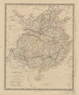
Detail View: Old Maps Collection: China : the interior chiefly from Du Halde and the Jesuits 1710 to 1718 and the sea coast from modern authorities
|
Barcode:
|
4687820500448
|
|
Title:
|
China : the interior chiefly from Du Halde and the Jesuits 1710 to 1718 and the sea coast from modern authorities
|
|
Original Title:
|
China : the interior chiefly from Du Halde and the Jesuits 1710 to 1718 and the sea coast from modern authorities
|
|
Contributor:
|
Society for the Diffusion of Useful Knowledge (Great Britain)
|
|
Category:
|
General Maps
|
|
Type:
|
Printed
|
|
Language:
|
English
|
|
Create Year:
|
1853
|
|
Format:
|
JPEG, 8807 × 10480, 93.5MB
|
|
Scale:
|
[ca. 1:7,700,000] (E 100°--E 120°/N 40°--N 20°)
|
|
Physical Map Dimension (cm):
|
38 × 31
|
|
Note:
|
Relief shown by hachures. Published for the Society for the Diffusion of Useful Knowledge.
|
|
Note:
|
Macao and the surrounding islands were depicted in this map.
|
|
Note:
|
Macao in Routes
|
|
Note:
|
Macao in China Maps
|
|
Geographic Area:
|
China
|
|
Pub Title:
|
China : the interior, chiefly from du Halde and the Jesuits 1710 to 1718, and the sea coast from modern authorities
|
|
Pub Author:
|
Society for the Diffusion of Useful Knowledge (Great Britain)
|
|
Pub Year:
|
1853
|
|
Pub location:
|
London
|
|
Provenance:
|
Harvard Map Collection - Harvard College Library
|
|
MUST holding:
|
http://10.20.100.239/record=b1352182
|