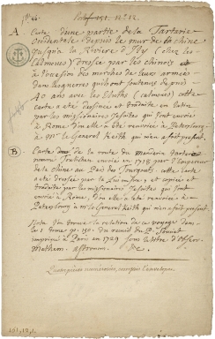
Detail View: Old Maps Collection: [Description of two charts].
|
Barcode:
|
3687800354487K
|
|
Title:
|
[Description of two charts].
|
|
Category:
|
Description and Travel
|
|
Type:
|
Manuscript
|
|
Language:
|
French
|
|
Create Year:
|
[173-]
|
|
Scale:
|
Scale not given.
|
|
Physical Map Dimension (cm):
|
34x 21 cm, on sheet 38 x 27 cm
|
|
Note:
|
This is a manuscript sheet with description of two charts that are included in a set of documents on the French National Archives. Map 'A' is a part of Tartary (most probably modern Mongolia and Siberia) near the Great Wall of China. Map 'B' is about the route of a Mandarin named Touchichen send by the Emperor, in 1718, to 'Pais des Tourgouts' (most probably Siberia).
|
|
Note:
|
Original is a manuscript sheet describing two maps.
|
|
Subject:
|
Description and Travel
|
|
Geographic Area:
|
China
|
|
Geographic Area:
|
Russia
|
|
Geographic Area:
|
Mongolia
|
|
Provenance:
|
Archives Nationales de France
|
|
Provenance Call No.:
|
MAP/6JJ/74/A/13c
|
|
MUST holding:
|
https://must.primo.exlibrisgroup.com/permalink/853MUST_INST/171sgkf/alma991003000649805076
|