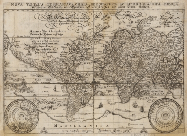
Detail View: Old Maps Collection: Nova totius terrarum orbis geographica ac hydrographica tabula = Wahre Bildtnüss des gantzen Erden Kraÿses mit allen seinen Theilen

|
Barcode:
|
4687820500204
|
|
Title:
|
Nova totius terrarum orbis geographica ac hydrographica tabula = Wahre Bildtnüss des gantzen Erden Kraÿses mit allen seinen Theilen
|
|
Original Title:
|
Nova totius terrarum orbis geographica ac hydrographica tabula = Wahre Bildtnüss des gantzen Erden Kraÿses mit allen seinen Theilen
|
|
Contributor:
|
Merian, Matthaeus, 1593-1650
|
|
Category:
|
General Maps
|
|
Type:
|
Printed
|
|
Language:
|
Latin
|
|
Create Year:
|
1638
|
|
Format:
|
JPEG, 8980 × 6622, 68MB
|
|
Scale:
|
[ca. 1:9,000,000]
|
|
Physical Map Dimension (cm):
|
27 × 37
|
|
Note:
|
Includes inset maps of the North and South Poles.
|
|
Geographic Area:
|
World
|
|
Pub Year:
|
[1638]
|
|
Pub location:
|
[Frankfurt]
|
|
Provenance:
|
Harvard Map Collection - Harvard College Library
|
|
MUST holding:
|
http://10.20.100.239/record=b1389012
|