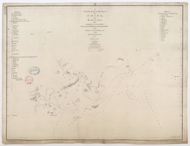
Detail View: Old Maps Collection: A chart of part of the coast of China, and the adjacent islands from Pedro Blanco to the Mizen : laid down from observations made in 1759 and 1760, in the Schooner Cuddalore, and in the Ship London, 1764

|
Barcode:
|
4687820501177
|
|
Title:
|
A chart of part of the coast of China, and the adjacent islands from Pedro Blanco to the Mizen : laid down from observations made in 1759 and 1760, in the Schooner Cuddalore, and in the Ship London, 1764
|
|
Contributor:
|
Dalrymple, Alexander, 1737-1808, hydrographer, publisher
|
|
Contributor:
|
Henry, B., fl. 1770-1775, engraver
|
|
Contributor:
|
Lerpinière, Daniel, 1745-1785, engraver
|
|
Contributor:
|
Whitchurch, William, fl. 18th century, engraver
|
|
Contributor:
|
Lane, Bartholomew, fl. 19th century, engraver
|
|
Category:
|
Sea Charts
|
|
Type:
|
Printed
|
|
Language:
|
English
|
|
Create Year:
|
1771
|
|
Format:
|
JPEG 2000, 10432 × 8015, 16MB
|
|
Scale:
|
Scale not given.
|
|
Physical Map Dimension (cm):
|
47 x 62 cm, on sheet 56 x 78 cm
|
|
Note:
|
Even though this chart was made to serve as a navigational aid, the depicted area is very incomplete and several places remain uncertain. The coastline of the mainland and islands are also incomplete, leaving many blank spaces open to speculation. Some place names are given both on the map and on the two legends on each side of the map and some soundings provide the water depth between the depicted islands.
|
|
Note:
|
Original is a copperplate printed map, 50 x 65 cm.
|
|
Note:
|
On the left bottom corner of the map: "Graduated & Engraved by B. Henry. The Hills Etched by D. Lerpeniere". And on the right corner: "The Writing engrav'd by W. Whitchurch, Bartholomew Lane, Royal Exchange London."
|
|
Note:
|
Half fleur de lis at the head of the map indicating north.
|
|
Note:
|
Relief shown by hachures and bathymetric relief by soundings.
|
|
Note:
|
Latitude on both sides of the map.
|
|
Note:
|
Map outlined in simple bold fillet.
|
|
Note:
|
Macao and its surroundings.
|
|
Reference:
|
Dung, Kai-cheung. Atlas: The Archaeology of an Imaginary City
|
|
Geographic Area:
|
Guangdong Sheng (China)
|
|
Geographic Area:
|
Macao (China)
|
|
Geographic Area:
|
Hong Kong (China)
|
|
Geographic Area:
|
Pearl River Estuary (China)
|
|
Provenance:
|
Bibliothèque Nationale de France
|
|
Provenance:
|
https://catalogue.bnf.fr/ark:/12148/cb406664338
|
|
Provenance Call No.:
|
GE DD-2987 (7233)
|
|
MUST holding:
|
https://must.primo.exlibrisgroup.com/permalink/853MUST_INST/171sgkf/alma991000825529705076
|